So I made this map showing Europe divided in two: if a raindrop falls in Berlin, Toulouse, Warsaw or London, it will cross Northern Europe, flat terrain and mostly farmland and eventually end up in the waters of the great Atlantic Ocean, or in the North Sea and maybe in the Baltic Sea too.
On the other hand, the other half of Europe shows the area where raindrops will travel south, crossing a rugged terrain, more arid lands, to end in the Mediterranean Sea or the Black Sea too.
I was inspired by the map showing North America Great divide, between the watersheds ending in the Pacific Ocean and those ending in the Atlantic Ocean. I find it fascinating that you can cross the two ans that there’s a line going through thousands of kilometres that will determine where a raindrop will go.
![A map of Europe seen by a raindrop [OC]](https://www.europesays.com/wp-content/uploads/2024/02/u4nd5tliookc1-1920x1024.jpeg)
4 comments
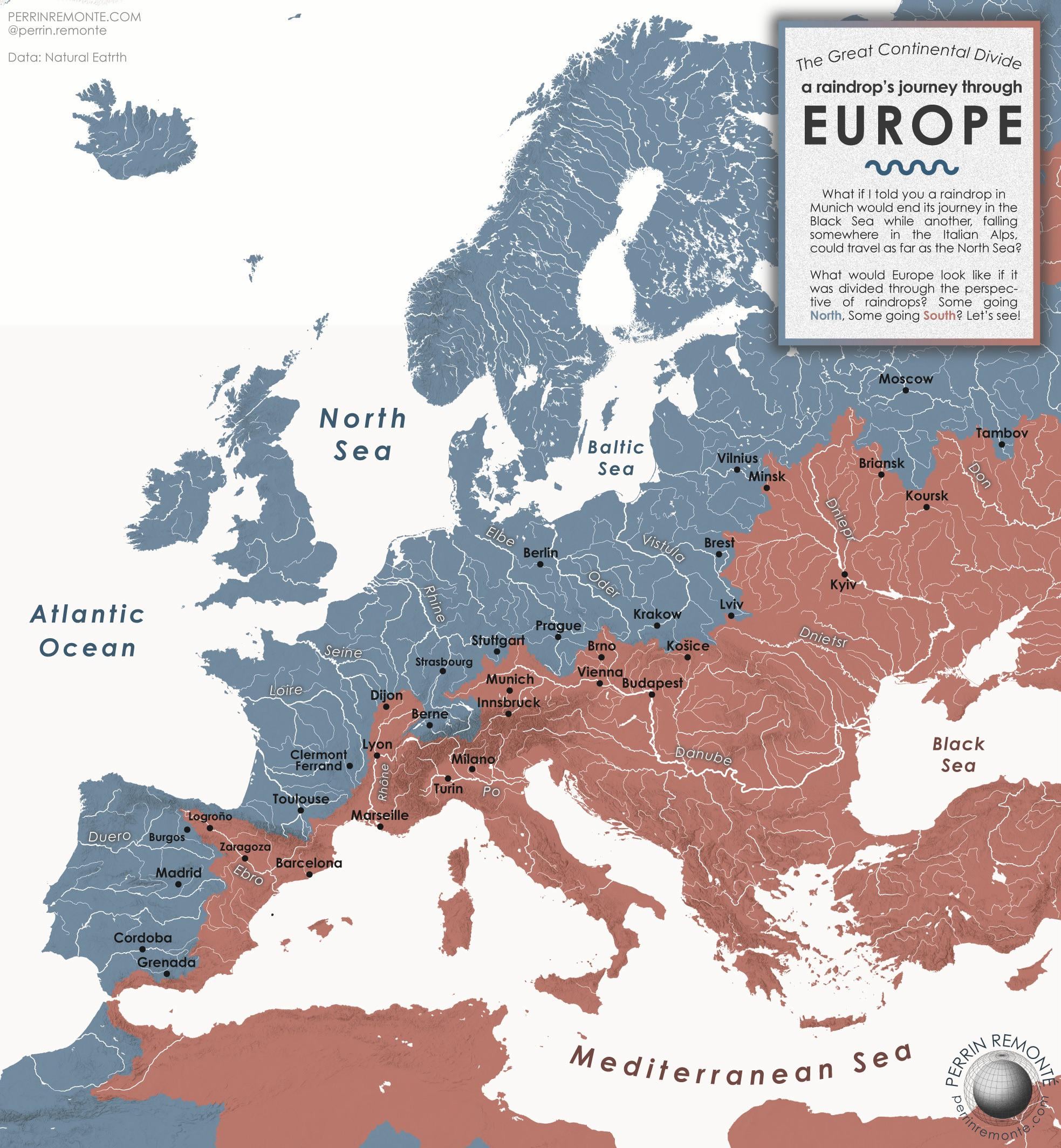
So I made this map showing Europe divided in two: if a raindrop falls in Berlin, Toulouse, Warsaw or London, it will cross Northern Europe, flat terrain and mostly farmland and eventually end up in the waters of the great Atlantic Ocean, or in the North Sea and maybe in the Baltic Sea too.
On the other hand, the other half of Europe shows the area where raindrops will travel south, crossing a rugged terrain, more arid lands, to end in the Mediterranean Sea or the Black Sea too.
I was inspired by the map showing North America Great divide, between the watersheds ending in the Pacific Ocean and those ending in the Atlantic Ocean. I find it fascinating that you can cross the two ans that there’s a line going through thousands of kilometres that will determine where a raindrop will go.
Hope you liked it!
Excellent!
Super cool, I’d even buy a poster of it.
Dnietsr 🤦