News 5 has several articles on our website regarding the ongoing Lake Effect storm including ourregular forecast page, plus another News articlethat shows pictures and discusses road closures, parking bans, etc. Meanwhile, this article is going to focus on the forecast for the days to come but in greater detail including updated timing, totals, and impacts to expect.
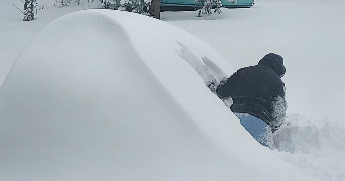
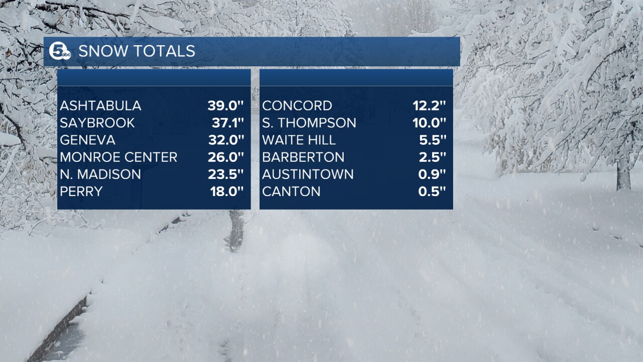
SNOW TOTALS: More than 3 feet of snow has already been reported to the NWS across parts of Ashtabula County. Totals in the warned counties range from 5 inches to 39 inches. Lake-effect in a nutshell! Meanwhile, the rest of NEO has seen minimal or no snow since Thanksgiving. However, we are expecting more snow that will impact a larger area over the next few days. When all is said and done the storm’s total snowfall for this event could be 4 to 5 feet in some communities.
News 5
ALERTS: The lake-effect snow warning has been extended until Tuesday morning for Lake and Ashtabula Counties. A new winter storm watch for Cuyahoga and Geauga Counties has been upgraded to a Lake Effect Snow Warning as well as of Saturday afternoon. That also expires at 7 am on Tuesday.

News 5
TIMING: We are experiencing a brief lull in the intense LES band as southwesterly winds have moved it offshore. But the break is brief. To use an analogy, this break is almost like being in the eye of a hurricane. It is briefly calmer and quieter, but the snow will be back soon. Even during the lull, blowing and drifting snow could create issues on the roads.
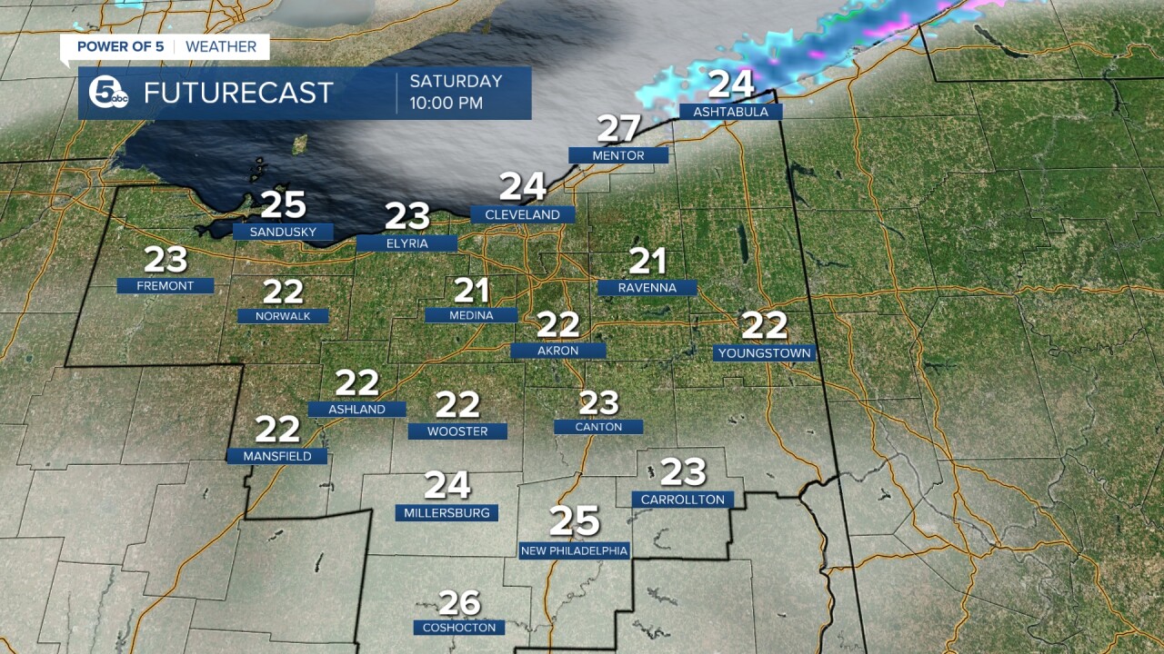
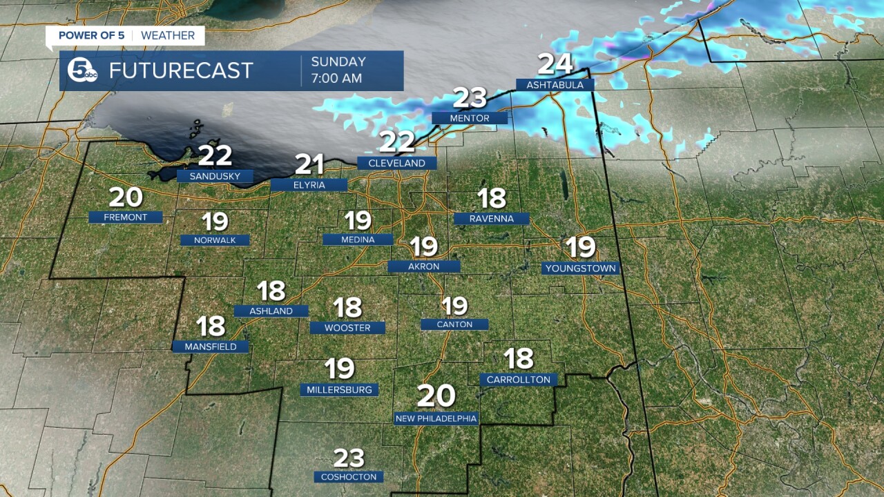
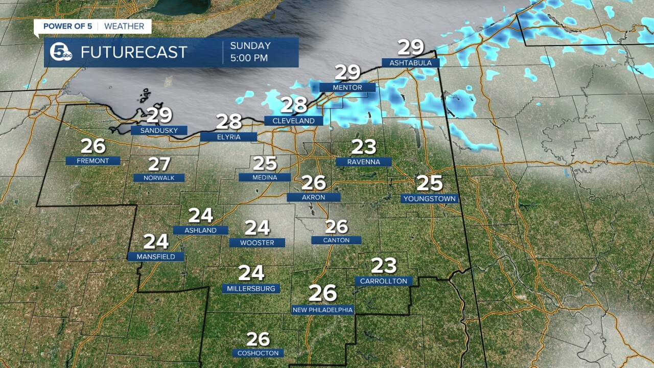
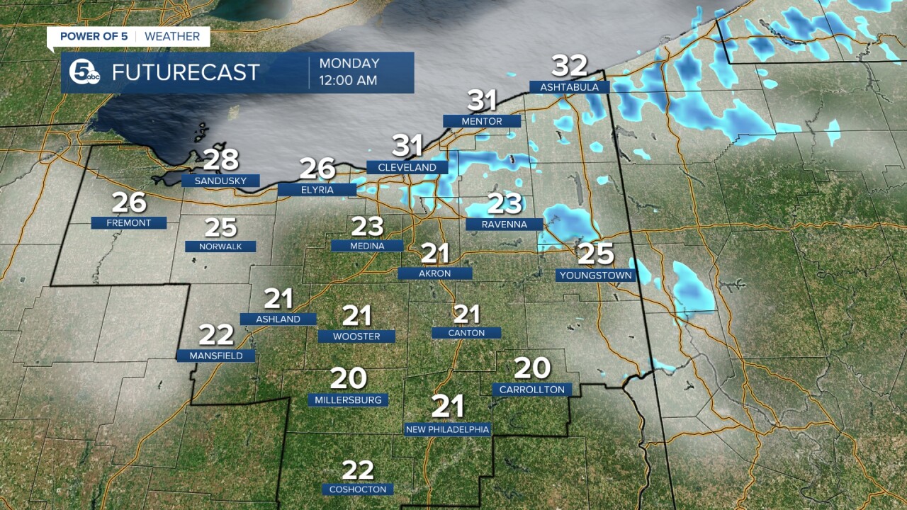
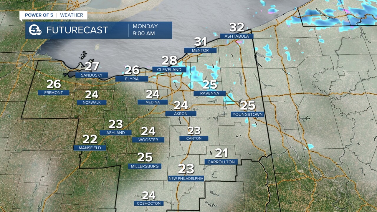
I will be honest, the exact timing of the return is a bit of a question mark, but it looks like it could be as soon as early Sunday morning. This time, the snow is expected to move farther inland and more to the west with multiple bands of lake-effect snow. Therefore, more accumulation is expected across more communities in the area including in eastern Cuyahoga and northern Geauga Counties. Heavy lake-effect snow will continue into Tuesday with snowfall rates of 1 to 2 inches per hour.
The rest of the viewing area will be cold and breezy with limited snow. Scroll through the images of Futurecast to get an idea about the timing of lake-effect snow and the potential placement of the LES bands.
News 5
News 5
News 5
News 5
News 5
TOTALS: The highest accumulations are once again expected along the I-90 corridor and north with totals quickly decreasing to the south. In Cuyahoga County, the heaviest totals will be in the eastern half with a massive range of totals across the country from less than 1 inch to a foot of snow. Several inches or even feet of snow will be possible. Below is my updated snowfall map as of Saturday morning covers additional snowfall on top of what has already dropped through at least the next two days. It is always important to remember the fickle nature of lake-effect snow, so this map will likely be updated later today. However, take note of the areas where we expect the highest numbers (along I-90, southern Lake, eastern Cuyahoga, and northern Geauga Counties).

News 5
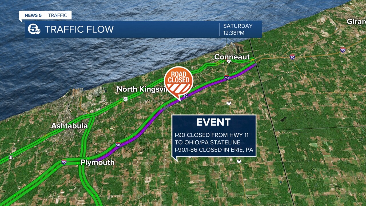
IMPACTS: Travel could be very difficult. During lake effect snow, the weather can vary from bands of locally heavy snow to dry weather just a few miles away. Visibility can also vary greatly. Be prepared for rapid changes in weather visibility and road conditions. The snow could also negatively impact the Monday morning and evening commutes. Keep in mind I-90 is closed in both directions starting at Hwy 11 to the Ohio/PA state line. Additional closures continue along I-90 and I-86 in PA/Erie County.
News 5
Want the latest Power of 5 weather team updates wherever you go? Download the News 5 App free now: Apple|Android
Download the StormShield app for weather alerts on your iOS and Android device: Apple|Android
Click here to view our interactive radar.
Read and watch the latest Power of 5 forecast here.
Follow the News 5 Weather Team:
Mark Johnson: Facebook & Twitter
Trent Magill: Facebook & Twitter