Weather warnings in place across the country from later today, with Status Orange alerts from 5pm in Cork, Kerry and Waterford (for rain and snow) and in Carlow, Kilkenny, Laois, Offaly, Wicklow, Clare, Limerick and Tipperary (for snow and ice)Met Éireann’s Joanna Donnelly described it as a ‘multi-hazard weather event’In areas where snow doesn’t fall, rainfall is likely to freeze and cause icy conditionsThe Department of Education has said that a decision on whether schools should close on Monday will be a matter for individual school management authorities
Not since Storm Emma or “the Beast from the East” in early 2018 has the country experienced such Arctic-type weather conditions, with temperatures now forecast to plummet to between -8C and -10C.
The next five days will see Arctic conditions across parts of the country – with some areas not rising above freezing temperatures for 48 hours.
The National Directorate for Fire and Emergency Management (NDFEM) held a detailed briefing yesterday following consultations with Met Éireann about the polar weather front.
A source indicated that more than 10cm of snowfall is expected across many Status Orange areas, with snow drifts reaching much greater depths across higher ground.
All local authority Severe Weather Assessment Teams (SWAT) were briefed by NDFEM on the potential scale of the weather-related challenges facing Ireland over the coming days.
Met Éireann has forecast a cold, frosty start today with some patches of fog in the north. Cloud will thicken from the south, bringing rain in southern coastal areas.
Rain is set to extend over the south of the country into the afternoon, turning to sleet and snow in some areas. Rain, sleet and snow will continue to spread across most of the country, though it may stay dry in north Ulster.
Accumulations of snow will build up in some places, particularly in the midlands and south. Highest temperatures will range from 0 to 4 degrees.
It will be cold and breezy tonight with widespread rain, sleet and snow continuing. “Significant” accumulations of snow are expected in some areas, particularly the south midlands. Rain and sleet will fall in eastern and southern coastal areas with some snow at times.
Heavy rainfall in southern coastal areas may bring some isolated flooding, with lowest temperatures of -1 to 3 degrees.
We need your consent to load this Social Media content. We use a number of different Social Media outlets to manage extra content that can set cookies on your device and collect data about your activity.
Please review your details and accept them to load the content
A Status Orange snow and ice warning is in place for Carlow, Kilkenny, Laois, Offaly, Wicklow, Clare, Limerick and Tipperary from 5pm this evening until 5pm tomorrow, amid concerns that significant volumes of snow will fall in some areas.
A separate rain and snow warning will also come into effect in Cork, Kerry and Waterford from 1pm today, starting at Status Yellow. It will upgrade to Status Orange then from 5pm today and expire at 5pm tomorrow.
A Status Yellow snow and ice warning will also apply to Cavan, Donegal, Monaghan, Dublin, Kildare, Longford, Louth, Meath, Westmeath and all of Connacht from 5pm tonight until 5pm tomorrow.
Wexford will be under a separate rain and snow warning from 5pm tonight to 5pm tomorrow.
Weather conditions are expected to prove challenging and could significantly impact rail, air and road services with snow falls, black ice, dense freezing fog and heavy sleet showers.
The polar spell will see snowfalls over the weekend but the coldest of the weather is likely between Monday and Wednesday.
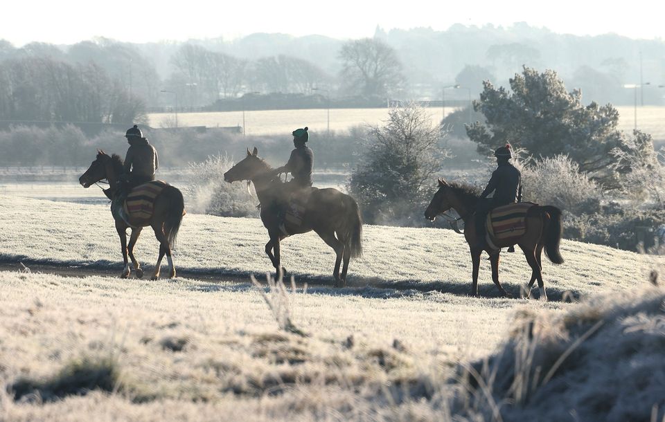
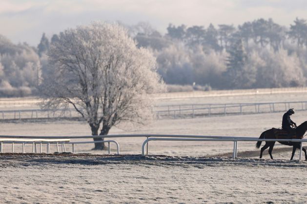
Horses in a frost-covered Curragh, Co Kildare. Photo: Damien Eagers
Disruption is expected at some sporting events over the weekend given the impact of the snow and freezing temperatures on ground conditions.
It could also prove chaotic and treacherous for those travelling home this weekend after the festive season.
An estimated 2.5 million people undertake festive travel between December 20 and January 6.
Met Éireann’s Gerry Murphy said there is a “possibility that schools may not open” when children return from the Christmas break on Monday.
“There is likely to be accumulations of snow in places on Monday morning, coupled with a very severe frost as well,” he told RTÉ.
“So there’s the possibility that schools may not open, but that will become more apparent as we go through the weekend.
“As we get more details on the exact accumulations of that snow, it will give us more information on the exact types of warnings that we will be issuing today and tomorrow.”
The Department of Education has said that a decision on whether schools should close on Monday will be a matter for individual school management authorities around the country.
A spokesperson said it is “carefully monitoring developments” and a decision to close must be made “in light of local weather conditions, taking into consideration the full guidance and direction available from the principal response agencies”.
No decision on school closures or later reopening times will be taken before tomorrow evening.
Meanwhile, the national forecaster stressed that further warnings will be issued over the coming days as the precise track and likely depth of snowfalls becomes clearer.
Temperatures could drop to as low as -10C on Tuesday night.
Across parts of Cork and Kerry, where rain is likely to fall as sleet rather than snow, downpours could prove sufficiently heavy to cause localised spot flooding.
BoyleSports’ Brian O’Keeffe confirmed the company has slashed odds of a record low temperature from 100/1 to 33/1.
However, the mercury will have to drop a whopping 10 degrees below Met Éireann’s lowest weekend forecast to exceed the -19.1C temperature recorded at Markree Castle, Sligo on January 16, 1881.
Met Éireann’s Joanna Donnelly has warned that there was the potential for significant accumulations of snow in some areas, most likely in the midlands and on higher ground.
“This is expected to be a multi-hazard weather event,” she said.
“Disruption will be due either to the accumulations of snow or, in areas where snow doesn’t fall, the sleet and rain that falls.
“In those very cold conditions, the rain is going to freeze and that is going to create icy stretches and potentially treacherous conditions for travel.”
Councils confirmed that stocks of road salt and grit have been replenished for the treatment of all Priority One and Priority Two roads nationwide.
.jpg)
People walk through Phoenix Park in Dublin during icy weather. Photo: PA
Local authorities and Uisce Éireann are also preparing for any possible disruption to water pipes caused by the freezing weather.
“Uisce Éireann is urging people to do their bit to help avoid expensive repairs and a disrupted water supply at home or in their business by taking a few easy preventative measures,” spokesperson Margaret Attridge said.
These include adjusting heating systems to intermittent settings to prevent pipes from freezing or turning off water supplies to exposed outdoor pipes.
All national and major secondary roads have been treated for icy conditions since last Wednesday and council crews will treat the roads daily during the Arctic spell of weather.
However, there are fears that if the worst of the Arctic weather hits as forecast, it will result in widespread travel disruption early next week.
Gardaí and the Road Safety Authority (RSA) urged people to travel with extreme care.
Next Tuesday will see the peak of the Arctic conditions.
.jpg)
Deer in a frosty Phoenix Park in Dublin on Friday. Photo: Brian Lawless/PA Wire
The UK – which is expected to receive much higher amounts of snow than Ireland – has already warned that major travel disruption could be caused by the Arctic conditions.
The Met Office has issued an amber alert for low temperatures across the UK with heavy snowfalls predicted for northern England, Wales and Scotland.
A yellow ice alert has been issued for Antrim, Down, Tyrone and Derry until 10am today with further alerts expected.
Elderly support groups including Age Action have urged people to check on the old, ill and vulnerable in their communities in advance of the weather event.
People have been asked to check that the vulnerable have access to heating, warm food and drinks as well as proper clothing.
Homeless support charities have also put in place plans to offer emergency shelter to rough sleepers.
Agencies dealing with international protection applicants and refugees are also monitoring the weather forecast to ensure everyone is protected from the worst of the conditions.
Farming and animal welfare groups have urged all livestock owners to check that animals have sufficient access to fodder and water given the likely impact of snow and ice.