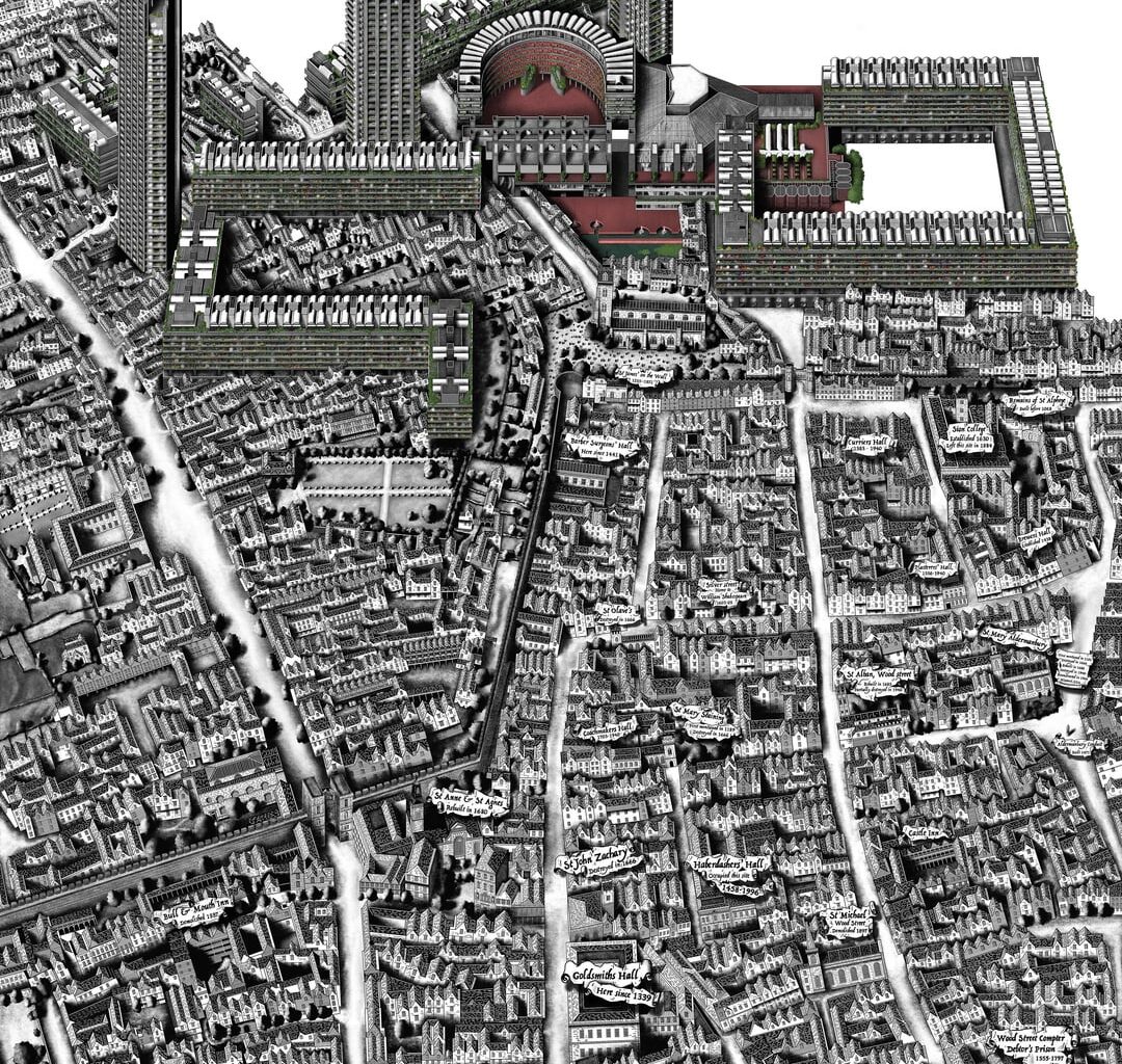
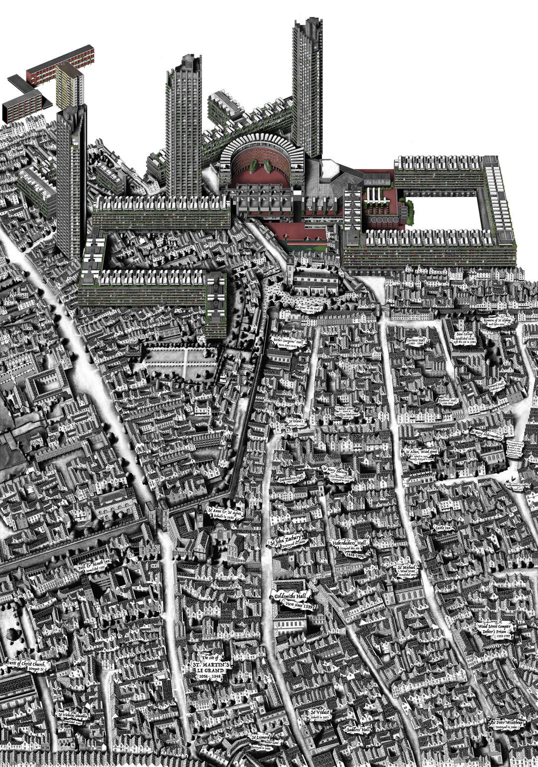
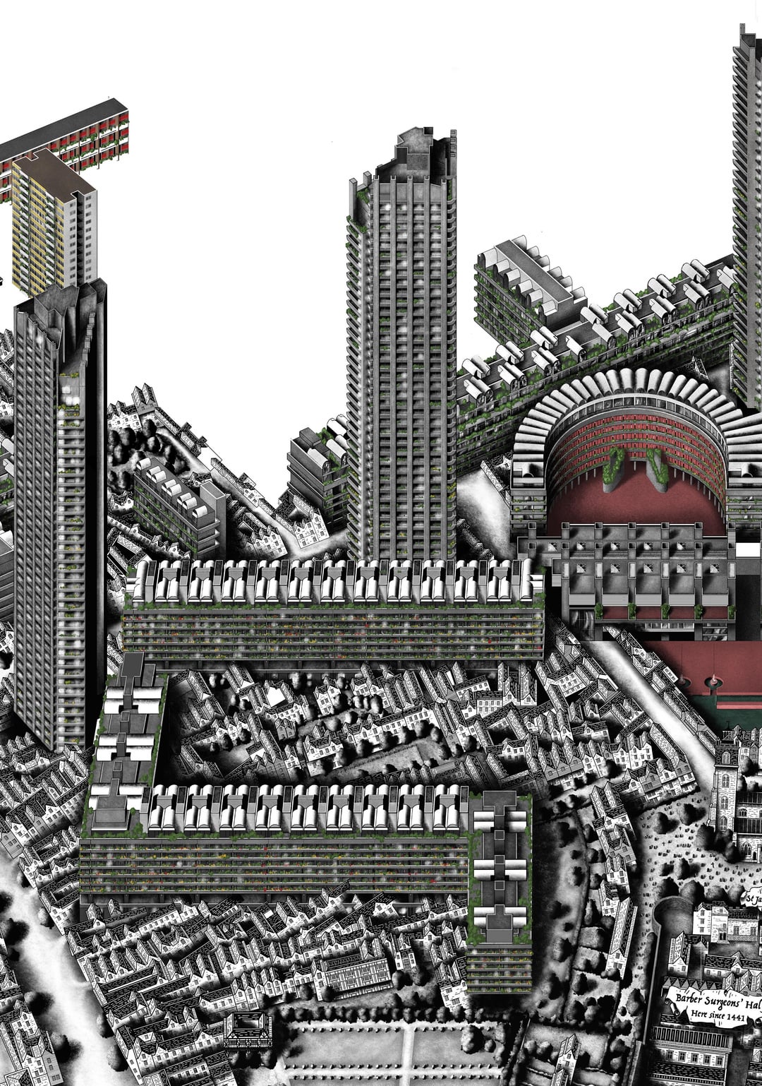
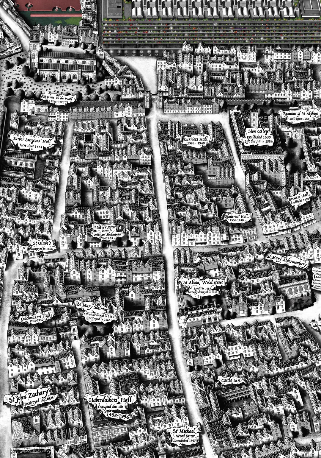
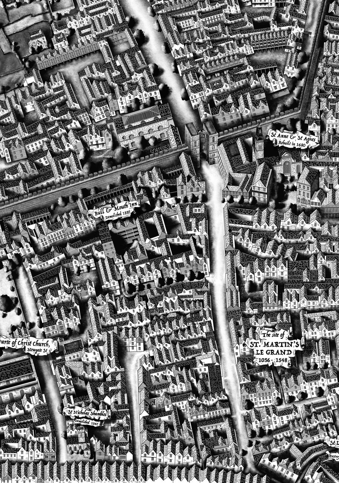
I wanted to share some progress on my latest map, which focuses on the Barbican and its surrounding area. This piece has been in the works for a couple of months, and through it, I’ve been exploring over 1,000 years of London’s history.
The map takes inspiration from various historical sources, with the street plan based on maps from the mid-1700s. However, I’ve also incorporated elements from earlier Tudor-period maps, as well as later additions.
Creating these maps is a passion of mine, as I’m deeply interested in London’s history. Mapping the city in this way not only allows me to express that passion but also helps me learn more about its evolution over time.
This is the 10th map in an ongoing project I started back in 2020. Each one takes several months to complete, with the majority of the time dedicated to research. I draw them digitally using an iPad and later print them on a larger scale.
I’m hoping to finish this piece in the next few weeks and will be sharing the final version once it’s complete.
I have my socials linked in my profile if anyone wishes follow along for updates 🙂
by Lndmjd
7 comments
Insane detail, nice stuff
I remember the former Museum of London had a small alcove room with old maps wallpapered over the walls. It was fascinating to see the former street layouts where the Barbican now stands. I would love to travel back in time and see the London of yesteryear. Fantastic work.
Damn if you get anymore detailed you will have a bunch of tiny cunty residents trying to abuse the bylaw in the Barbican to impose their will over people.
Love this – thanks for sharing!
Wow!! Do you sell these? 😊
Marvellous work, thanks for sharing with us, you ought to get an exhibition so a wider audience can see. It’ll be funny when stuff like the Guildhall is drawn, showing its tiny scale surrounded with much newer buildings.
Ohh love it
Comments are closed.