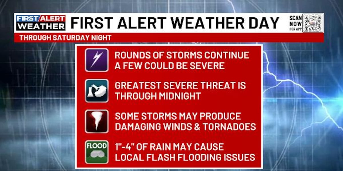
LEXINGTON, Ky. (WKYT) – This is a super-active weather day across Kentucky and most of the region as a significant severe weather event continues. This is bringing the potential for severe storms, high winds and flooding rains.
Some quick thoughts on the setup:
Rounds of strong to severe storms continue to develop across central Tennessee and southern Kentucky.These waves of strong to severe storms then move to the northeast through the wee hours of Sunday morning.Damaging wind is the main threat, with a few tornadoes possible. The best tornado threat is across the southern half of the state.These storms will also be moving over the same areas, putting down a ton of rain.Flash flooding is a good bet for some areas.Showers and storms will slow down overnight and early Sunday.There could be one more round of strong storms in the east Sunday afternoon before the chilly winds kick in from the northwest.There’s also an outside chance for a late Sunday snowflake to show up as temps drop.
Calm weather is then with us Monday and Tuesday.
Copyright 2025 WKYT. All rights reserved.