![I rendered arrival and departure traffic from Cincinnati International Airport [OC]](https://www.europesays.com/wp-content/uploads/2025/03/pivlfz7aswqe1-1080x1024.jpg)


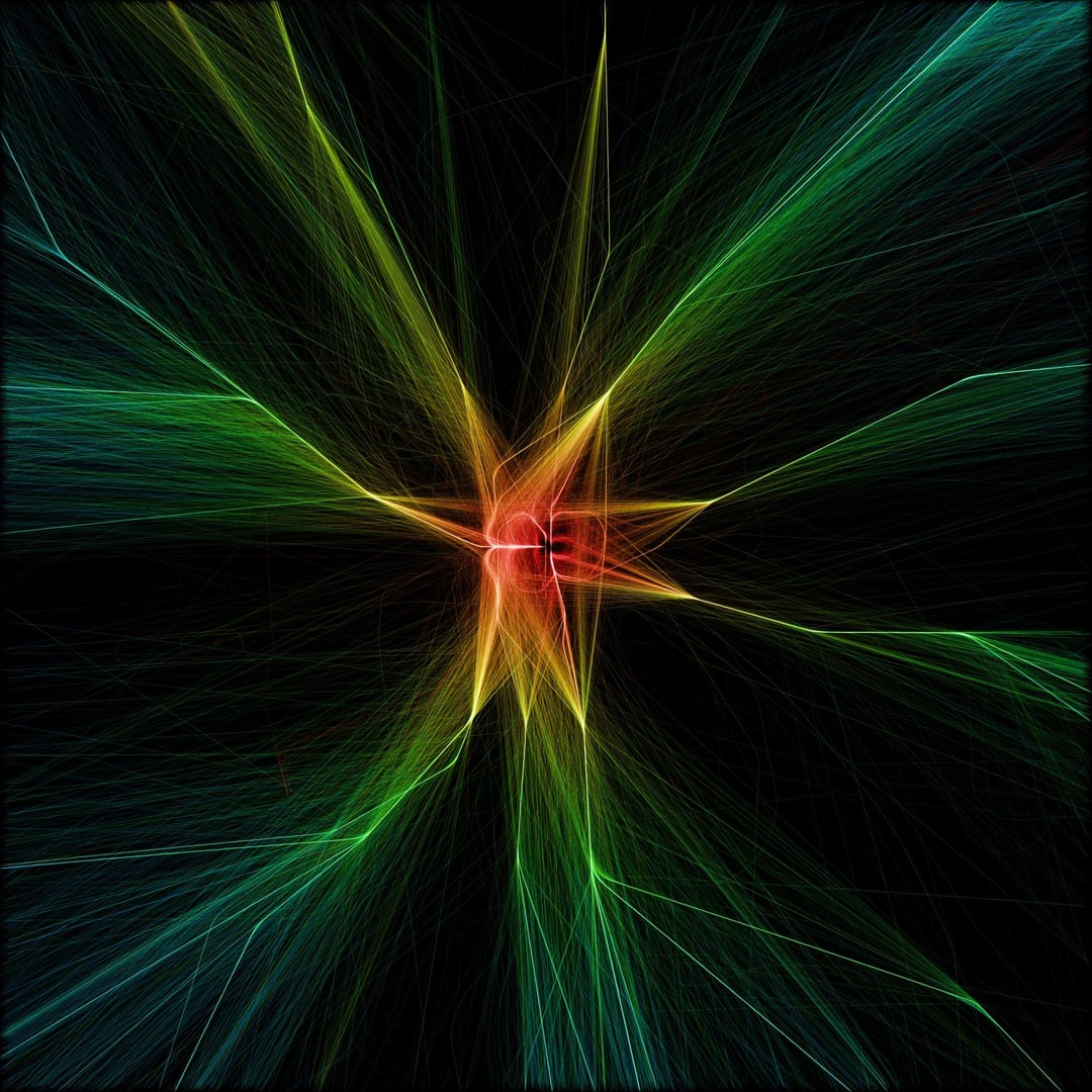
My previous post was so well received, so this time I decided to show my heatmap of position data of arriving and departing flights from Cincinnati International Airport (CVG/KCVG). I have now made about 75 of these renders, and from what I have seen, this airport has the most "boxy"/perfect square appearance in the approach patterns around its 3 north-south and 1 east-west runways.
Swipe to see only the approaches in blue, and the departures in green as separate renders. As before, the observed scale is about 400km across in both directions.
Posted by jimbob3806
13 comments
these are so pretty! excellent
This image was generated with historical data from [adsb.lol](https://www.adsb.lol/docs/), and arrival and departure flight data offered by the [OpenSky Network](https://openskynetwork.github.io/opensky-api/). To see previous renders of airports which I have posted here, please refer to my profile or check out my Instagram, linknin bio @heatmaphorizons.
You images are amazing! Could you please do some of the Moscow airports?
How did you get the data for this?
Hey careful now, seem to be making the mistake of understanding what this sub is about 😉
VERY cool. looked through your post history and did not see Denver (DEN), could you do that one also? I have a request for a small airport too if you are willing, Aberdeen, SD (ABR). That one is fairly low traffic so might need days of flights to generate anything cool.
Yes! A post worthy of this sub. Thank you!
This is gorgeous. Could you do several airports if they are in close enough proximity? Thinking of JFK (New York City) and EWR (Newark, New Jersey) OR SFO (San Francisco), OAK (Oakland), and/or SJC (San Jose)
I’ll add my line. I fly into CVG tomorrow.
Wow! That is so cool!
Love this
Sent you a DM after I saw your post in the aviation sub!
This is the definition of this sub and all of your renders of airport traffic are beautiful.
I’d love to see Denver (DEN/KDEN) if you are willing.
Cool to see how much tighter the arrival lanes are than the departure ones.
Comments are closed.