
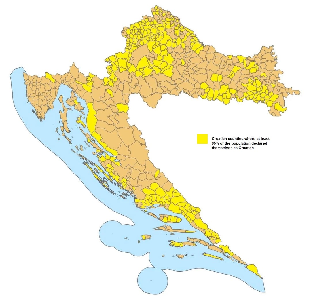
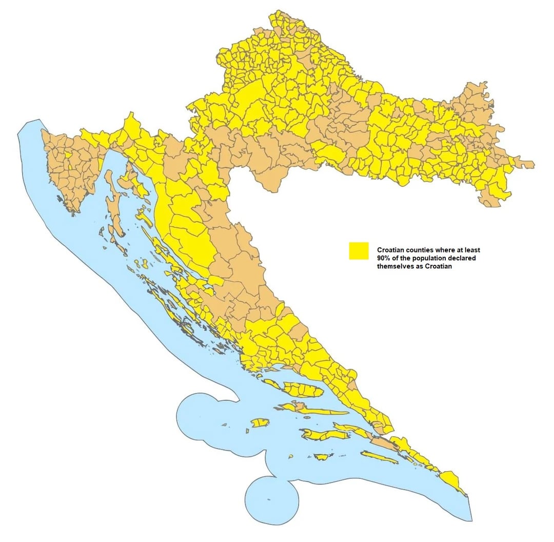
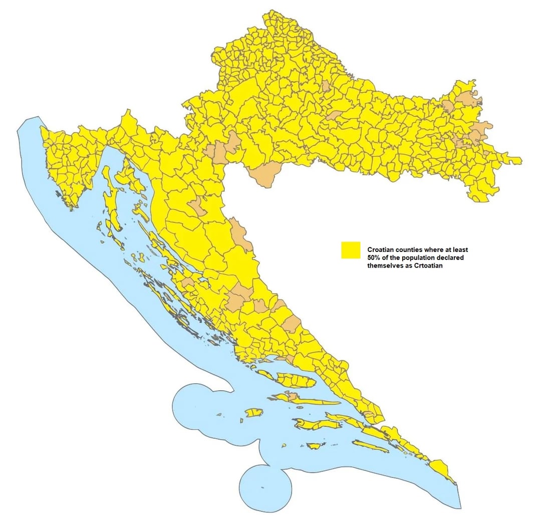
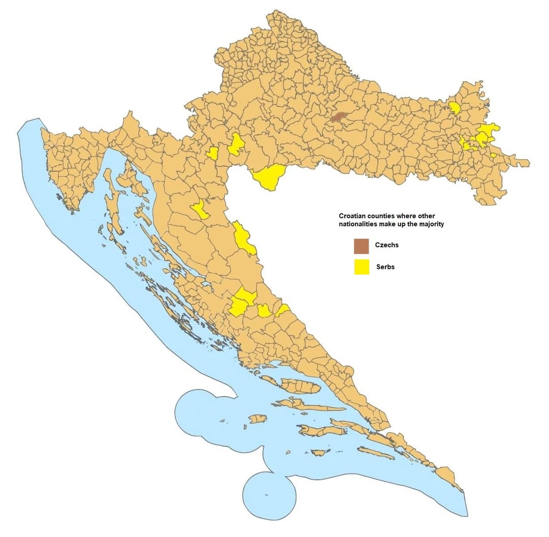
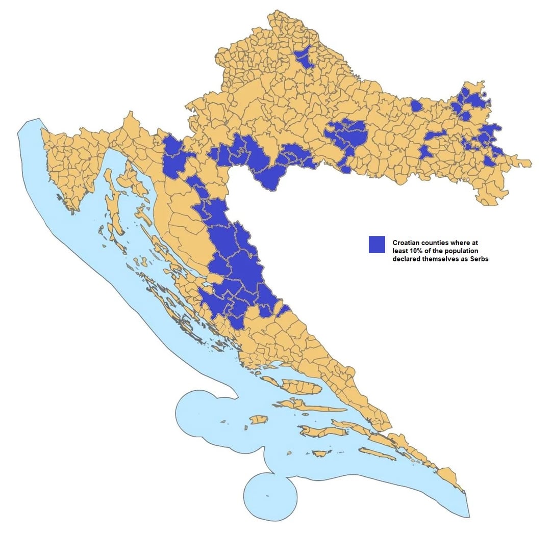

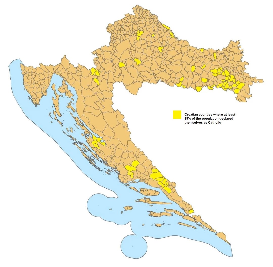
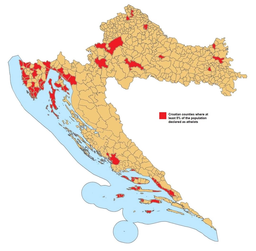
I made a few maps about the nationalities and religions in Croatia, according to the population census from 2021. Source: dzs.gov.hr
Posted by taccobelli
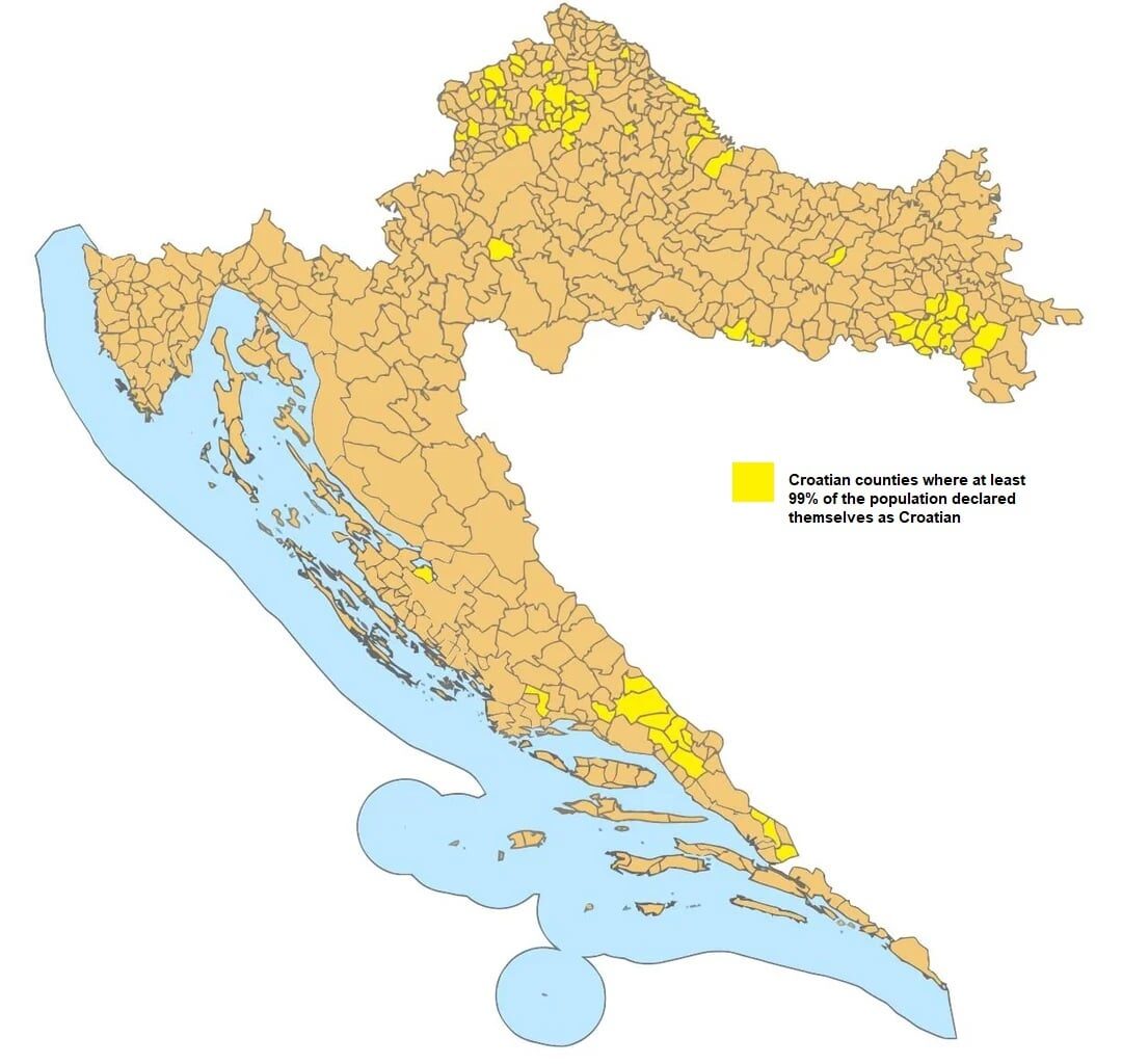
I made a few maps about the nationalities and religions in Croatia, according to the population census from 2021. Source: dzs.gov.hr
Posted by taccobelli
3 comments
Whats up with the Czech majority county? How did that come to be?
It looks a little odd with the little bit of water sitting there and no other land masses. Maybe include other land as grey and include all the water.
Couldn’t you just use a gradient and have one figure? I don’t understand why we need multiple figures
Comments are closed.