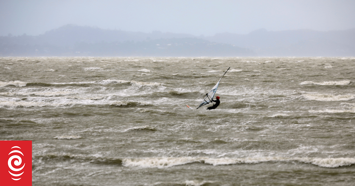

A lone wind surfer could be seen at Auckland’s Eastern Beach during Cyclone Tam.
Photo: RNZ / Marika Khabazi
While a severe thunderstorm warning has been lifted in the Auckland region, it is not the end of ex-Tropical Cyclone Tam, which has been wreaking havoc across the top of the North Island this week.
Read more: As it happened: Wild Easter weekend weather causes power outages, flooding.
“There is indeed the potential of thunderstorms developing in the western half of Auckland, though I must stress they are not expected to be anywhere near as intense as the ones we saw overnight,” meteorologist Alec Holden said.
According to MetService, Cyclone Tam lies west of New Zealand and is expected to slowly move east across the upper South Island during Sunday and Monday, while gradually weakening.
️Rain will persist through to Monday, with heavy rain watches still in place for the northern South Island until Monday morning. In those areas, rainfall could reach warning levels, do keep up with the latest weather warnings from the metservice.
— MetService (@MetService) April 19, 2025
Associated troughs will move eastwards across the country through into Monday, bringing heavy rain to parts of New Zealand, with a warning issued to Mount Taranaki and Tasman – northwest of Motueka – between 10am Saturday and 6am Monday.
There is also a heavy rain watch in place for ranges of Westland District through to 3pm Sunday.
Watches have also been issued for Gisborne north of Tokomaru Bay and the Bay of Plenty northeast of Te Kaha between 9pm Saturday and 12pm Sunday as well as for Nelson about and southeast of Motueka including Bryant and Richmond Ranges, the Buller district, Marlborough excluding the Sounds, and North Canterbury about and north of Waimakariri River between 6am Sunday and 9am Monday.
A severe thunderstorm watch is also in place for the Bay of Plenty and Gisborne between 4am Saturday and 12pm Sunday.
MetService warned a band of rain with embedded thunderstorms may affect eastern Bay of Plenty and northern Gisborne on Sunday morning, with a moderate risk the thunderstorms could be severe with localised rainfall rates of 25-50mm/h – or possibly more.
It said rainfall of that intensity could cause surface and/or flash flooding, especially about low-lying areas such as streams, rivers or narrow valleys, and may also lead to slips. Driving conditions will also be hazardous with surface flooding and poor visibility in heavy rain.
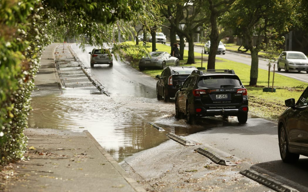
Traffic queued as cars drive through the remaining floodwater on St Lukes Road on Saturday morning.
Photo: RNZ / Calvin Samuel
Hundreds of properties are still without power, with several small-scale outages affecting rural properties in the Far North, but the vast majority of homes in Northland have had their power restored.
“Our crews are continuing to work tonight, where it is safe to do so, but we have advised a small number of customers that we won’t be able to get to them until tomorrow, and some repairs may take until Monday to fix,” Vector said in a statement late Saturday.
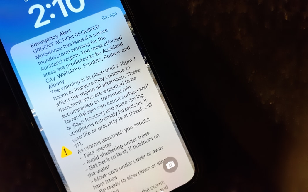
An emergency alert on Saturday afternoon.
Photo: RNZ / Nik Dirga
People in Auckland have also been advised to report flooding and blocked stormwater drains at 09 301 0101. Fallen trees on public property should be reported using Auckland Council’s Report a Problem tool here.
RNZ is New Zealand’s statutory civil defence lifeline radio broadcaster, providing vital information and updates as they come to hand. RNZ National frequencies on FM and AM are available here.
Sign up for Ngā Pitopito Kōrero, a daily newsletter curated by our editors and delivered straight to your inbox every weekday.