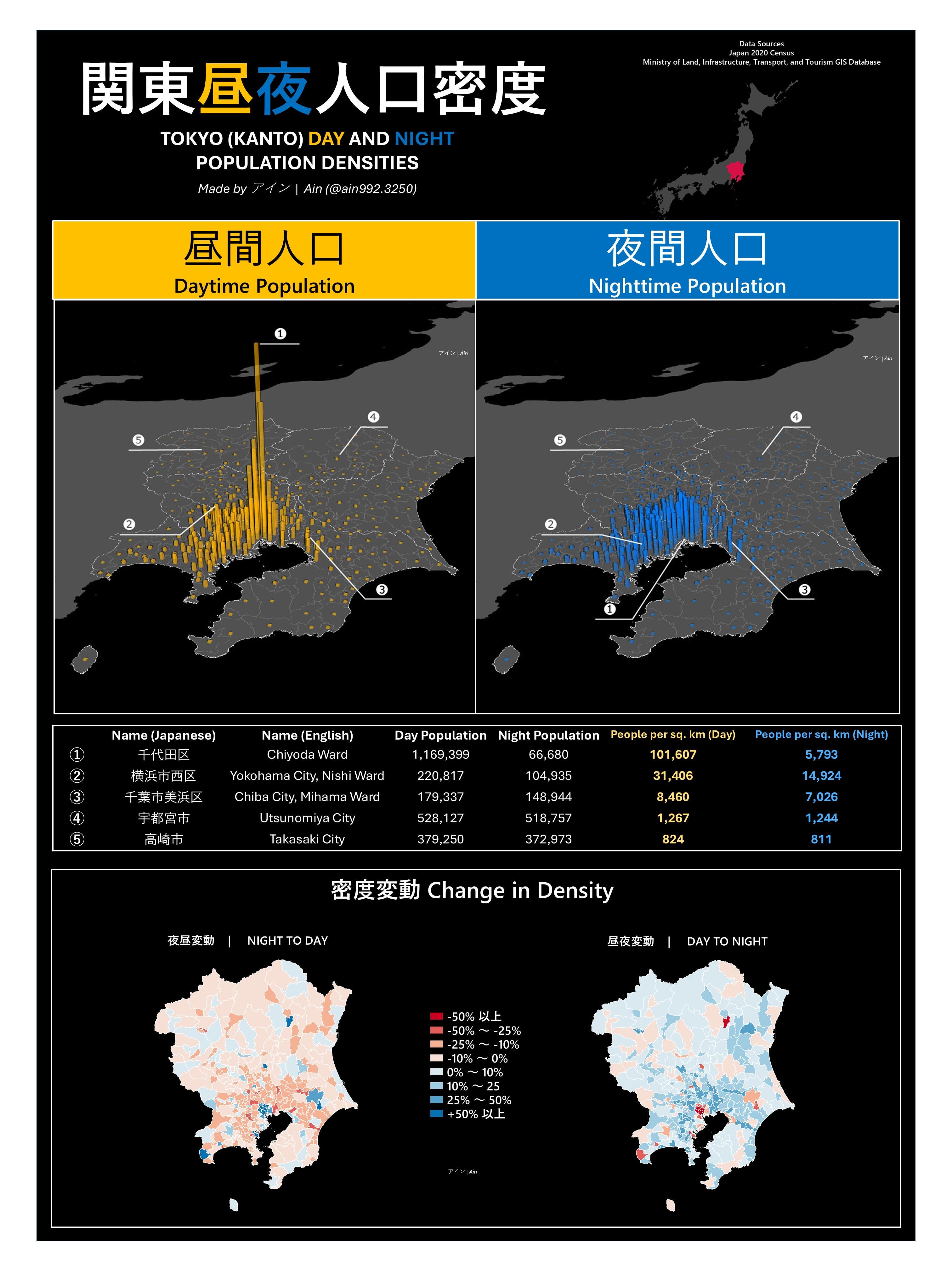
3D Visualization of Tokyo’s Day and Night Populations [OC] Posted by ain992_3250 Tags:DataData Is BeautifulDataIsBeautiful 1 comment Made for a school project with QGIS, redesigned in a style I prefer. 3D Visualization features census data down to the municipality/ward levels, with each “box” extruded to each place’s density in the day and night. Sources: Japan 2020 Census & Ministry of Land, Infrastructure, Transport, and Tourism GIS Database Comments are closed.
Made for a school project with QGIS, redesigned in a style I prefer. 3D Visualization features census data down to the municipality/ward levels, with each “box” extruded to each place’s density in the day and night. Sources: Japan 2020 Census & Ministry of Land, Infrastructure, Transport, and Tourism GIS Database
![3D Visualization of Tokyo's Day and Night Populations [OC]](https://www.europesays.com/wp-content/uploads/2025/04/534wrj20pgxe1-1920x1024.jpeg)
1 comment
Made for a school project with QGIS, redesigned in a style I prefer.
3D Visualization features census data down to the municipality/ward levels, with each “box” extruded to each place’s density in the day and night.
Sources:
Japan 2020 Census & Ministry of Land, Infrastructure, Transport, and Tourism GIS Database
Comments are closed.