NORTH PLATTE, Neb. (KNOP) – This week, Mother Nature is serving up a sampler platter of spring weather sunshine, chilly nights, gusty breezes, and a few chances for rain. Whether you’re itching to get your hands in the garden soil, scheduling outdoor workouts, or simply soaking in the sun, here’s how the days ahead are shaping up.
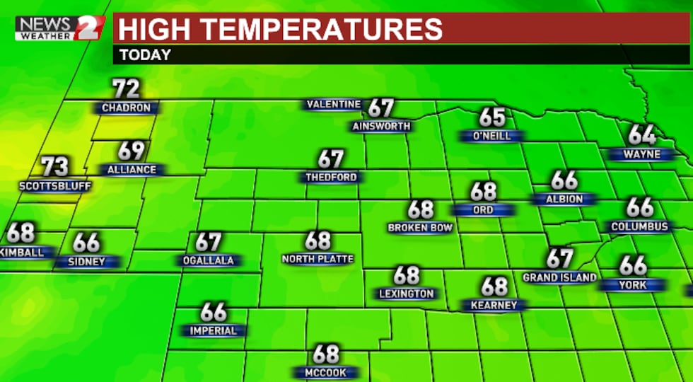
Spring wakes up with a refreshing chill, but don’t worry—it won’t last long. After morning lows in the upper 30s to low 40s, temperatures rebound into the upper 60s by afternoon under crystal-clear skies. Winds will be light, shifting from the north to southeast, making for a tranquil day. Tuesday night remains calm and cool, dipping to around 42°F—ideal for opening the windows and enjoying that fresh spring air.
Highs in the upper 60s for Tuesday across the region.(Justin Craft)
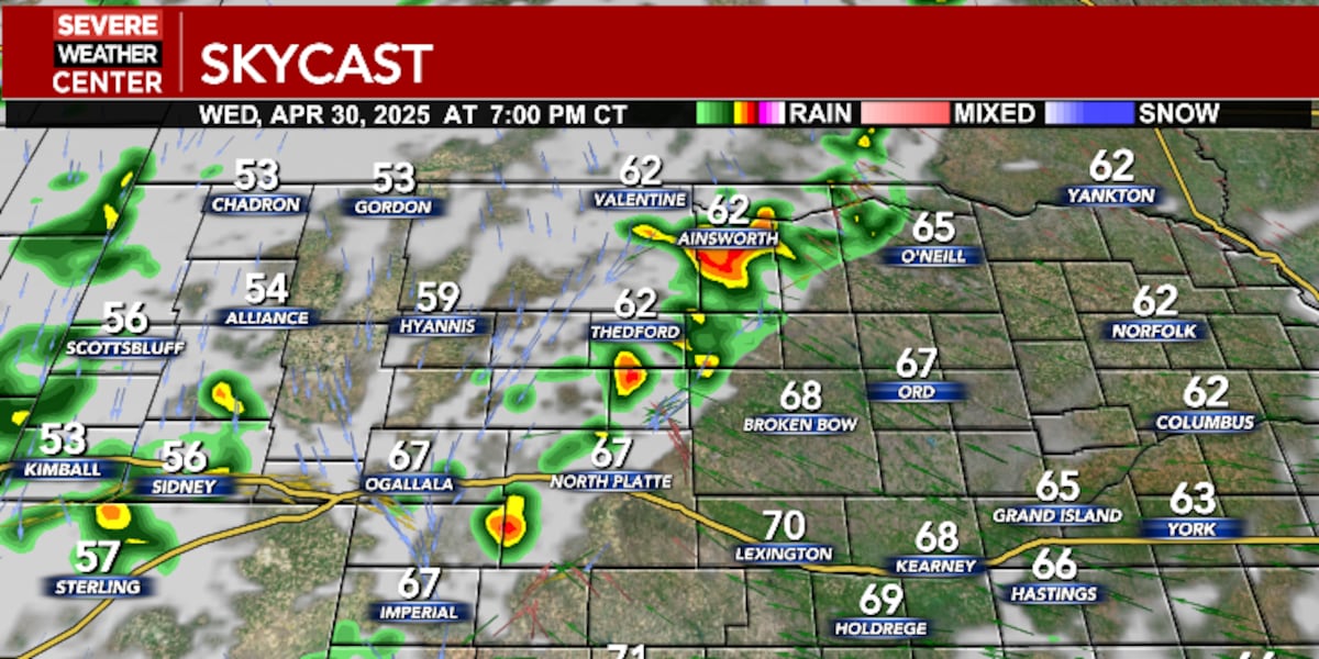
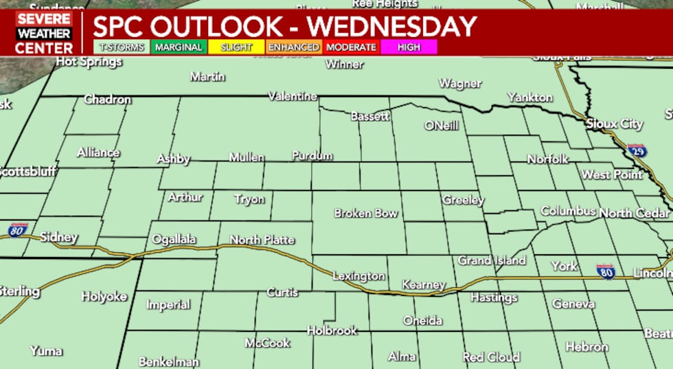
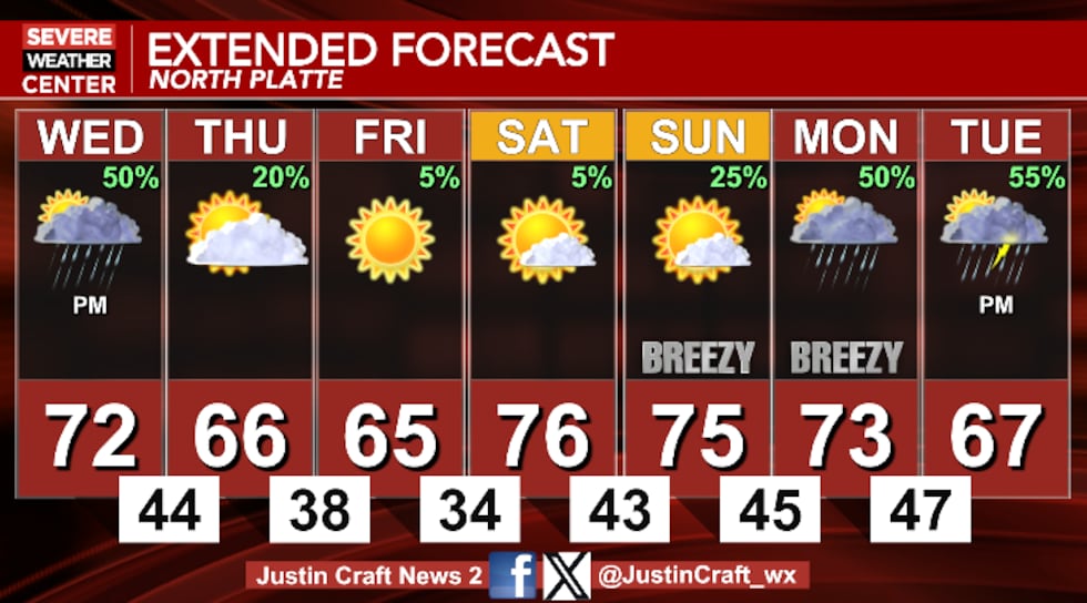
Wednesday offers a split personality. The first half of the day brings ample sunshine and a high near 73°F, but changes are on the horizon. By mid- to late afternoon, clouds thicken, and a 20% chance of showers develops after 3 PM. That chance increases into the evening and overnight hours, with scattered thunderstorms possible between sunset and 4 AM. A few rumbles of thunder and brief downpours can’t be ruled out, but it won’t be a total washout. Overnight lows drop to the mid-40s, and storm chances rise to around 50%.
A chance of thunderstorms Wednesday night across the region.(Justin Craft)
The unsettled weather clears quickly behind a weak front. Thursday starts off partly sunny and turns cooler, with highs topping out near 67°F. Winds settle, and by evening, skies will clear out, leading to a brisk night with lows around 38°F. It’s a great evening to break out a cozy sweater or gather around a backyard fire pit.
Friday is picture-perfect. Expect abundant sunshine, light breezes, and a high near 68°F. It’s the kind of day that reminds you why spring is worth waiting for—perfect for gardening, walking the dog, or enjoying lunch outdoors. The night remains clear and comfortably cool with lows in the low 40s.
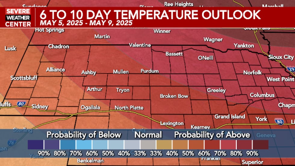
An above average temperature trend through early May, in the 60s and 70s.(Justin Craft)
Spring warmth returns for the weekend. Both Saturday and Sunday will be mostly sunny with highs in the upper 70s—warm enough to bring out short sleeves and sunglasses. Saturday looks dry and pleasant overall, while Sunday brings a slight chance of isolated showers or thunderstorms after 1 PM and again overnight. It won’t spoil the day, but it’s worth keeping an eye on the sky if you’re planning outdoor plans late in the day. Winds turn breezy by Sunday afternoon, a sign of another shift on the way.
A chance of showers/thunderstorms Wednesday, Monday and next Tuesday.(Justin Craft)
Click here to subscribe to our KNOP News 2 daily digest and breaking news alerts delivered straight to your email inbox.
Copyright 2025 KNOP. All rights reserved.