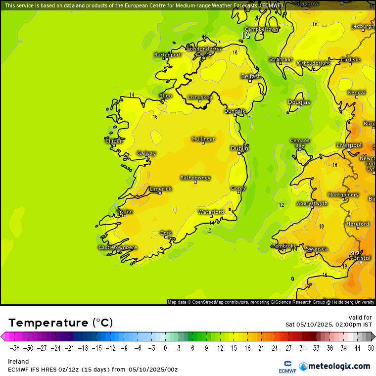
IRELAND is set to see temperatures rise higher than parts of Spain today as high pressure remains dominant – but for one day only.
Weather bosses have warned that a major twist in conditions is only around the corner as heavy rain and thunderstorms begin to emerge.
3
High temperatures are dominating today
3
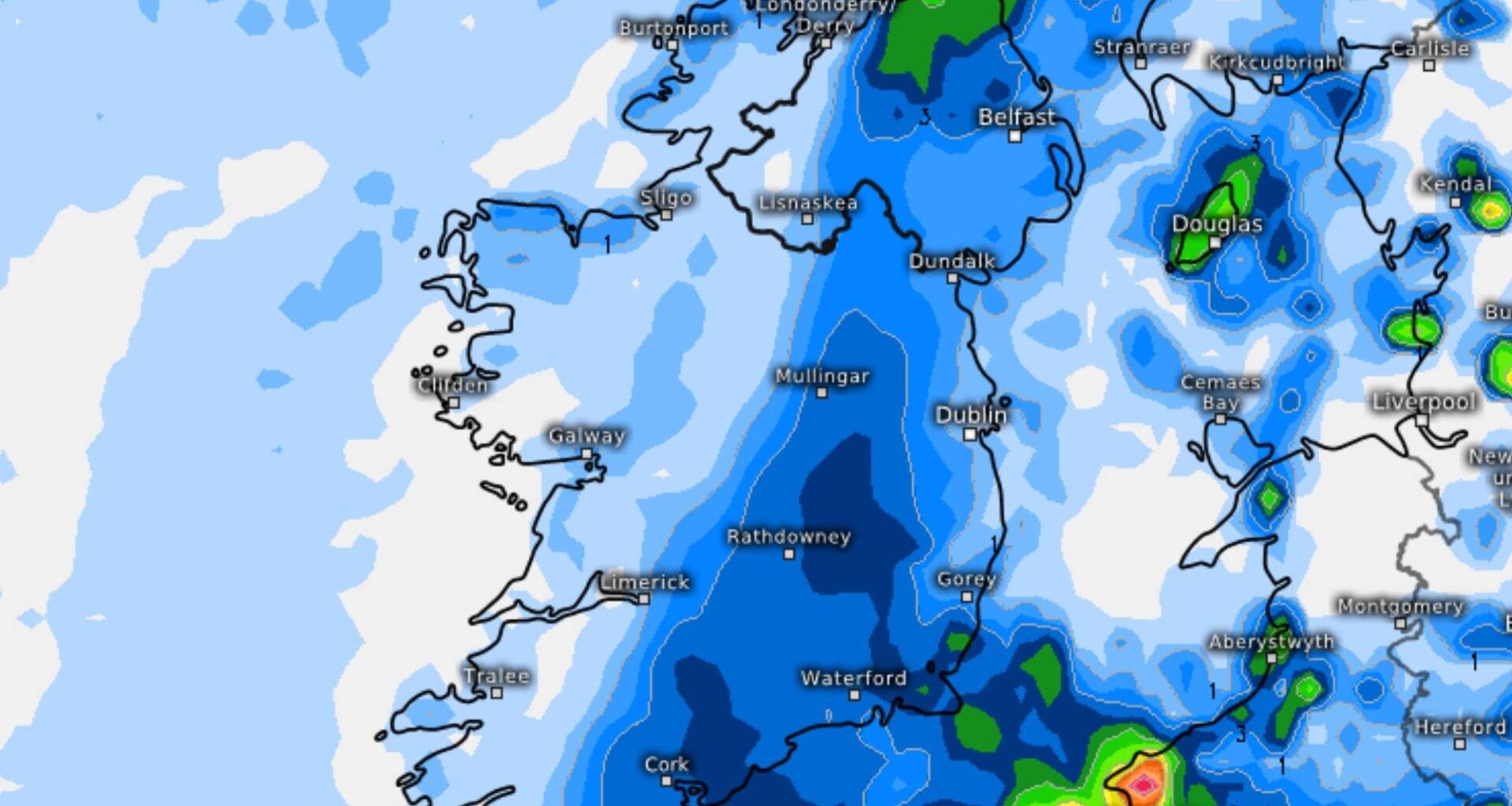
Rain is returning next week
The country will see one final day of summer sun before outbreaks of heavy rain take over in the coming days.
However, despite the impending downpours, temperatures will still remain high throughout the week.
Today, it is set to be warmer that parts of Spain as temperatures are to reach highs of 21C.
In Barcelona, it will reach 19C, while Madrid will only see 16C and Tenerife hitting 20C.
Met Eireann’s Liz Walsh said: “High pressure remains dominant across Ireland today, Saturday, with another fine and settled day on the cards.
“Something of a change tomorrow, Sunday, with cloudier conditions and outbreaks of rain or showers in the mix.
“And that chance of rain or showers will stick around into early next week.
“A gradual improvement will occur from midweek though, with high pressure becoming more dominant once again, with the mainly dry, settled and warm weather returning later in the week.”
TODAY’S WEATHER
Today is looking to see the last of the summer weather, but these spells of sunshine will be here all day.
Liz said: “So, largely dry today, Saturday, with long spells of sunshine. Isolated light showers may affect the west and northwest counties later today.
“Highest temperatures 16C to 21C in mostly light southerly or variable breezes.”
Overnight, rain will begin to build lightly, with cloud developing over Ireland.
She added: “Largely dry and clear, with just the odd light shower possible then early tonight.
“Cloud will build overnight, with perhaps the odd spot of drizzle near the west coast by morning. Lowest temperatures 3C to 7C in mainly light variable breezes, moderate near some coasts.”
TOMORROW’S TURN
Tomorrow will see the rain begin to return fully, patchy to begin before turning heavier as the day goes on.
Liz said: “Some areas of mist and shallow fog will develop too. Mostly dry with a mix of cloud and hazy sunny spells to begin on Sunday then, although cloudy conditions with patchy rain and drizzle will affect parts of West Connacht and West Ulster.
“It will become mostly cloudy as the day goes on, with outbreaks of rain spreading from the south east, although some western regions will hang on to the sunny spells until evening.
“Highest temperatures of 15C to 20C in light to moderate northerly or variable breezes, but a little cooler near Atlantic coasts with the northerly winds freshening there.”
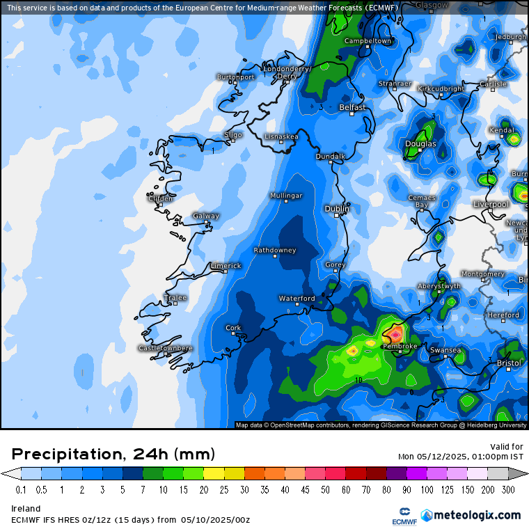
WET WEEK
Into next week, longer spells of rain will hit on Monday and continue into the early week, with some possibly turning heavy or thundery – but temperatures will remain in the high teens.
Liz said: “Monday is going to bring a mix of cloud and sunny spells, along with showers or longer spells of rain. Some heavy or thundery downpours are possible. Highest temperatures 14C to 18C in mostly moderate northerly winds, fresh near Atlantic coasts.
“And Tuesday and Wednesday look like bringing a mix of sunny spells and showers, some heavy with isolated thunderstorms, with the focus area of the showers becoming confined to the west and south west of the country on Wednesday.
“Highest temperatures 16C to 21C both days in light to moderate easterly breezes.”
Some good news for later in the week as it will only be a few days before more settled conditions return.
Liz said: “High pressure then is likely to become increasingly dominant through the latter part of the week, mitigating the risk of further showers and re-establishing mainly fine and settled conditions, with daytime highs in the high teens or low twenties.”
3
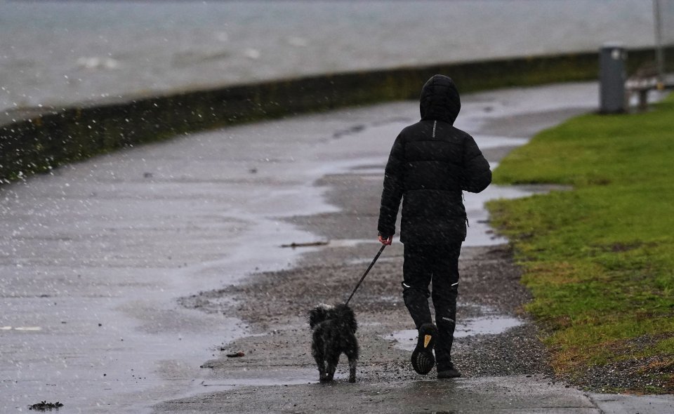
It will be warm but wet next weekCredit: � 2024 PA Media, All Rights Reserved