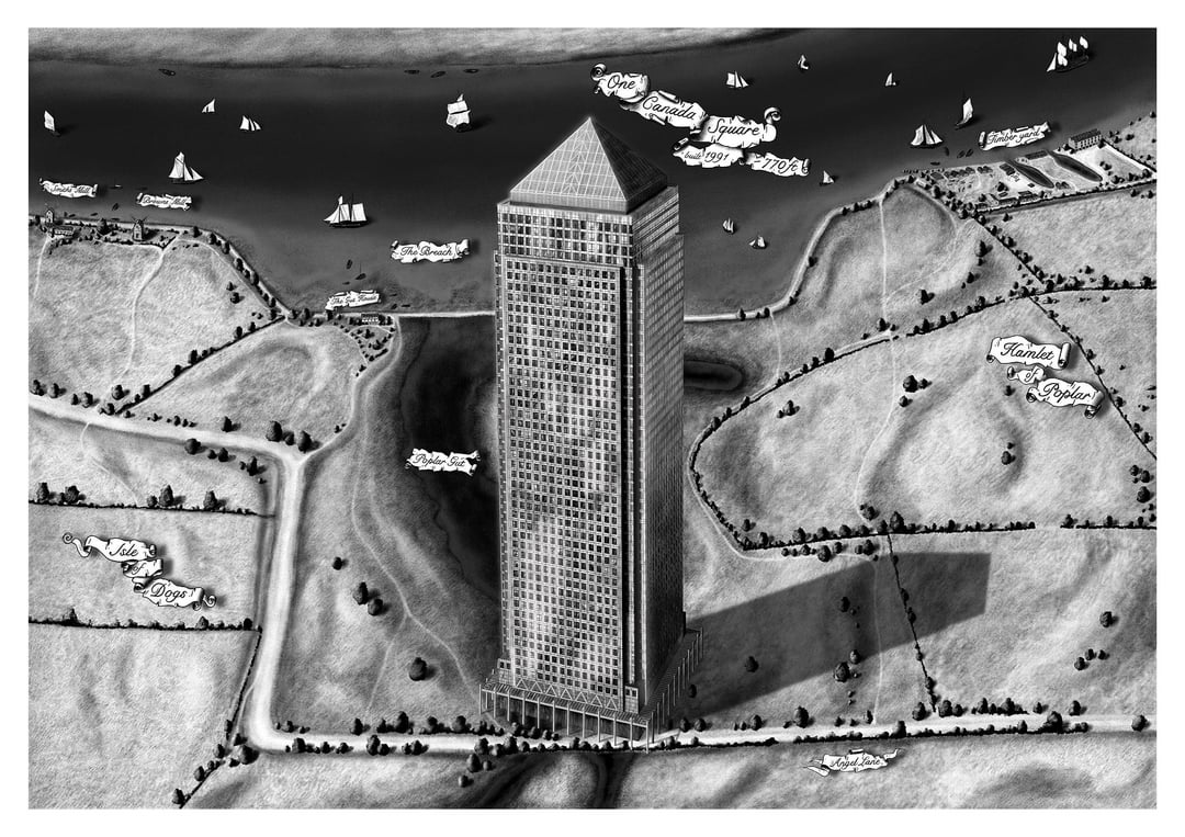
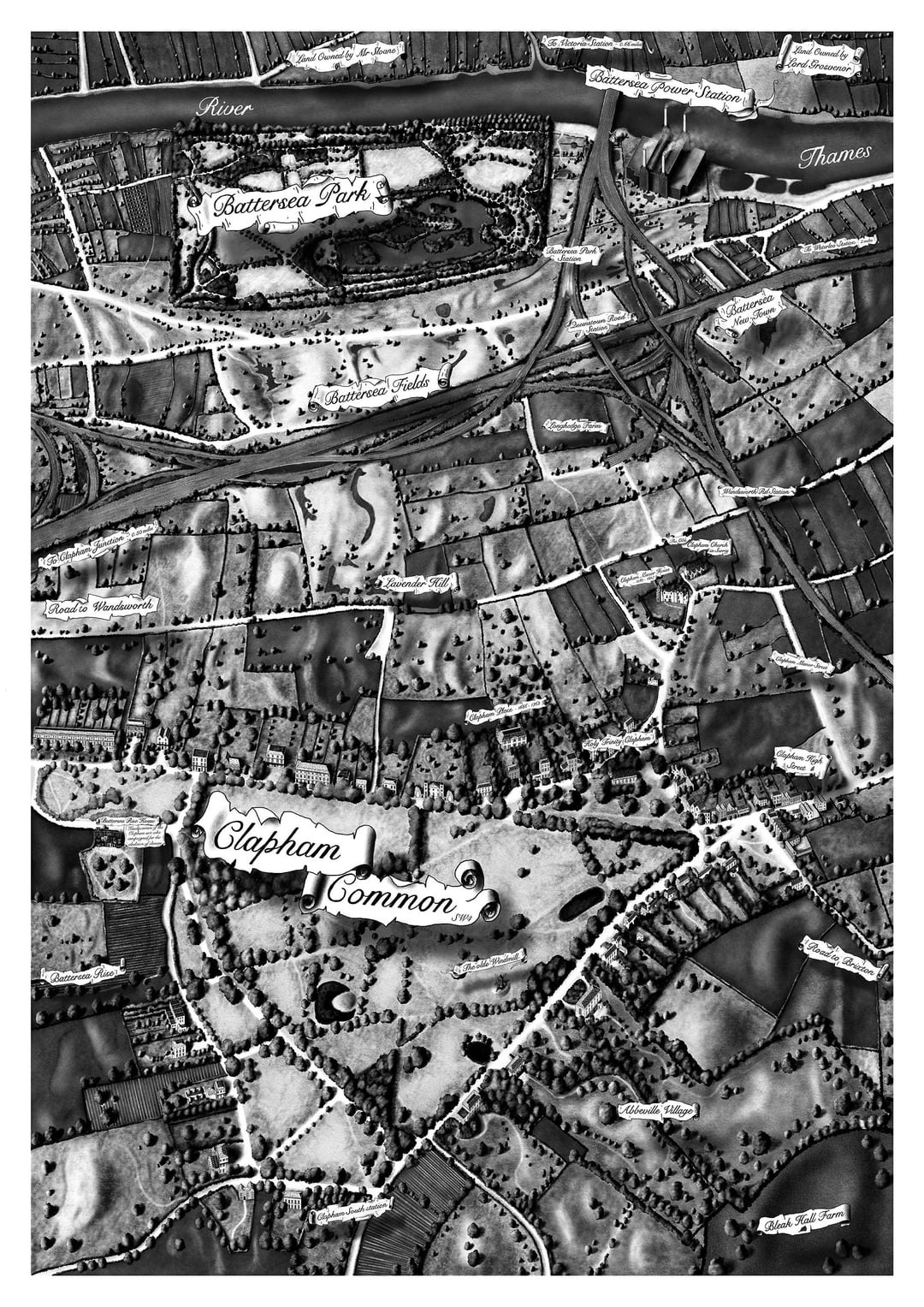
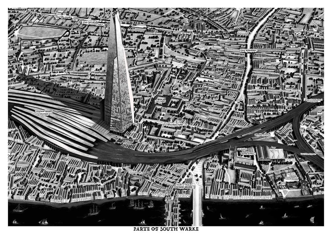
Hey everyone – just wanted to share more from my illustrated London map series, which explores the history of the city.
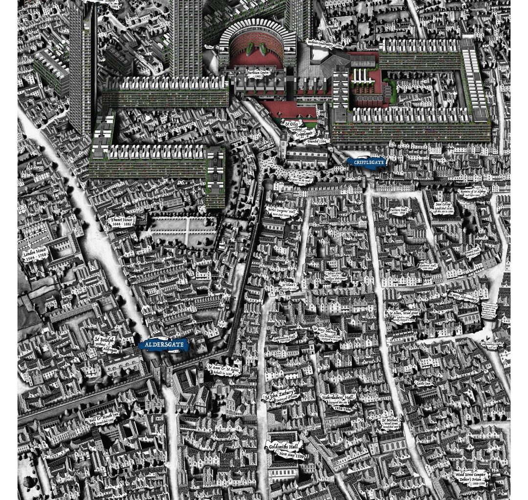
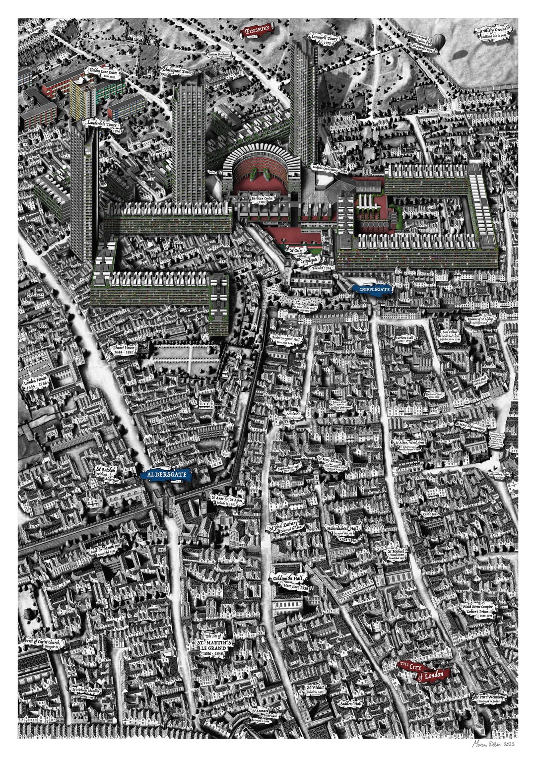
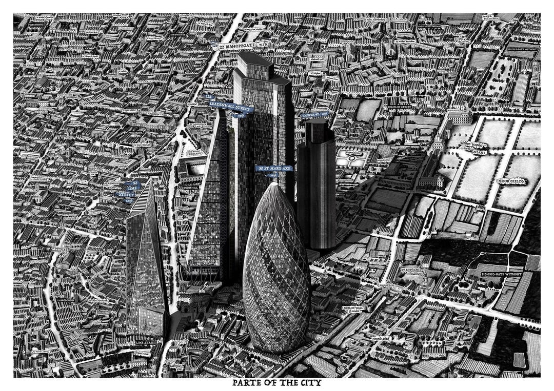
I’ve been working on this series since early 2020, and just last month I completed my 10th map: Barbican & the City. Each map takes around 2–3 months to complete and is drawn entirely on an iPad at A0 size. These are then printed in various sizes.
The next map in the series is now underway and will be centred around St Paul’s Cathedral.
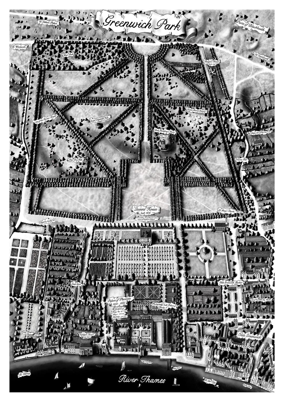
These maps began as a personal way to learn more about London’s past. A lot of time goes into researching lost churches, streets, livery halls, and historical layouts. Many of the maps are based on a street plan from the 1600s–1700s, with a present-day landmark included to help show scale and anchor it in the modern city.
I’d love to hear your thoughts or feedback—and if there’s anything you think I should include in future maps, feel free to message me or drop a comment. Always open to ideas and insights!
Thanks!
by Lndmjd
4 comments
These are incredible! You’re very talented.
I like the mix up of timelines, a lil bit steampunk
Absolutely love these! Stunning and such talent
Patiently waiting for you to illustrate my postcode ah
Hey, these are amazing. Are they for sale?
Comments are closed.