
Despite rain shifting south over the past 24 hours and making way for clear skies, Bureau of Meteorology meteorologist Gabrielle Woodhouse warned of ongoing flood warnings and strong winds.
These include major flooding in Bulga on the Wollombi Brook, near Singleton, and flooding at the Hawkesbury-Nepean up through the Mid North Coast and towards Kempsey and Coutts Crossing at the Orara River.
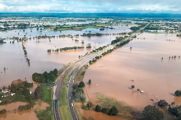
Vision from NSW Police’s PolAir aircrew working in Taree on Friday. Credit: NSW Police
“At this stage, we’re still expecting some of those flood levels to slowly recede through the course of the weekend and into early next week, but those flood warnings remain current,” she said.
And while there will generally be dry conditions along the coastal areas across the weekend, Woodhouse said a cold front is approaching from the west, which will bring strong winds.
“Now, this is going to be particularly true for Monday and Tuesday, when very windy conditions are forecast to be pretty much right across NSW and also across the coastal areas on Tuesday,” she said.
“We are seeing tides start to increase, and we’re expecting tides to be up near the highest astronomical tide, as well as some dangerous southerly swells developing in the wake of this system next week”.
Hazardous surf warnings remained in place for the Illawarra Coast, Batemans Coast and Eden Coast.