
I have seen these all my life, but never understood all the symbols.
This is most likely water accsess spots. But are there any factsheets to read these?
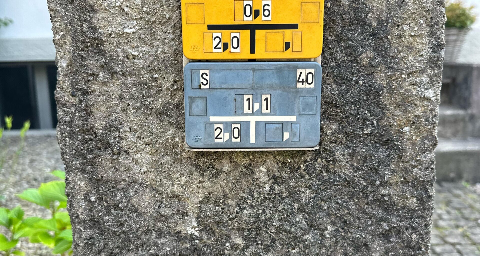
What does the numbers say?
Thank you for helping me learn
by Pleasant_Feedback826
I have seen these all my life, but never understood all the symbols.
This is most likely water accsess spots. But are there any factsheets to read these?
What does the numbers say?
Thank you for helping me learn
by Pleasant_Feedback826
9 comments
[Utility location markers](https://de.wikipedia.org/wiki/Hinweisschilder_zu_Stra%C3%9Feneinbauten)
Ukrainian flag upside down
They mark the location of access points to infrastructure, usually valves or fire hydrants, in this case for gas (yellow) and water (blue). There are also other colours (red and green, IIRC).
No, it is not a can.
Former Tardis location.
A „Dose“ is usually a can for liquids. They can be recycled and are actually better for the environment than bottles. But at least beer still tastes better out of bottles.
Jokes aside. Other commenters already gave the answer so i thought I add some fun to the thread.
[https://www.plica.ch/de/PLAT-140-x-113-36016.html](https://www.plica.ch/de/PLAT-140-x-113-36016.html)
We learnt that in primary school
its like a map for backpackers. the blue one shows the next fountain, the yellow one is the sunniest road
Comments are closed.