
Published on Jun. 13, 2025, 12:45 AM
Beware the risk for severe storms over the next couple of days, and keep up with the latest watches and warnings in your area
A spell of active weather continues on the western Prairies to end the week, bringing the risk for severe thunderstorms to some major population centres, while much-needed drenching rains fall up north.
Stay up-to-date with the latest watches and warnings in your area, and have a plan in place to seek safe shelter if severe thunderstorms threaten your location on Friday and Saturday.
DON’T MISS: Tornado, waterspout, landspout, gustnado: what’s the difference?
Friday storms could pack large hail
A centre of low pressure will develop and move north across Alberta on Friday, bringing persistent rain to northern portions of the province.
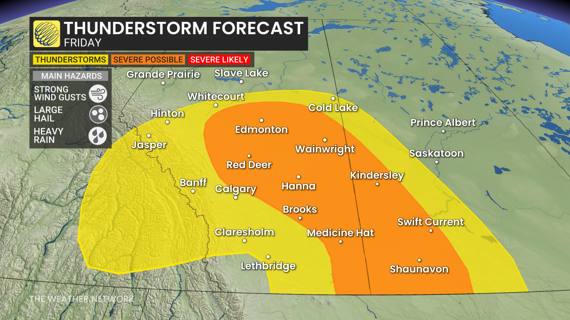
Farther south, expect a risk for thunderstorms to develop as instability builds from central Alberta through southwestern Saskatchewan. Higher levels of thunderstorm energy are possible toward the southern extent of the provincial border by Friday evening.
Friday’s risk for severe thunderstorms includes Edmonton, Red Deer, and Medicine Hat. The strongest storms in this region could produce large hail and strong wind gusts. Funnel clouds are also possible in central Alberta, and the potential for a landspout isn’t out of the question.
The changing wind direction should help clear some of the smoke out of southern regions by the afternoon hours.