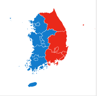
I recently came across the first map of South Korea’s presidential vote that seemed to show a neat left-versus-right, east-versus-west split. You’ve probably seen similar maps before, so consider this your yearly reminder that “land doesn’t vote—people do.”
Like in most elections, the bulk of ballots are cast in a handful of dense urban pockets. A choropleth makes big, sparsely populated provinces look more important simply because they cover more ground.
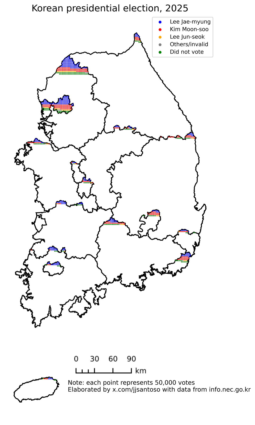
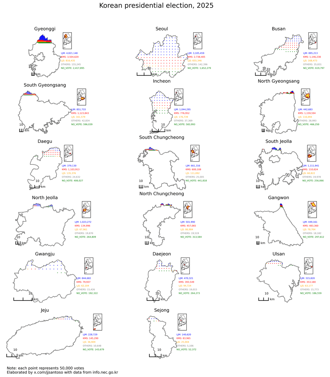
That’s why I prefer dot-density plots (see images 2 & 3). They anchor the data where people actually live, and they reveal that within every region there’s not a hard binary but a whole spectrum of political preferences.
Tools used: Matplotlib, GeoPandas
Code and data: https://gist.github.com/jjsantos01/810f03cbca36e5f1890e58525c26c0fa#file-korea_2025-ipynb
Posted by Affectionate-File-21
16 comments
Good idea, but the data is so small that it’s hard to read
…why is your dot density map just feeling the top 5% of every province and so small, though?
You’d be surprised how much geography affects voting patterns. But it also wasn’t such a clean East-West split if you look at municipalities instead of provinces:
https://preview.redd.it/p9301i5pdc7f1.png?width=1024&format=png&auto=webp&s=03a36e5b22ff7a820ad1670f44f9eb387fc223be
[deleted]
The important takeaway here is that western South Korea looks like a cool dude with sunglasses holding back an angry monster.
Imagining SK legislators shouting “west side motherfuckers” in their legislature
Why are all the cities at the top of each province??
I would break out Seoul and Incheon, and make all the dots big enough to mostly fill Gyeonggi. This all is too hard to read otherwise.
Alternatively, have them all fill the mass, but varying the density.
Should note that left/right follows the red/blue convention of the US, not the rest of the world. South Korea is one of just a few countries that does it this way.
Hmm, maybe we should bring back the landed vote system… each person’s vote is worth as much as how many hectares of land they own – it would make for some really beautiful graphs and election maps
I only recently learned just how empty most of Korea is from an article in the New Yorker about their declining birth rate. It’s possible that large swaths of the country could be essentially abandoned in another generation or two.
[https://www.newyorker.com/magazine/2025/03/03/the-population-implosion](https://www.newyorker.com/magazine/2025/03/03/the-population-implosion)
If you swop the map of S. KOREA for Ireland, I bet 99% of North Americans wouldn’t notice.
Enough time has passed, we need west and east Korea too
What’s with west vs east Korea?
Land votes when you have an electoral college
> [OC] Land doesn’t vote. People do.
Is this saying used to compensate for whatever insecurities people have when they see a map?
Comments are closed.