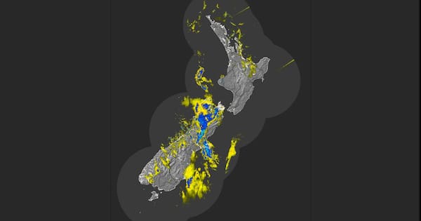
An active front across parts of the central North Island and South Island will bring heavy rain, thunderstorms, gales and possible flooding, MetService says.
Earlier in the week, the forecaster issued orange heavy rain watches and warnings for parts of the South Island and the lower North Island into Friday.
1News meteorologist Daniel Corbett said for some places the heavy rain will be “almost off the scale” as some “nasty” weather moves in.
Watch Daniel Corbett’s weather warning on TVNZ+
MetService meterologist Heather Keats told RNZ Canterbury High Country experienced “massive” 250km/h wind gusts overnight.
Wind gusts of more than 120km/h were recorded in Wellington.
Keats said other places experienced 90km/h gusts while some areas also had 10mm to 20mm of rain hourly.
New Zealand Transport Agency urged motorists to take care on State Highway 73 through Arthur’s Pass and State Highway 7 near Springs Junction due to weather.
Earlier, a slip closed State Highway 6 through Haast Pass. NZTA confirmed the road has since reopened.
MetService meteorologist Michael Pawley said the Nelson and Tasman region recorded significant rain as high as 25mm/h and should expect “a lot more to fall by Friday evening”.
Northern parts of the South Island were likely to have than a month’s worth of rain before the end of tomorrow.
Thunderstorms were expected in Northland before dawn on Friday and, as the front moved, the risk would spread to other regions of the North Island and top of the South Island.
Overnight into Saturday, the winds would shift southerly, meaning heavy rain in Dunedin and Otago with the possibility of heavy snow above 600m inland, potentially impacting alpine roads.
“Sunday looks like the better day to travel if you’re going away for the school holidays because the severe weather is expected to ease,” Pawley said.
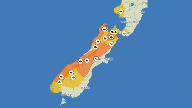
Heavy Rain Warning – Orange
Taranaki – 18 hours from 9pm tonight.
Tasman District northwest of Motueka – 33 hours from 3am today.
Buller District – 13 hours from 9am today.
Nelson District about and southeast of SH 6 and north of Nelson Lakes, also Marlborough about and north of Seddon (excluding the Sounds) – 33 hours from 9am today.
Strong Wind Warning – Orange
Marlborough Sounds and Wellington – nine hours from 9am today.
The morning’s headlines in 90 seconds, including Iran strikes report, stranded travellers land safely, rough weather coming, Bezos’ wedding under fire, Kiwi basketballer joins LA Lakers. (Source: 1News)
Heavy Rain Watch
Bay of Plenty and Rotorua – 12 hours from noon today.
Taranaki – 21 hours from 6pm today.
Marlborough Sounds – 33 hours from 9am today.
Nelson and Tasman Districts from Motueka to SH 6, including Nelson Lakes – 29 hours from 10am today.
The ranges of Grey District – 12 hours from 4am today.
Dunedin and North Otago – seven hours from 9am today.
Strong Wind Watch
Marlborough about and south of Seddon – 15 hours until 3pm today.
Heavy Snow Watch
Central Otago and Canterbury High Country south of the Rangitata River – 11 hours from 11pm on Friday.