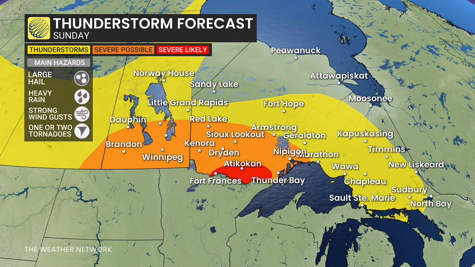
Large hail, gusty winds, heavy rainfall, and one or two tornadoes are possible in these storms. The environment is favourable for rotating thunderstorms near the international border, including Fort Frances and Atikokan.
STAY SAFE: Tornado warning safety: Here’s what you should do
There remains some uncertainty in the timing and coverage of the lines of storms in northwestern Ontario, as they depend on the timing of the cold front’s arrival and the atmosphere’s ability to destabilize itself amid the wildfire smoke over the region.
Folks across southern Manitoba, including Winnipeg, could see severe thunderstorms fire up beginning Sunday afternoon as a low-pressure system moves into the region. The main hazard from this cluster of storms will be large hail and heavy rainfall.
Stay with The Weather Network for all the latest on this evolving severe weather threat.
Header image created using graphics and imagery from Canva.
WATCH: In a tornado warning? Here’s what you should do