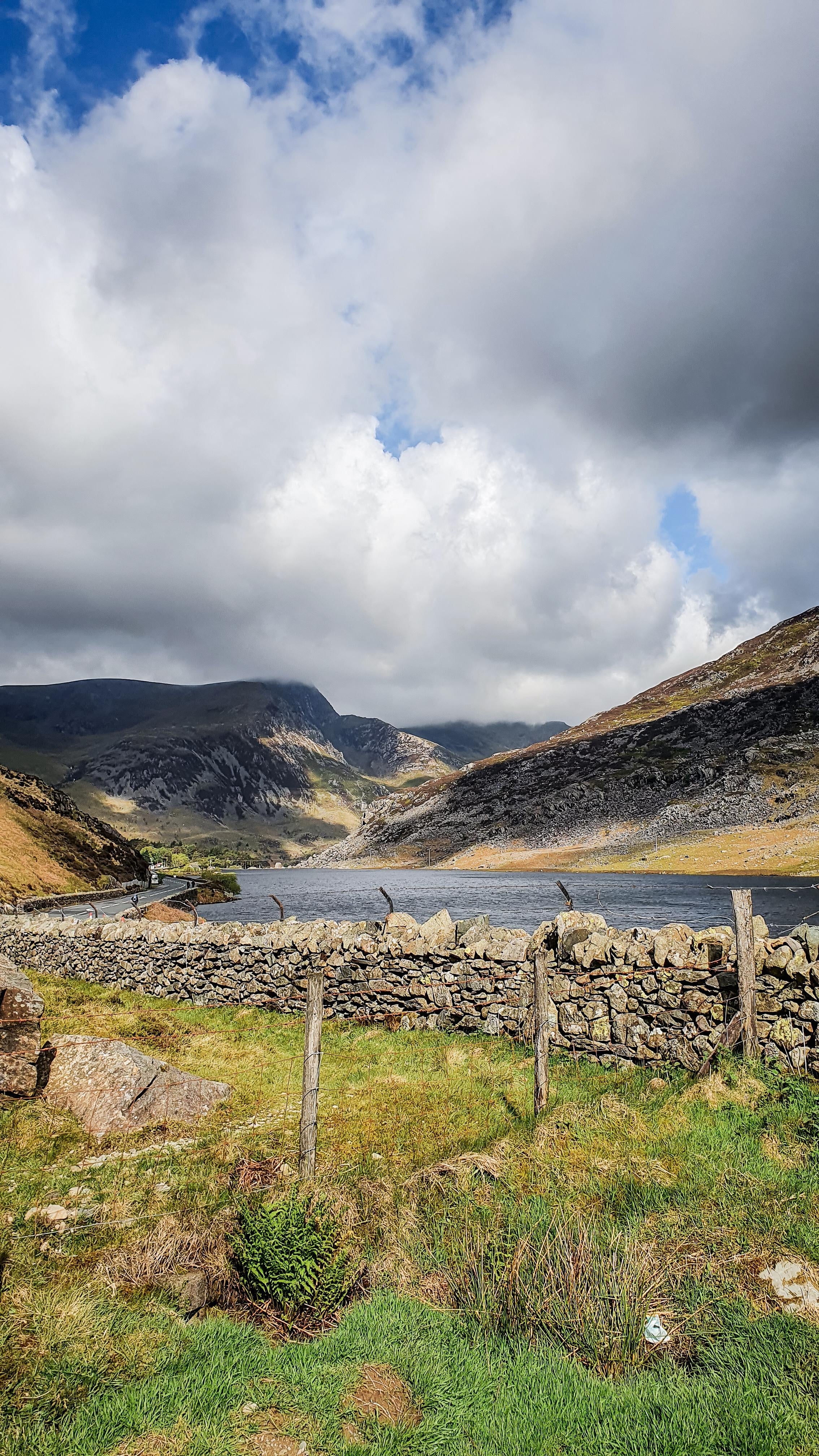
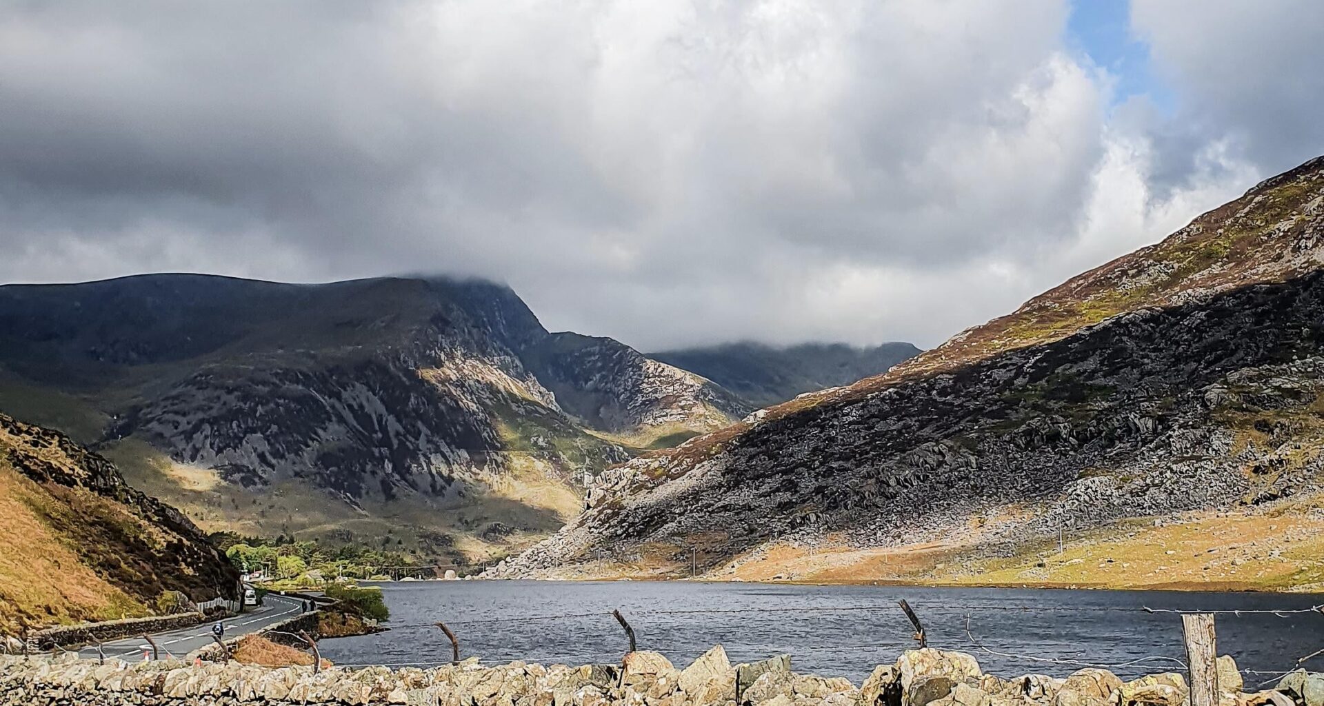
Does anyone know where I took this picture? by lebele Tags:United KingdomWales 16 comments Wales? Google Lens suggests Eryri National Park / Snowdonia. By that fence Ogwen Valley, at the base of Tryfan. Looking west across Llyn Ogwen [deleted] From in front of where you were standing? looks like about here [https://maps.app.goo.gl/1fSm6uYmAtXc5YD2A](https://maps.app.goo.gl/1fSm6uYmAtXc5YD2A) Next to a lake Station Road, Port Talbot Wales I think Could be wrong but I’m going to suggest this is the lake up the road from Beddgelert on the way up to Snowdonia. Wales Bottom of tryfan that is 🙂 Call me risky, but my guess is Wales.🤪 Holyhead town centre, opposite where Woolies used to be. Wales! Comments are closed.
looks like about here [https://maps.app.goo.gl/1fSm6uYmAtXc5YD2A](https://maps.app.goo.gl/1fSm6uYmAtXc5YD2A)
Could be wrong but I’m going to suggest this is the lake up the road from Beddgelert on the way up to Snowdonia.
16 comments
Wales?
Google Lens suggests Eryri National Park / Snowdonia.
By that fence
Ogwen Valley, at the base of Tryfan. Looking west across Llyn Ogwen
[deleted]
From in front of where you were standing?
looks like about here
[https://maps.app.goo.gl/1fSm6uYmAtXc5YD2A](https://maps.app.goo.gl/1fSm6uYmAtXc5YD2A)
Next to a lake
Station Road, Port Talbot
Wales I think
Could be wrong but I’m going to suggest this is the lake up the road from Beddgelert on the way up to Snowdonia.
Wales
Bottom of tryfan that is 🙂
Call me risky, but my guess is Wales.🤪
Holyhead town centre, opposite where Woolies used to be.
Wales!
Comments are closed.