
17:01 BST
Paul Brown and Sherie Ryder
BBC Verify
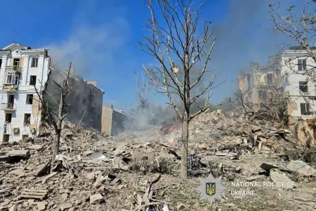 Image source, National Police of Ukraine
We’ve been looking at reports from this morning of an explosion in the Kramatorsk area of eastern Ukraine, which left a building severely damaged and one person dead, according to local officials. The city of Kramatorsk is just 35km away from Chasiv Yar that Russia claims to have seized.
Looking at several clips on social media we were able to match focal points such as a major roundabout and a row of trees that are also visible on Google Maps.
In between some of the trees, we also spotted the pillars belonging to the Palace of Culture and Technology – a key building in the city. From there we were able to identify which nearby building was damaged.
With the help of some old photos we found on Google Maps, from 2019, we could match up a chimney, trees and flag poles to an image we saw in one clip from , externalT, externalelegram, external.
From there we were able to pinpoint the location to a building on a main road that runs through the centre of the city.
 Image source, Telegram
The cause of the explosion remains unconfirmed, although the head of the Donetsk Regional State Administration, Vadym Filashkin, has blamed Russia.
We’ll continue to monitor for more updates this afternoon.