Late summer storms like Thursday’s deluge, which can include excessive rainfall and flooding, have become more frequent on Long Island and other parts of the Northeast due to warmer temperatures and increased moisture caused by climate change, experts said.
Thursday’s storm, while not as strong as past deluges, followed the trend of heavy and sometimes sudden rainfall that can drop 3 inches or more of precipitation in a few hours, meteorologists said.
“The trend will continue, because the last five decades have been warmer and the earth continues to warm by greenhouse gasses,” said Kevin Reed, associate provost for climate and sustainability programming at Stony Brook University. “For the foreseeable future, the frequency and magnitude of this extreme rainfall will continue.”
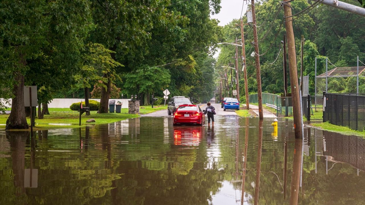
This week’s storm dropped about 6 inches of rain in Queens, more than 3 inches of rain in Great Neck and nearly 5 inches of rain in Sayville, according to the National Weather Service. The late afternoon rain flooded streets and highways, including the Cross Island Parkway, and forced suspension of the Port Washington branch of the Long Island Rail Road, east of Flushing-Main Street in both directions, due to high water..
In early July, a storm flooded New York City subways with 2 inches of rain. Last year, an August rainstorm dropped 10 inches of rain on Suffolk County’s North Shore, destroying bridges, roads and dams in Stony Brook and Smithtown.
“Thursday’s storm wasn’t as extreme as last August, but 3 inches of rain in a few hours is a lot of rain for infrastructure to deal with,” Reed said. “It’s not built to deal with our roads and the drainage systems.”
The storm systems are propelled by increased moisture in the atmosphere during hot and humid weather, National Weather Service meteorologist John Murray said.
Rain has become more severe as the Earth’s temperature has increased by 2.5 degrees Fahrenheit, compared with 50 years ago, according to the last National Climate Assessment, completed in 2023. The Northeast has seen a 60% increase in heavier downpours since the 1950s, according to the report.
Long Island has seen heavy storms come in August and September for the past several years, including deadly floods during Hurricane Ida in 2021 and in 2014, when 13.5 inches of rain fell on Islip.
“Mid-to-late summer on Long Island has seen warmer temperatures and the waters and the marine environment influence that,” Murray said. “Showers and thunderstorms don’t weaken as much and maintain their strength, leading to torrential downpours.”
The storms are generated by the same type of extreme weather that led to deadly flooding last month in Texas, experts said.
Climate change caused by fossil fuels and greenhouse gases has increased temperatures to allow the atmosphere to carry more moisture, which is released during extreme rainstorms, said Marc Alessi, a science fellow with the nonprofit Union of Concerned Scientists.
“This is kind of our new normal. The storms that used to be once in a lifetime, we’re seeing every couple of years,” Alessi said. “This is how climate change is revealing itself. One of the most clear signals in the Northeast we’ve seen is warming every season, and in the summers we experience more extreme rainfall and downpours.”

John Asbury is a breaking news and general assignment reporter. He has been with Newsday since 2014 and previously worked at The Press-Enterprise in Riverside, California.