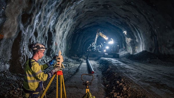
Skanska’s survey engineers use the unique, smart AP20 AutoPole to boost on-site productivity. (Credit: Hexagon)
Hexagon’s surveying solutions are playing a key role in the construction of Project Rogfast, a 27-km subsea road tunnel in Norway that is set to be the longest and deepest of its kind. Running 392 m below sea level, the tunnel will link Stavanger, Haugesund and Bergen, aiming to cut travel time by up to 50% and strengthening economic connections in the oil and gas sector.
The project, led by construction firm Skanska, presents unique engineering challenges, including tunneling from both ends with a final meeting point that allows for no more than a 5 cm margin of error. Even small misalignments could result in significant delays and costly rework. Skanska is using Hexagon’s portfolio of Leica Geosystems solutions to align machinery and validate measurements in real time, enabling precise tunneling under extreme conditions.
Hexagon’s technologies are delivering measurable impact across the project by:
Enabling precise alignment with total stations, GPS, multistations and laser scanners.
Reducing rework, emissions, and cost through real-time data capture and validation.
Powering safe operations under extreme conditions, 392 m below sea level.
“In a project like this, even a millimeter of misalignment can trigger cascading risks,” said Trond Valleur, vice president at Skanska. “Hexagon’s technology gives our teams the confidence to move forward with accuracy, efficiency and safety.”
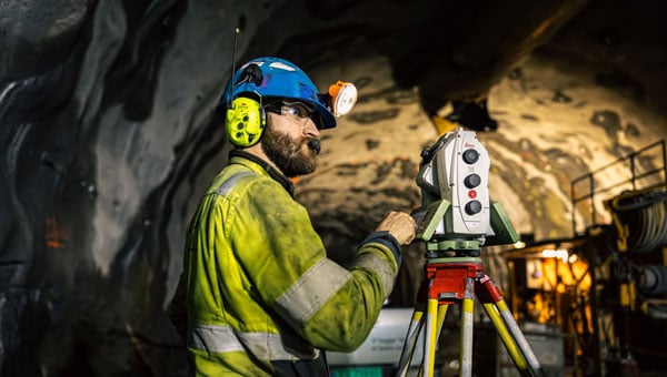 The Leica Nova MS60 MultiStation is a robotic total station that can measure points down to 1 mm to 2 mm and capture 3D scans. (Credit: Hexagon)
 The collaboration reflects a partnership between Skanska and Hexagon that has spanned more than 30 years. The Skanska team is using several Leica Geosystems surveying instruments, including the Leica RTC360, Leica MS60 MultiStation, Leica AP20 AutoPole and Leica TS60.