![[OC] Distribution of Hillforts in Ireland](https://www.europesays.com/wp-content/uploads/2025/09/d3xkx1o66wmf1-1500x1024.jpeg)
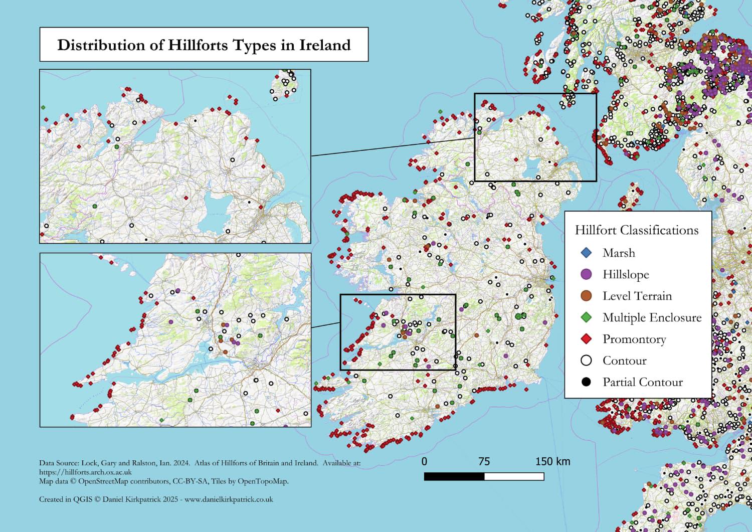
I love a good hillfort, but I never realised there were so many until I started researching it. For those who share my interest, you can see my latest map which shows the distribution based on hillfort classifications.
The map is populated using archaeological data from the amazing Atlas of Hillforts available here. The map was built using some PowerQuery transformations and then designed in QGIS.
There's obviously a few trends you can see from the data, particularly the distribution around coastlines. I’m sure you can spot many more.
I previously mapped a bunch of other ancient monument types the latest being prehistoric burials.
Any thoughts about the map or insights would be very welcome.
Posted by Sarquin
3 comments
For those who want to see the data sources check out Atlas of Hillforts here: [https://hillforts.arch.ox.ac.uk/](https://hillforts.arch.ox.ac.uk/) For the tooling, I used QGIS and PowerQuery (Excel).
If you want to see more of my research into Irish hillforts, you can see here: [https://www.danielkirkpatrick.co.uk/historical-sites/irish-hillforts/](https://www.danielkirkpatrick.co.uk/historical-sites/irish-hillforts/)
Who were they defending against?
In hindsight, they probably would have done better to have focused a bit more on the English-facing coast.
Comments are closed.