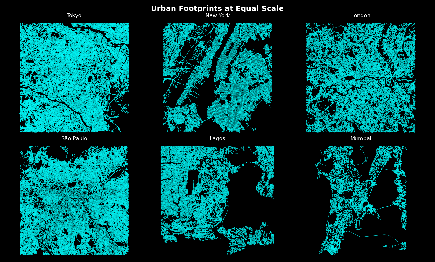
Each panel shows a 7 km around the city center. All of them have the same zoom so you can compare each city. Each of those thin blue lines is a road
I’ve always been intrested by how a city’s layout reflects its history, like how NYC's planned boxy lanes date back to the 1700s, while newer cities exploded outward in a rush of population and growth.
Built entirely in python using OpenStreetMap data.
Have fun exploring it, mabye you will see your own city.
[OC]
Posted by Electrical-Topic1467
7 comments
Have fun exploring
Always amazing how small manhattan is geography wise.
oh also btw does anyone want the code, cus I can provide a collab or just the raw code, and then ppl can easily change the settings for their own cities or towns
It’s incredible how cramped people in Mumbai are.
Can you calculate the % of area in the cities used for only roads?
Half of NY map is New Jersey.
great work! do you have github?
Comments are closed.