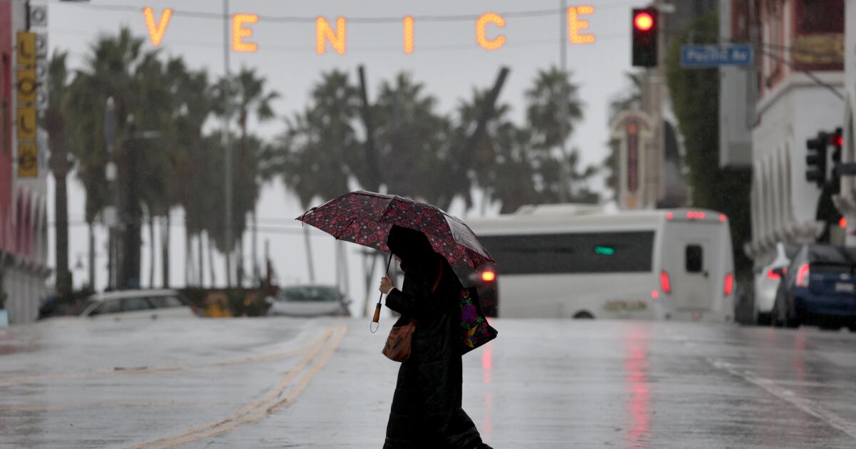
An unusual series of storms has made this the wettest November on record for swaths of Southern California, dumping as much as 8.9 inches of rain along the coast as of Friday afternoon before a week of dry weather will provide a reprieve through the Thanksgiving holiday.
Scattered light showers are still possible through Saturday, and snow levels will remain near 6,500 feet in elevation in the mountains, the National Weather Service said. But the weather is expected to dry out and warm up through Thanksgiving. Rain could return in the days after Black Friday, however.
Santa Barbara Airport has recorded the wettest ever November in its record books, which started in 1941, with 8.9 inches of rain falling this month, breaking the record in 1965, when 6.92 inches fell, the National Weather Service office in Oxnard said.
So did Van Nuys, which recorded 5.18 inches of rain this month, about seven times the average for a November; and San Luis Obispo Airport, which recorded 3.69 inches, about 2½ times the average for this month.
Downtown Los Angeles has recorded its fifth wettest November since records began being tracked in 1877, with 5.52 inches having fallen there. The record wettest November for downtown was in 1965, when 9.68 inches of rain fell.
Combined with a robust mid-October storm, the city of Santa Barbara — which has records dating to 1899 — has reported its wettest start to the water year on record. More than 9.5 inches of rain have fallen since Oct. 1, the start of the water year.
The heavy rains weren’t so severe that they caused destructive and deadly mudslides and debris flows in recently burned areas. But they were heavy enough to put a damper on the autumn fire season, and likely put an end to it. Before these storms, meteorologists said 3 to 4 inches of widespread rain in the lower elevations were needed to effectively end high fire season in Southern California.
In Orange County, a possible tornado or waterspout moved ashore around 10:15 p.m. Thursday in the eastern Dana Point Harbor, a witness reported to the National Weather Service. The wind “lofted a 12-foot segment of chain link fence with privacy fabric and threw it 70 feet across parking lot,” the weather service said.
There were numerous calls of flooding in the city of Westminster, police said, where an astonishing 1.84 inches of rain fell in a single hour, between 9:30 and 10:30 p.m. Thursday, according to the National Weather Service. One gauge in Garden Grove recorded 1.5 inches over the same hour.
In Huntington Beach, a three-mile stretch of Pacific Coast Highway was closed — between Warner Avenue and Seapoint Street, just southwest of the Bolsa Chica Ecological Reserve — due to roadway flooding. Inches of rain also covered a section of Artesia Boulevard in Redondo Beach and a road in a Huntington Beach neighborhood, KABC-TV Channel 7 reported. On Kelton Avenue in Palms, some residents were shocked to see their cars immobilized by thigh-high floodwaters in their parking garages, the TV station reported.
Floodwaters surged above the curb level along two of Santa Barbara’s main streets Thursday night — State and Anacapa streets, with a few cars stalled in the water, the weather service said. Overnight in Long Beach, interchange ramps connecting the 710 and 91 freeways had to be closed due to flooding. Police noted cars getting stuck at the intersection of La Cienega Boulevard and Slauson Avenue.
In Ventura County, three-foot-long boulders blocked lanes along Highway 150, a winding key route that connects Ojai to Santa Barbara County. A mudslide blocked one lane of a roadway on the Palos Verdes Peninsula, and a rockslide was reported on a canyon road north of Sunland. A 60-foot pine tree fell onto a home in La Habra Heights, and a tree crashed into a vehicle on Olympic Boulevard in Westlake; the driver was able to escape and was uninjured, KTLA-TV Channel 5 reported.
Before dawn Friday, flooding and a rockslide hit Highway 330, the winding road north of Highland that leads to the San Bernardino Mountains. In Irvine, all lanes of the southbound Highway 133 offramp to Irvine Boulevard were flooded with several vehicles that were possibly stuck, the weather service said; rain had been falling nearby at a rate of about half an inch per hour.
In Big Bear Lake, a dozen vehicles were trapped in the snow along Highway 18 at Bear Valley Dam, authorities said.
After the main storm faded midday Friday, there was a risk of a “semi-wet Santa Ana event” across parts of Los Angeles and Ventura counties. Typically, Santa Ana winds come from the north and east and are dry, capable of spreading wildfires; with this event, winds would come from the same direction, but with rain.
In Los Angeles County, there will be a 10% to 20% chance of rain Saturday morning.
In Orange County, San Diego County and the Inland Empire, light to moderate showers could continue, with some “wrap-around precipitation” into Saturday, referring to rain that could head from the south and from the east after the main cold front pushes through from the west.
A winter storm warning was in effect for the San Bernardino County and Riverside County mountains through Saturday morning for areas at an elevation of 6,500 feet or higher above sea level, including in Big Bear. Heavy, wet snow was expected to fall at elevations above 6,500 feet. The first phase of the storm was expected to dump 4 to 8 inches of snow from 6,000 to 7,000 feet; 7 to 11 inches from 7,000 to 7,500 feet; and 12 to 16 inches above 7,500 feet. The city of Big Bear Lake is at an elevation of 6,752 feet above sea level.