November the 24th, 2025 – Krndija is an often overlooked eastern Croatian mountain that was once an island in the long dead Pannonian Sea. It’s now full of dense forests and fascinating history.
As Putni kofer writes, Slavonia is an eastern Croatian region adorned with endless fertile fields and centuries-old green forests. It was once called the “Golden Valley” by the Romans who were enchanted by its beauty. Although it is known as a flatland, this overlooked part of the country also has several mountains. They may not impress you with their height, but that doesn’t mean that they aren’t worth visiting. One of them is Krndija. It is actually a mountain in the very heart of Slavonia, stretching in a northwest-southeast direction for a length of about 30 kilometres and is part of the mountainous framework of the Požega Valley. Its highest peak is called Kapovac and stands at 792 metres.
It is located just east of the Papuk mountain, from which it is separated by the Londža river, which is the left tributary of the Orljava. Its western border is formed by the mountain pass between the peaks of Češljakovački vis on Papuk and the aforementioned Kapovac. The eastern edge is somewhat difficult to determine because Krndija near Đakovo and further east towards Vinkovci gradually turns into a plain.
the oldest parts of the slavonian “mountains”
The Kutjevo-Orahovica road, which passes between Kapovac and Petrovo Vrh divides Krndija into two parts, and over the Gradac pass, which lies at 355 metres, the Našice-Slavonski Brod road intersects it. This mountain, together with Papuk and Psunj forms the oldest parts of the so-called Slavonian mountains.
Krndija is made of Precambrian and Paleozoic crystalline rocks, eruptive rocks (magmatic or volcanic rocks) and Triassic, Oligocene and Quaternary sediments, i.e. limestone and marl. The most common are metamorphic rocks, which over than 300 million years old, which makes them the oldest known in all of Croatia.
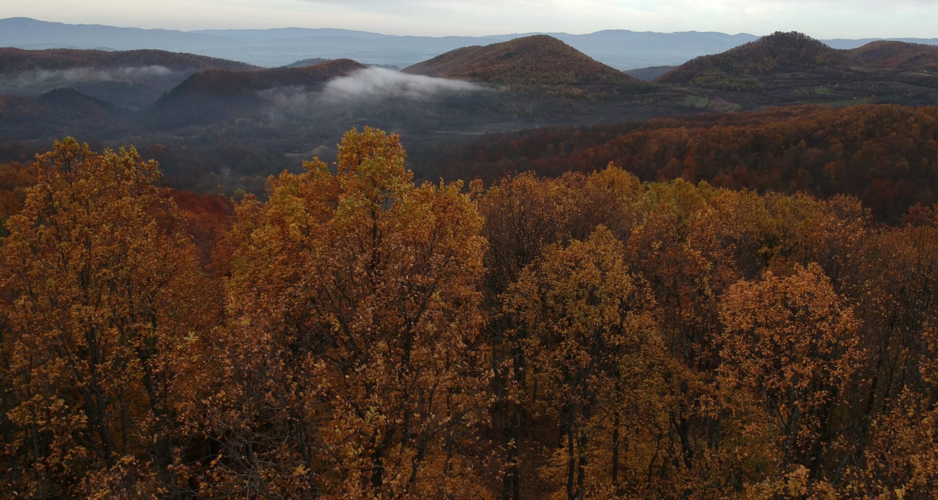
The western parts of Krndija, characterised by dense beech and oak forests, belong to the Papuk Nature Park, while its foothills are rich in orchards and vineyards. This area naturally connects to Papuk itself, and is located south of Orahovica and Našice, which is just a little north of Požega and Kutjevo.
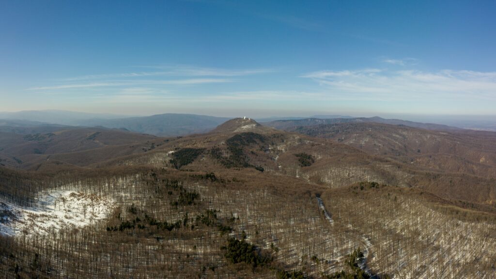
On the densely forested Kapovac, the highest peak of Krndija, you’ll notice a television transmitter, from the platform of which a fantastic, sweeping view of the entire Đakovo region, Podravina and the Požega Valley is laid out before you.
historical fortifications are dotted throughout
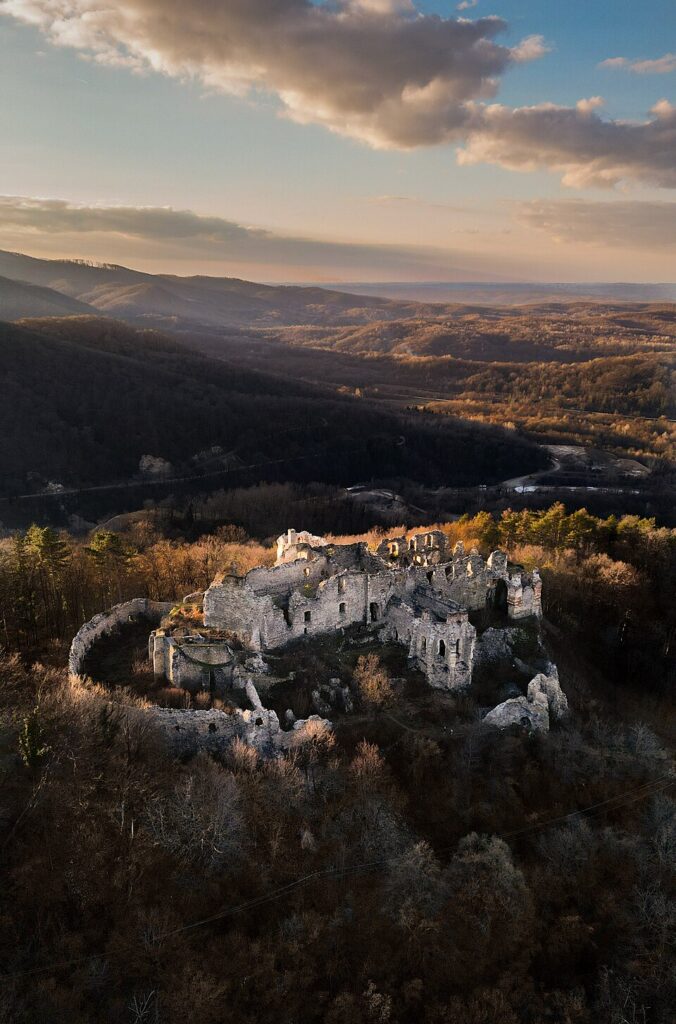
In addition to its aforementioned thick forests, Krndija is also known for its historical fortifications, and by far the most impressive is the one called Ružica grad. It once boasted a palace, a fortress, a Gothic church and noble mansions, and in ancient legends this place was also mentioned as a gathering place for fairies.
A very old story, which is still told today, claims that it was precisely those fairies who disrupted the plans of a powerful man who wanted to build a whole city there. It is said that they went and destroyed everything he had built throughout the night, until the man in question spread a net around the construction site. It was in this net that caught the most beautiful fair of all, who was named Ružica. Vengeful as he was, he had her constructed into the foundations of the city, which was then named after her.
a hiking trail like no other
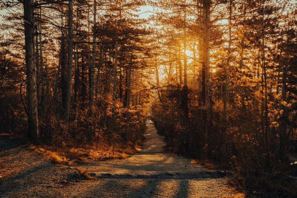
The longest Slavonian hiking trail of all, which spans a massive 300 kilometres, also passes through Krndija. In addition to being full of cycling trails, this Slavonian mountain is also home to a sports climbing area. Lovers of outdoor activities will also be delighted by the impressive circular route, which starts from the village of Seona and leads to the peak of Lončarski vis, which is located at 482 metres above sea level.
Along this route, not too far from Našice, on the 407-metre-high Krndija volcanic cliff, you’ll also come across the 14th-century Bedemgrad fortress. Remains from the ancient Roman era have also been found at the same site, and an ancient road passed under Bedemgrad itself, which is believed to have connected the Požega region with today’s Našice and Osijek.
At about 600 metres above sea level on the northern slopes of Krndija, more precisely in the Papuk Nature Park itself near Orahovica, the Tisina Cave was discovered back in 2002. It is believed to be around 200 million years old. It is exceptionally rich in natural wonder, stalactites and stalagmites, seeing it very quickly declared the most beautiful cave in all of Slavonia.
Subscribe to our newsletter
the fields marked with * are required