Altamira, in southwestern Pará, covers 159.533 square kilometers, has a population density of less than one inhabitant per square kilometer, Amazonian terrain, more cattle than people, and districts more than a thousand kilometers from the city center, creating significant challenges for public services, logistics, urban development, and a sustainable future in the heart of the rainforest.
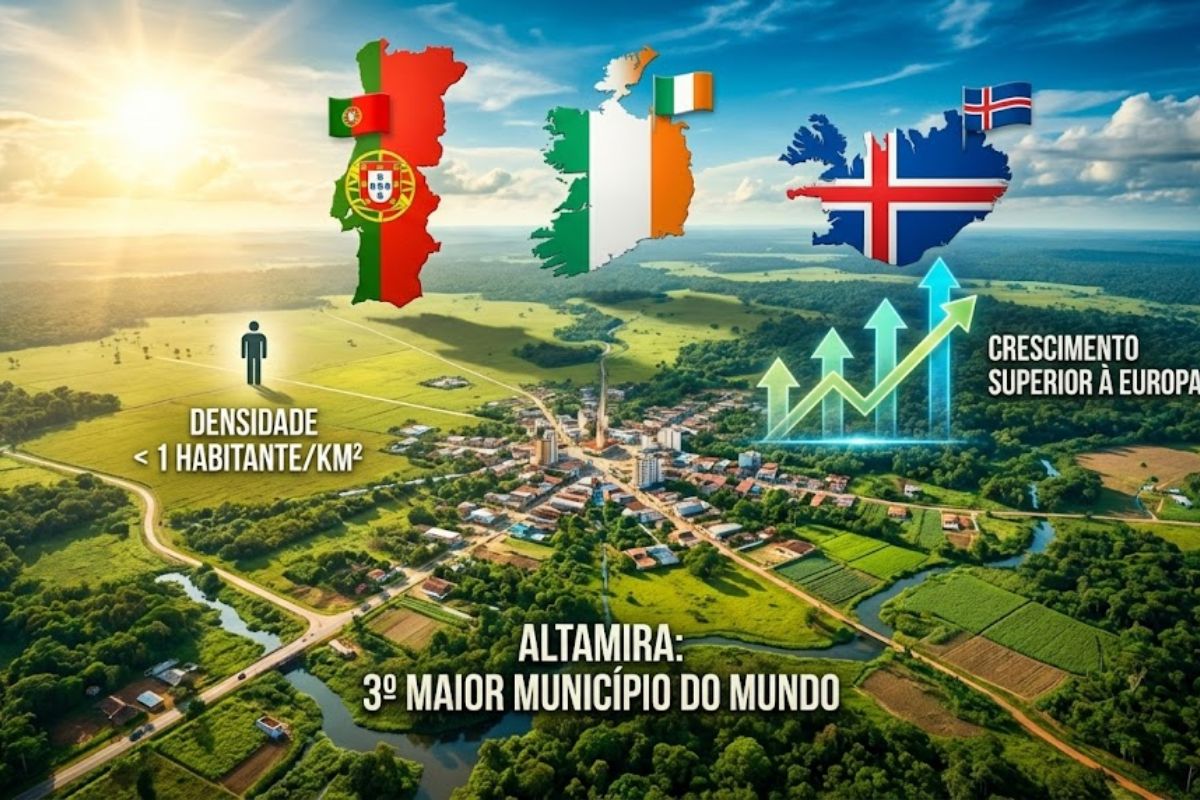
Altamira is not just a name lost on the map of Pará. Altamira has become a symbol of territorial excess and low human population., a municipality with an area larger than Portugal, Ireland, Iceland, and Greece, but which cannot even fill its own city. Instead of cramped buildings, what exists is too much space and too few people.
At the same time, Altamira appears in the statistics as the third largest municipality in the world in terms of area.Larger than 104 independent countries, but with approximately 138.749 inhabitants scattered across a vast territory that is expensive to maintain and difficult to integrate. Nestled between the Xingu River, creeks, long roads, and isolated farms, the The municipality experiences the paradox of being enormous on the map and sparsely populated in real life.
Giant Altamira, small population.

Altamira is located in southwestern Pará and occupies almost 13 percent of the state’s entire territory. In practice, that’s… 159.533 square kilometers for just over 138 inhabitants., a direct result of dispersed occupation, with few urban centers and much forest, pasture, and remote communities.
See also other features
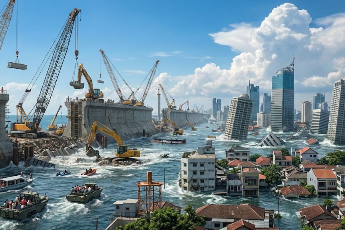
With 42 million inhabitants, a subsidence of up to 25 cm per year, and half of it below sea level, Jakarta is becoming the world’s largest city while facing the real risk of disappearing underwater.
Grandfather gets in his old Volkswagen Beetle, travels 600 km to personally deliver his grandson’s dream gift, and the episode touches the hearts of the internet.

Ilhabela will desalinate seawater by 2026: the first plant in São Paulo promises to end the water crisis, transform the coastal water supply, and inaugurate the era of “infinite water” in Brazil.

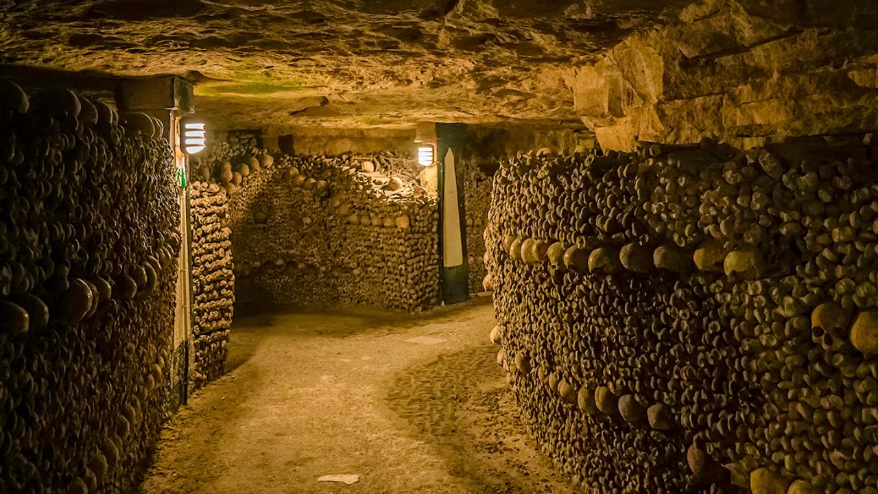
Hidden Paris: the gigantic underground world of tunnels, catacombs, sewers, and secret bunkers that form the invisible city beneath the City of Lights.
The population density of Altamira is less than one resident per square kilometer, a rare number even by Amazonian standards.
While metropolises fight for space, Altamira experiences the opposite scenario: plenty of land, but large empty spaces between the places where people actually live.
Altamira is bigger than entire countries.
To understand the scale, it’s worth comparing Altamira to the rest of the world. Altamira has a territory larger than Portugal, Ireland, and Iceland combined….and surpass Greece and over a hundred independent nations. All of this concentrated in a single Brazilian municipality, nestled within the map of Pará.
Founded in 1911, Altamira grew on the banks of the Xingu River, between streams and forest, connecting territorially to 13 neighboring municipalities.
This sheer size has become a strategic advantage in some areas, but also a monumental logistical problem.Because any public policy needs to overcome distances that, in many countries, would require a different level of planning and budgeting.
The urban center of Altamira formed around the Xingu River, surrounded by streams and impressive biodiversity.
Altamira has more than 60 neighborhoods within its urban area., with shops, services, schools and infrastructure that cater to those who live closer to the city center.
But the municipality doesn’t end where the paved roads end. Beyond the main city, Altamira manages a sprawling territorial network, encompassing riverside communities, rural areas, and forested regions that lie many hours away from the urban center.
The same Altamira that appears compact when viewed from the city is, in fact, a giant that is difficult to piece together entirely.
Districts of Altamira located more than a thousand kilometers from the city center.
Altamira still has two official districts that are extremely far from the main town: Castle of Dreams and Waterfall of the Mountainseach located more than a thousand kilometers from the main urban center.
In practice, they function almost like independent cities, but remain under the administrative umbrella of Altamira.
For those who live in these districts, “Going to Altamira” means facing a long, expensive, and tiring journey.This distances the population from the city center and complicates direct access to public services, political decisions, and administrative structures. A single municipality, several different worlds within it.
For decades, the occupation of the Altamira territory was marked by extensive livestock farming. In many rural areas, the cattle population exceeds the human population, with large farms, open pastures, and a few houses scattered across the landscape.
This model helps to explain why Altamira continues to have such a low population density., even after growing in economic importance.
The economy revolves around productive activities that do not require large concentrations of people, which keeps the municipality large, productive, but still sparsely populated compared to its size.
Governing Altamira: Country size, city budget
All of this combined makes managing Altamira a daily challenge. The enormous population dispersion and internal distances create problems such as:
difficulty in providing health, education and public services to remote communities
long journeys between communities and headquartersboth by roads and by rivers
logistical limitations for the public sector, which needs to cover a territory of continental size.
uneven growthwith the urban area concentrating infrastructure and many outlying regions remaining in a state of partial isolation.
Altamira, seen from above, looks like a colossus. But, seen up close, It shows a municipality that is still trying to transform size into quality of life., sewing a A vast territory with few resources and many demands.
If you could choose, would you prefer to live in a compact, bustling city or in a place like Altamira, huge, empty, and scattered across the Amazon?