
Following the early disruption of the Polar Vortex, the deep Arctic troughs emerging into the Atlantic are resulting in intense storms moving towards Western Europe. On Tuesday, a fierce windstorm (possibly soon to be named Bram) is forecast to pass near the western coast of Ireland, Northern Ireland, and Scotland (Outer Hebrides).
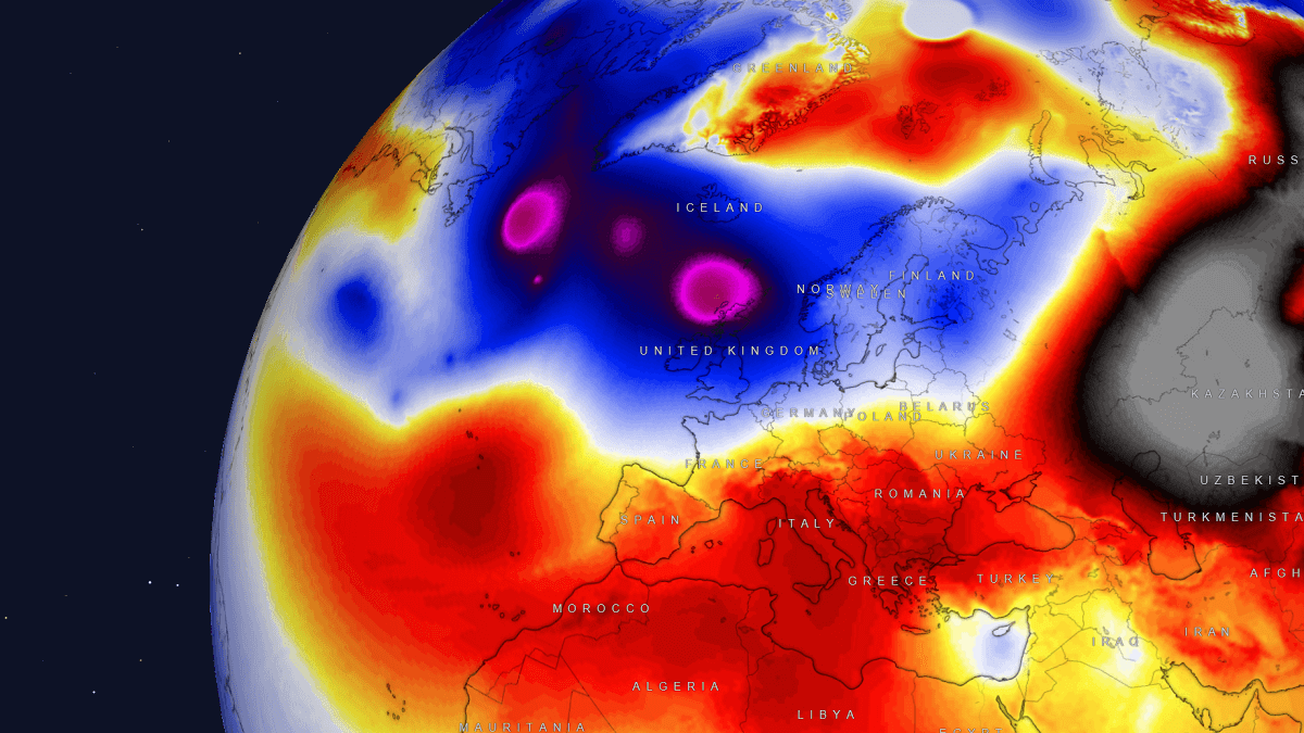
A more active North Atlantic means zonal flow returns, with much warmer, moister air masses spreading across the continent. Still, there is also the potential for violent storms to impact Ireland and Scotland. A significant warm wave will develop over Europe.
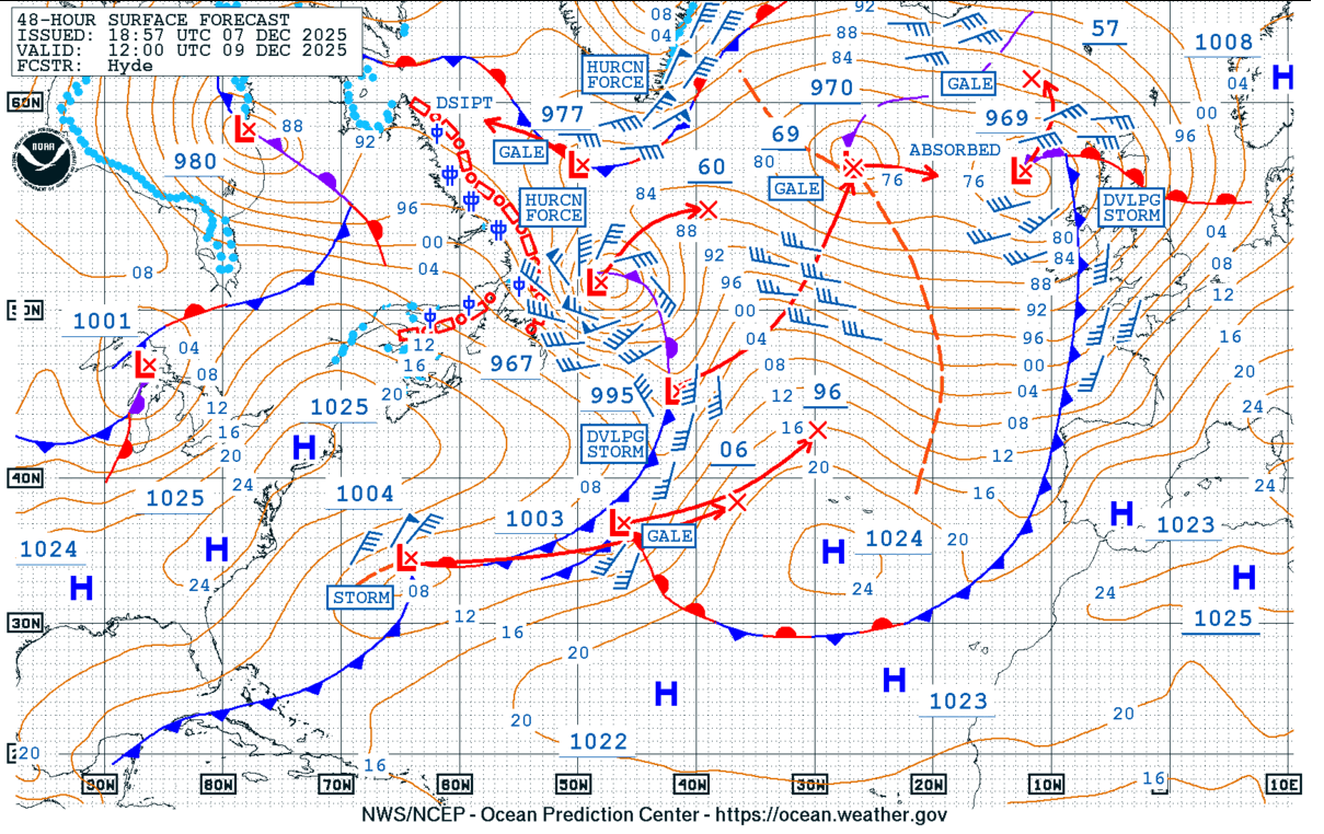
The following chart is the forecast by the NOAA Ocean Prediction Center (OPC), indicating how dynamic the pattern over the Atlantic is. We can see our storm of interest west of Scotland, with another monster storm emerging near Newfoundland as more Arctic air mass is spread from Canada into the Atlantic.
This is quite a typical evolution of the weather patterns over the Northern Hemisphere, where the Polar Vortex splits and Arctic cold is sent over North America, activating the North Atlantic ocean and developing warmth over Europe.
The violent storm expected on Tuesday will be followed by more intense systems over the North Atlantic throughout the week and into the following weekend. The patterns over the Atlantic will remain dynamic and powerful, with persistent zonal flow maintaining a warm wave over the continent.
Attached below is an overview of weather patterns over the Atlantic and Europe for the next 10 days, showing multiple Atlantic storms continue to develop over the ocean and blast towards Western Europe. While further east, warmer, more stable weather persists over the continent.
Aside note:
The Irish meteorological agency, Met Éireann, in partnership with the National Meteorological Services of the UK (Met Office) and the Netherlands (KNMI), has launched the new list of cyclone names for the 2025/26 storm season.
The Atlantic storm season that affects Europe runs from September 1st, 2025, until August 31st, 2026. Of the 21 names on the list, each national partner has contributed seven storm names, publicly voted on in the summer months.
A storm is named when it could result in medium or high impacts in any one of the three meteorological partner countries. Naming storms enables authoritative, consistent communication with the public, helping them prepare for and stay safe during potentially severe weather.
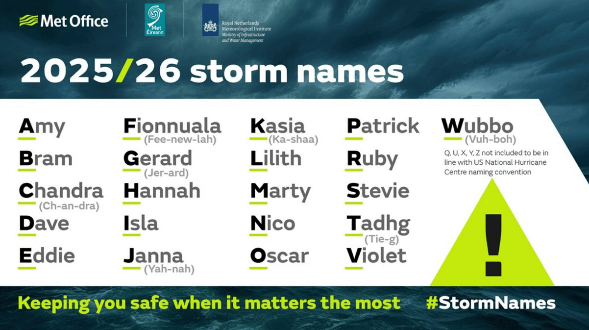
Naming storms is a powerful tool that supports meteorological agencies and other public safety organisations in increasing awareness of severe and impactful weather alongside regular weather warnings. Naming storms makes it easier for people to track essential and up-to-date forecast and safety-related information.
Let’s dig into details regarding the evolution of the intense Atlantic low coming up on Tuesday for Ireland and the northern UK. If the upcoming windstorm is sufficiently intense for Ireland or the UK, it will be named—the second on the list is Storm Bram.
Active weather pattern over the North Atlantic continues, warm wave over Europe
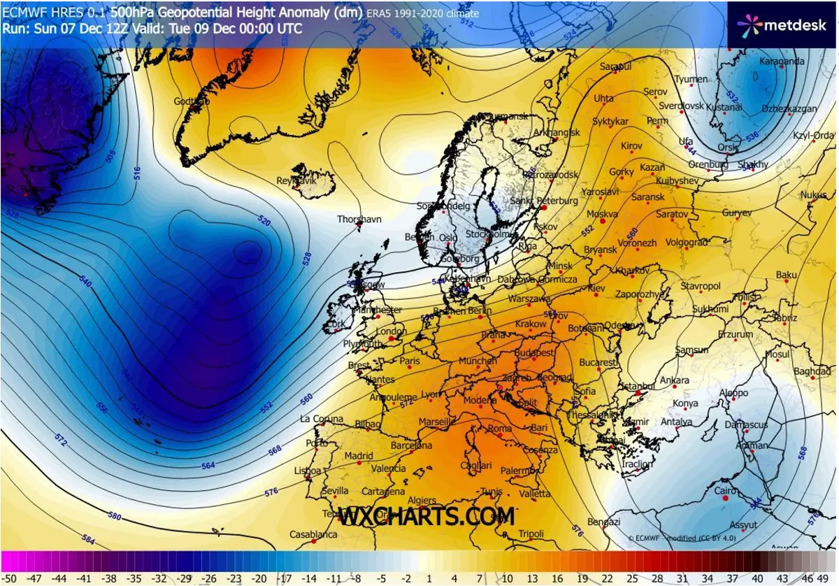
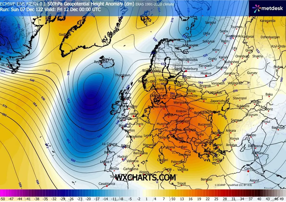
As we discussed earlier, the typical active North Atlantic follows the disruptions of the Polar Vortex, which sends cold air masses into North America. This Arctic air spreads onto the Atlantic, resulting in forming multiple deep waves and surface lows travelling towards Europe.
The ongoing pattern through mid-December remains unchanged mainly: more and more deep waves will form, while the European continent experiences warmth under a large Omega blocking pattern.
The wave approaching the Bay of Biscay and Western Europe early this week will bring an explosive deep low towards Ireland and Scotland on Tuesday.
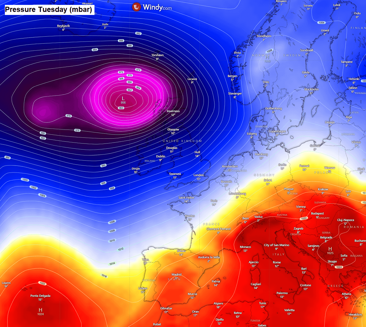
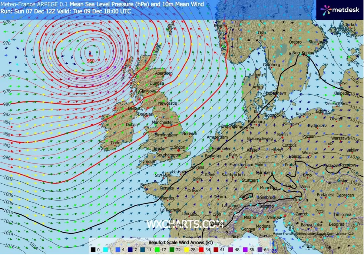
A deep low forms to the west of Iberia on Monday, then travels northeast through Monday night, strengthening. By Tuesday midday, the center of the low deepens to around 955 mbar as it passes northwards along the western coasts of Ireland, Northern Ireland, and Scotland.
The low further deepens while it continues towards the Faroe Islands on Wednesday morning.
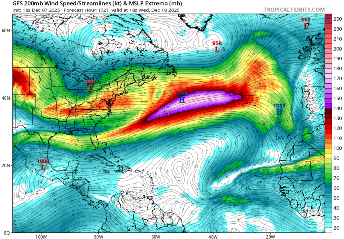
The sharp and massive pressure and temperature difference between the far North Atlantic and the Azores results in powerful zonal flow winds. The jet stream will continue to blast from west to east at 150 to 180 knots (200 mbar pressure level).
And there are no signs of the flow weakening or being changed until the Arctic outbreaks keep spreading across Canada towards the Atlantic, tightening the pressure and temperature gradients.
So, as a result of persistent zonal flow, the blocking high over the European continent remains, dominating the weather through at least mid-December.
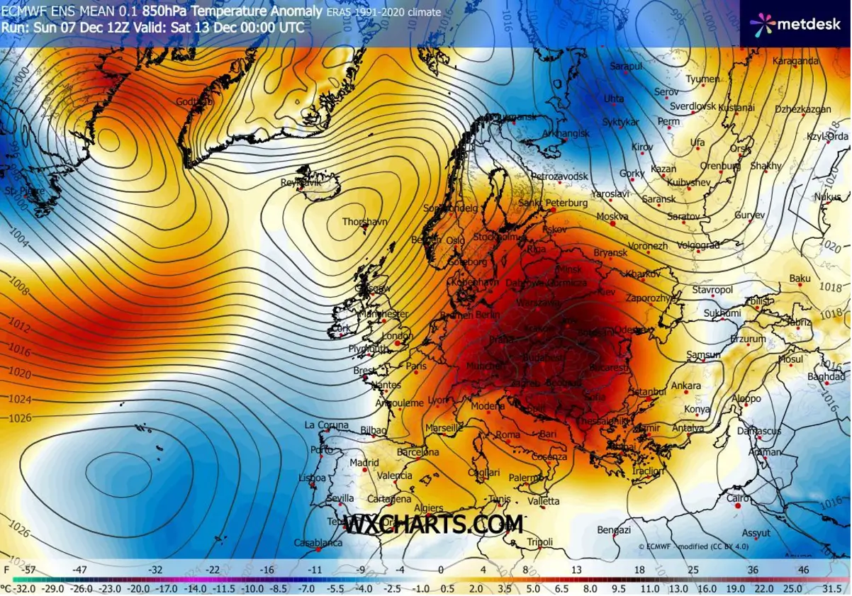
This maintains the warm wave over the continent, with significantly warmer air mass throughout the week. The temperature anomaly will be 8-12 °C above normal for this time.
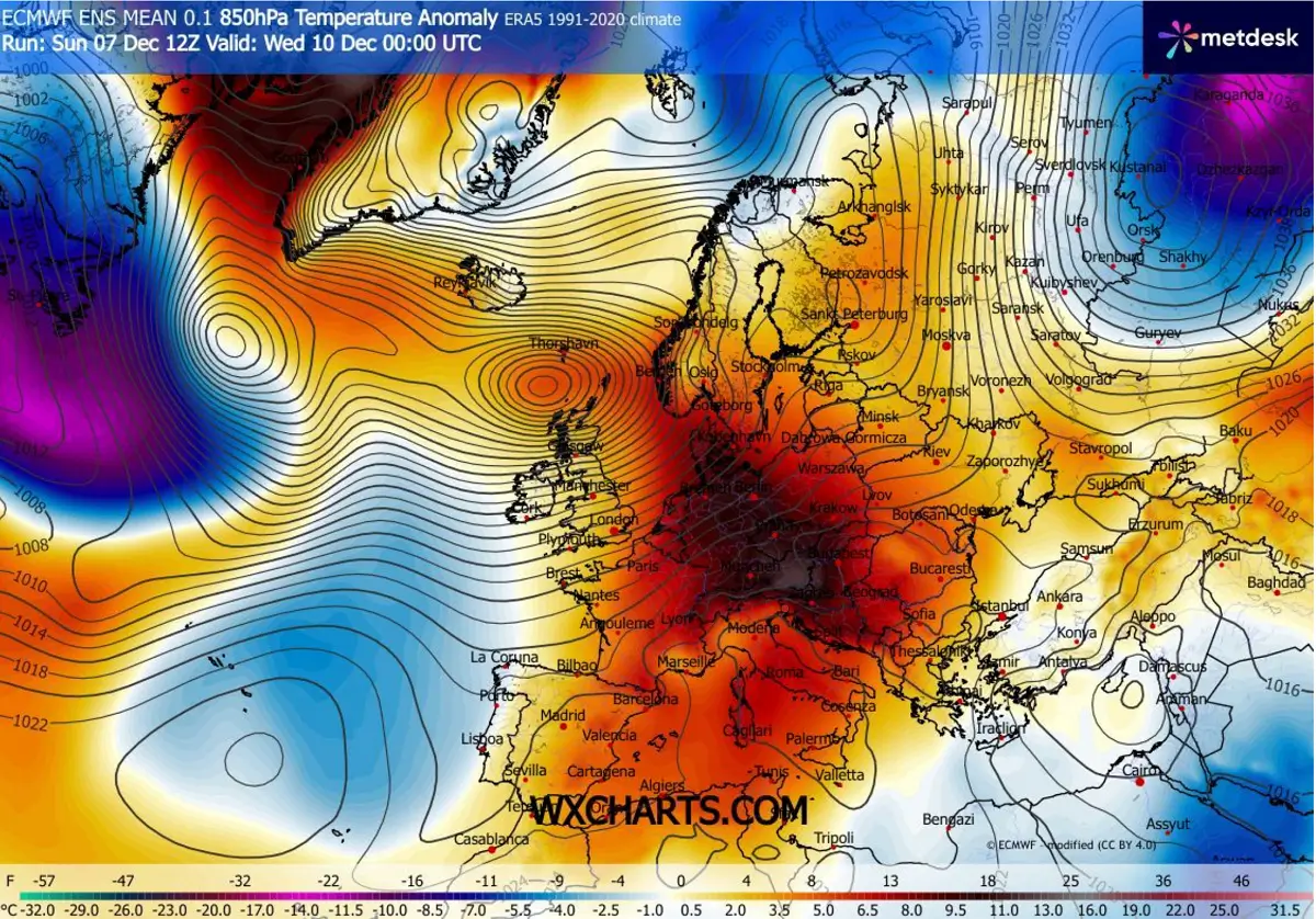
According to the general trends, such a warm airmass for December is possible to continue into the next week as well.
A violent Atlantic storm (Bram) will impact Ireland and Scotland on Tuesday
The upcoming storm Bram will form west of Iberia on Monday, gradually strengthening as it heads over the Bay of Biscay towards the north. It takes the rapid strengthening through Monday night and passes to the west of Ireland in the morning.
Bram continues north while still rapidly intensifying, passing west of Northern Ireland and Scotland, including the Outer Hebrides, at midday Tuesday.
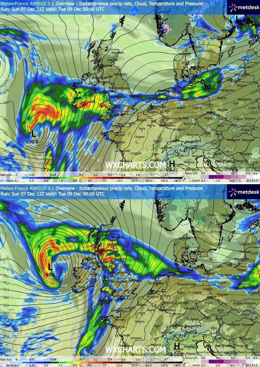
By evening, the storm will reach around 950 mbar while located northwest of Scotland.
According to the high-resolution models, the central pressure will continue to fall through Tuesday night as the low moves towards the Faroe Islands and finally matures.
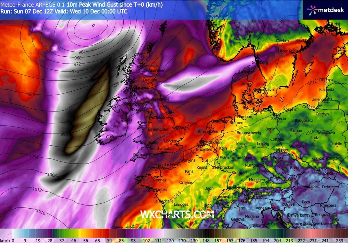
Violent winds and significant wave heights are expected to graze along the western coasts of Ireland, Northern Ireland, and Scotland.
Peak wind gusts could reach 150-180 km/h (90-110 mph). This is extreme and will make a violent impact on the coastal areas. A sting jet could develop, which is why violent winds are possible.
A west-southwesterly flow from the Atlantic into Western Europe will deliver widespread rainfall, primarily over areas that support orographic precipitation. This is especially pronounced in the higher terrain over Ireland, the northern UK, Wales, and Scotland.
Some areas could see around 120 mm or more over the next 5 days, increasing the potential for local flooding.
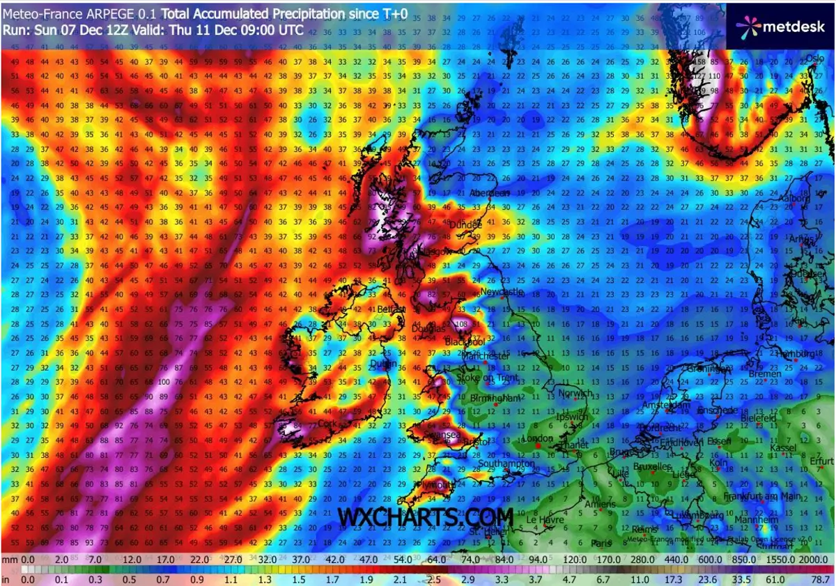
Looking closely, we can see the highest rainfall is forecast along the western and southern parts of Ireland, and in Wales and the southwestern and northern parts of the UK. And indeed, the Scottish Highlands are forecast to receive more than 120 mm of rain until Friday.
A lot of rain is also forecast for southern Norway, a typical region when southwesterly flow is established, as the moist air mass from the North Sea results in abundant rainfall (and snowfall inland).
To conclude, the upcoming period of 7-10 days or more is unfavorable for winter weather, meaning the chance of snow will be minimal to non-existent.
The weather pattern for the weekend basically shows no real change, deep troughs over the Atlantic, and the blocking High remains over Europe.
So, the temperatures will remain much above average for many, especially in the higher elevations and the mountains.
The lowlands will gradually be more trapped beneath strong thermal inversions, resulting in lower cloudiness and foggy weather.
We continue to closely monitor the evolution of the progressive patterns across the North Atlantic and Europe in the coming weeks. Following the unusually early and significant disruption of the Polar Vortex aloft this winter, conditions are prone to rapid changes.
Furthermore, the Polar Vortex’s disruption this winter has made conditions more prone to rapid changes.
Stay tuned for further updates.
Windy, TropicalTidbits, and Wxcharts provided images used in this article.
See also: