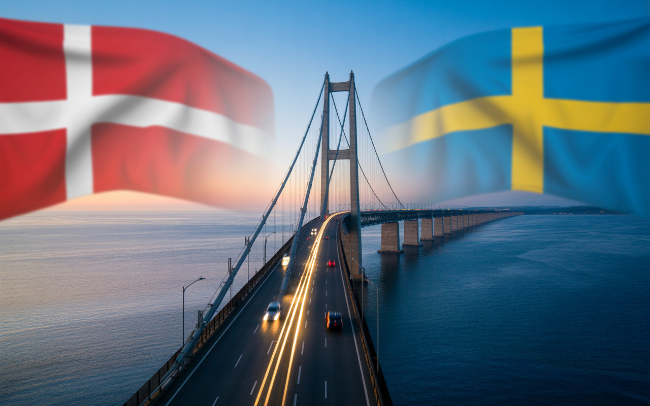
When the Øresund Bridge It began operating in the year 2000; what was being inaugurated was not just a steel and concrete structure of 7,8 kilometers long over the seaOne of them was born there. largest binational urban integration experiments ever undertaken in Europe.For the first time, two major cities from different countries — Copenhagen e Malmö — in practice, they began to function as parts of the same cross-border metropolis.
Before the bridge, crossing the Øresund strait required ferries, strict schedules, and logistical limitations. After it, the journey took much longer. about 15 to 20 minutes by train or car., completely transforming the dynamics of work, housing, tourism and investment between Denmark e Sweden.
A project that combined cutting-edge engineering and geopolitical vision.
The construction of the Øresund pipeline was not just an infrastructure decision. It stemmed from a… A strategic agreement between two countries that understand that the economy, mobility, and global competitiveness necessarily depend on the physical integration of their territories.The project combined:
See also other features
1.413 m² penthouse that belonged to Faustão in Jardim Europa: property valued at R$120 million with five suites is one of the most expensive in São Paulo

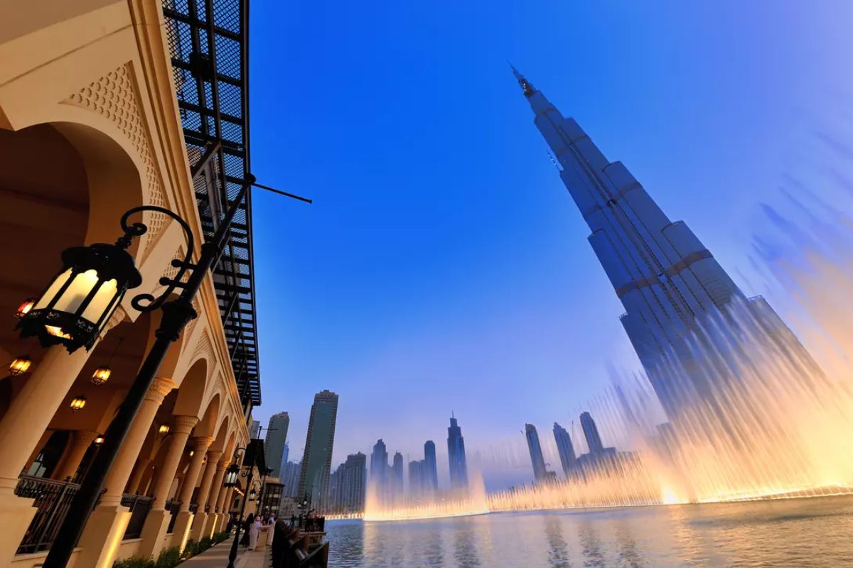
The world’s tallest building rises 828 meters in the Dubai desert, dominating the skyline with its glass facade, coveted observation deck, and becoming an extreme showcase of modern engineering, luxury, and economic power of the Emirates.
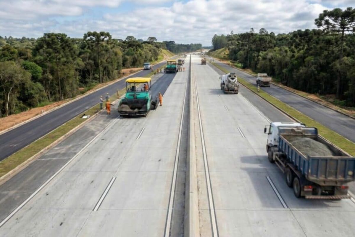
The duplication of the Rodovia dos Minérios highway with 13 viaducts in Almirante Tamandaré reorganizes traffic in Greater Curitiba, promises faster journeys, reduces the risk of accidents, and transforms PR 092 into a strategic corridor for Brazilian drivers.
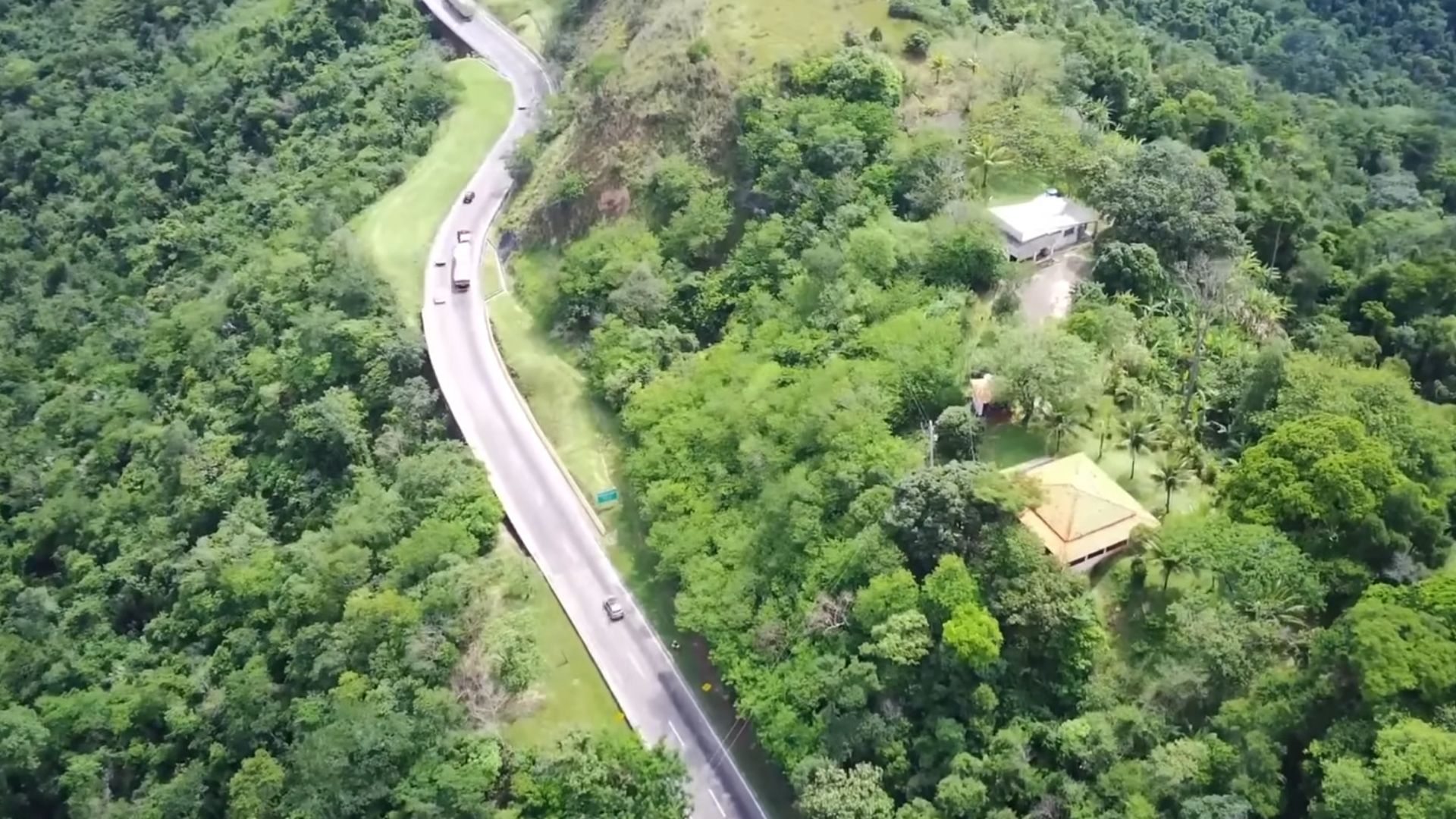
Highway connecting São Paulo to Rio de Janeiro: discover this incredible road construction project, one of the most anticipated in Brazil, featuring 8 lanes, 24 viaducts, and costing R$ 1,5 billion.
cable-stayed bridge over the sea;
submerged tunnel near Copenhagen;
artificial island built solely to connect bridge and tunnel.
This arrangement was necessary for not to interfere with air routes at Copenhagen Airport, one of the busiest in Scandinavia. The result was a rare hybrid engineering solution in the world, which combines bridge, tunnel and artificial island into a single continuous system.
The true scale of the project that reshaped the region.
The figures for the Øresund make it clear why it has become a symbol of continental integration:
7,8 km long main bridge;
4 km of submerged tunnel;
4 km of access on the mainland;
to over 15 km of continuous infrastructure adding all the segments together;
two levels of trafficRoad transport at the top and rail transport at the bottom.
This configuration allows simultaneous traffic of cars, buses, trucks and high-capacity trains, creating one of the most efficient multimodal corridors in Europe.
When two cities became one metropolitan area
The urban impact was immediate. Professionals who lived in Malmö began working daily in Copenhagen. Danes started living in Sweden, where the cost of living was lower, and working in the Danish capital, where salaries were higher.
That’s how the so-called [insert term here] was born. Øresund regionToday, it is one of the most dynamic metropolitan areas in Northern Europe. It is home to:
international universities;
research centers;
biotechnology hubs;
headquarters of global companies;
pharmaceutical industry;
clean technology startups.
The bridge literally created a new binational labor marketwhere borders have become mere administrative formalities.
The impact on tourism has multiplied the regional flow.
Before the bridge, tourism between Denmark and Sweden was limited by its reliance on ferries. With the Øresund Bridge, the flow exploded. Today, millions of tourists cross the bridge each year to:
Visit Copenhagen and Malmö on the same day;
to travel around castles, beaches and historical centers on both sides;
Participate in binational cultural events;
Use the region as a base to explore all of Scandinavia.
The bridge began to function as an international tourist artery, increasing local revenue, the hotel sector, and urban services.
The logistical axis that reorganized all of Scandinavia.
From a logistics point of view, Øresund has transformed itself into a A strategic corridor for exports and imports from Northern Europe.Goods that previously depended on longer routes now circulate directly between:
Danish ports;
Swedish industrial centers;
Continental rail networks.
This reduced operating costs, shortened delivery times, and made the region even more attractive for European distribution centersToday, numerous international logistics hubs have sprung up around the bridge precisely because of this geographical advantage.
The direct effect on the real estate market
Physical integration has completely altered the property price map. Malmö, which previously had much lower prices than Copenhagen, has begun a cycle of strong appreciation. Danes migrated to Sweden in search of lower housing costs, creating demand pressure.
This resulted in:
new residential neighborhoods;
planned urban expansion;
growth of commercial ventures;
increase in the value of land and real estate.
The bridge has become, in practice, a international real estate enginewhere living in one country and working in another has become routine.
A bridge that moves billions every year.
Although the exact figures vary from year to year, estimates from the region indicate that the direct and indirect economic activity generated by the Øresund Bridge contributes significantly to the economy. tens of billions of euros per decade when considering:
business;
tourism;
real estate market;
logistics;
cross-border jobs;
tax collection.
Furthermore, the bridge’s operation itself is subject to tolls, guaranteeing a steady income for maintenance, railway expansion, and structural modernization.
Engineering designed to withstand the sea, wind, and time.
The Øresund Strait is a region of strong winds, intense sea currents, and heavy naval traffic. Therefore, the bridge was designed to withstand:
severe storms;
Continuous marine corrosion;
naval collision impacts;
simultaneous vibrations of trains and vehicles.
Sensors monitor in real time:
structural displacements;
Cable fatigue;
tension in the pillars;
temperature variations.
This is one of the most technically monitored bridges in all of Europe.
A political symbol of an integrated Europe.
The Øresund pipeline is not just infrastructure. It has become… a physical symbol of European integration…of the free movement of people and cooperation between sovereign countries. In a continent historically marked by wars and rigid borders, the bridge represents:
Free movement of workers;
university integration;
transnational production chains;
Regional identity transcends formal borders.
It embodies, in steel and concrete, the idea that modern economies grow more when they connect than when they isolate themselves.
The bridge that also became a cultural landmark.
The Øresund Bridge has transcended its role as an engineering marvel and definitively entered popular culture. International series, documentaries, films, and thrillers have used the bridge as a setting precisely because of its symbolic nature. It connects two distinct worlds over a sheet of water..
This cultural aspect further helped to project the bridge globally, transforming it into one of the most recognized landmarks in Northern Europe.
Why is it considered one of the most important bridges on the planet?
There are bridges that are longer, taller, or have larger spans. But few have:
direct transnational urban impact;
economic reorganization of two large cities;
daily integration of thousands of workers;
Direct influence on the real estate market;
regional geopolitical role.
The Øresund River doesn’t just connect riverbanks. It It merged the economies, labor markets, and lifestyles of two entire countries..