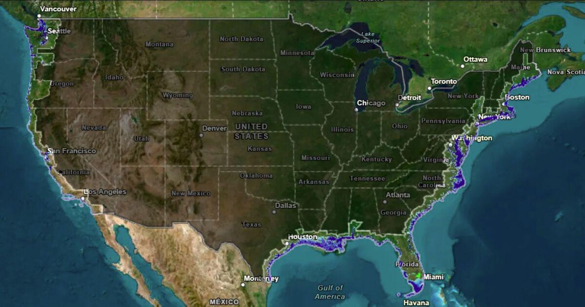
National Oceanic and Atmospheric Administration map lays bare US cities at risk if sea levels rise 10 feet
https://www.the-express.com/news/science/193445/us-cities-underwater-sea-levels-rise-global-warming
by TheExpressUS
National Oceanic and Atmospheric Administration map lays bare US cities at risk if sea levels rise 10 feet
https://www.the-express.com/news/science/193445/us-cities-underwater-sea-levels-rise-global-warming
by TheExpressUS
7 comments
A sea level rise would also impact groundwater, which is one of America’s major sources of drinking water, because, as sea levels rise, “so, too, does the groundwater table,” Randall Parkinson, a coastal geologist and professor at Florida International University said.
In other words, areas “more distant from the coastline may experience nuisance or permanent freshwater flooding well before they are affected by sea level rise,” he explained.
Ooof I can’t look at that website.
It’s not a matter of if, it’s when. So far things are happening right on schedule and each year CO2 emissions increase.
“The sea level has never been lower!” tweets POTUS from his life raft
So, we lose New York, Philadelphia, Boston, DC, Houston, NO, LA, Seattle, Portland and San Francisco just to be rid of Florida? Wait. Let me think about this trade off.
Not to worry. Trump will Sharpie them back in, and everything will be A-OK!
/s
I though this type of research was cut off at NOAA
Comments are closed.