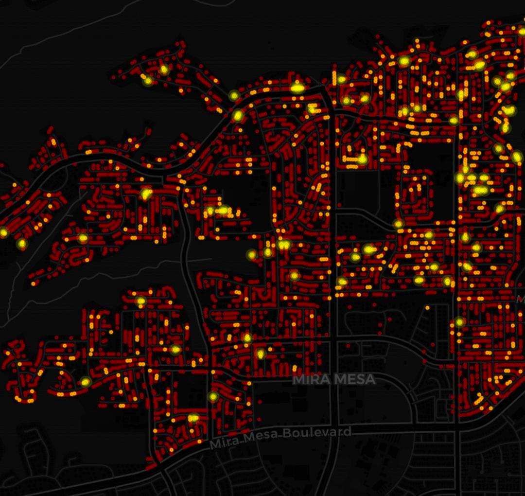
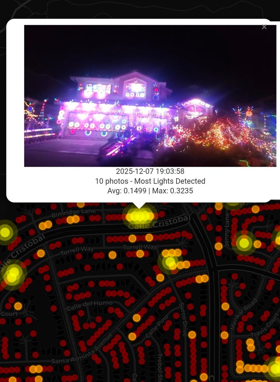
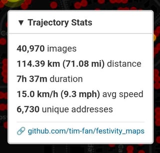
I drove around the neighborhood (for seven hours!) taking photos using phones taped to the windows. Post processed to produce this map of 6,730 houses in my area. Click on the dots to see the associated photo:
https://tim-fan.github.io/festivity/mira_mesa/
Posted by 3e8892a
4 comments
Interesting, but it seems like you need a way to differentiate between holiday lights and just regular lights. A lot of the red dots seem to just be street lights or porch light. Also some of the yellow dots seem to just be bleed over from an adjacent house?
Also, why does one neighborhood have just a couple dots at all, was there really not other lights? Or did you not map that neighborhood, in which case why are there a few dots?
This is a truly impressive labor of love. Eat your heart out, Google Street View!
That is really neat! Awesome resource for people in your area, I definitely wish I had a Christmas lights map like this where I live!
Nice, you mentioned that you worked with Clip before, in what instances would you say CLIP would be a better tool than DINOv3? Or is DINOv3 just superior?
Comments are closed.