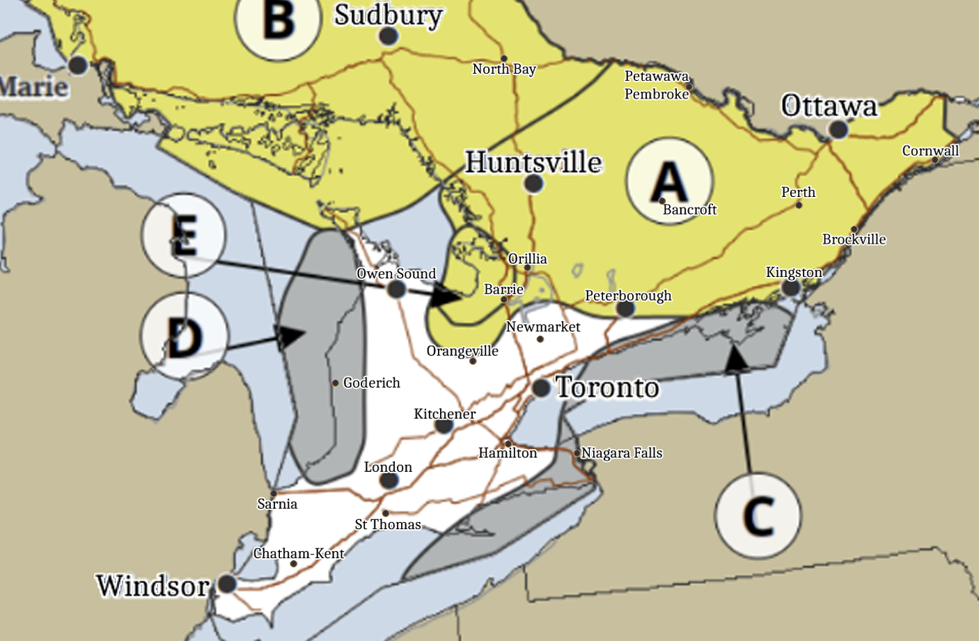
Location A (Ice, 10mm+): A strong and deep low could produce significant, prolonged freezing rain across eastern and central Ontario, with ice accretion on trees and power lines leading to branch breakage and power outages.
Location B (Snow & Blowing Snow, 15–20 cm): Portions of northeastern and central Ontario may receive 15–20 cm of snow with blowing snow and gusts up to 70 km/h, causing difficult travel and reduced visibility.
Locations C & D (Wind, 70–90 km/h): Westerly or northwesterly wind gusts of 70–90 km/h are possible along the eastern shores of Lake Huron, northeastern shores of Lake Ontario, and Lake Erie, potentially tossing loose objects and causing power outages.
Location E (Ice & Wind, 10 mm & 80 km/h): Southeast of Georgian Bay may experience a combination of prolonged freezing rain and wind gusts up to 80–90 km/h, resulting in ice build-up and possible significant impacts. Confidence remains moderate to low for precipitation type, amounts, and exact areas but we’ll continue to monitor this carefully over the next few days to see how it progresses.