MetService meteorologist Mmathapelo Makgabutlane told the Herald that temperatures remain on track to shatter current heat records, with northwesterly winds from Australia already pushing highs past 30C in several regions by midmorning.
“Hawke’s Bay and Tairāwhiti Gisborne are still looking to be some of the hotter places in the country,” she said.
“Once those northwesterlies hit the coast, that’s when we’re expecting the temperatures to ramp up.”
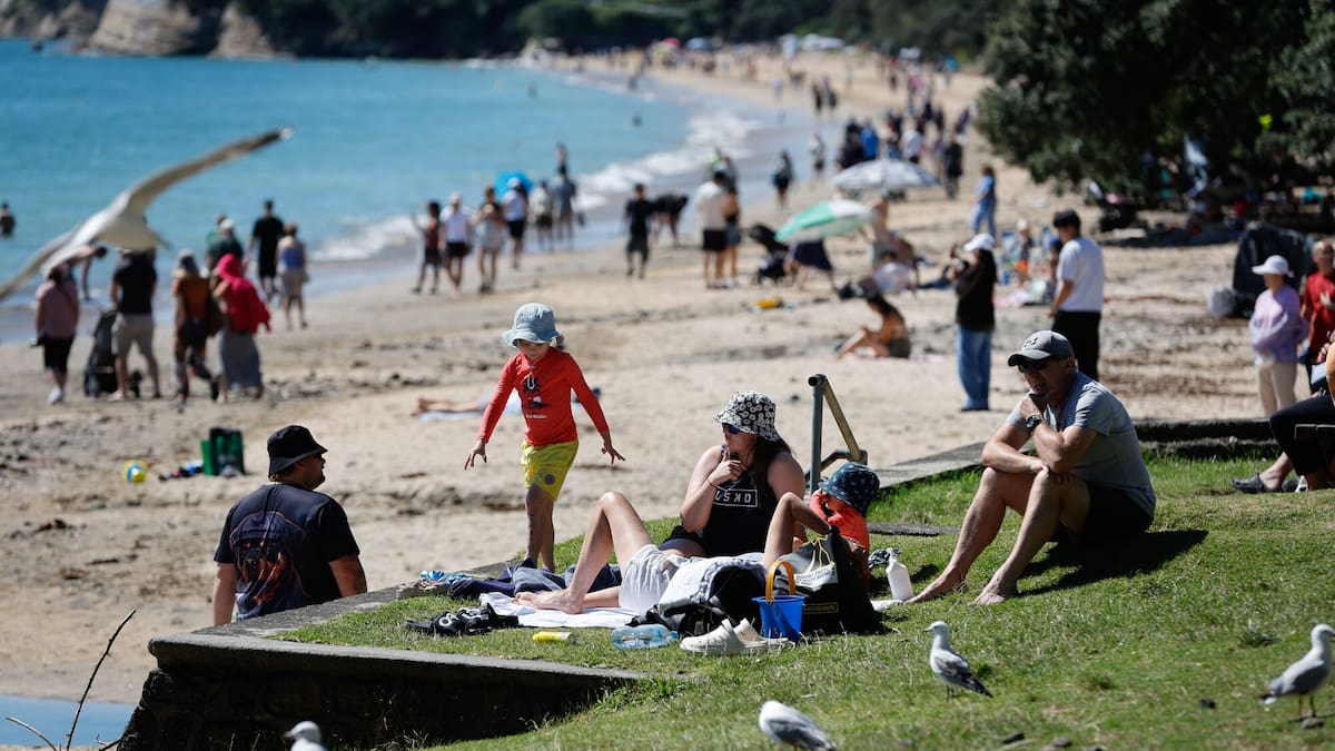
Fifteen heat alerts are in place across Aotearoa today as the sizzling temperatures set in.
So far, heat alerts have been issued for Kerikeri, Whangārei, Whitianga, Tauranga, Whakatāne, Rotorua, Taupō, Gisborne, Napier, Hastings, Motueka, Blenheim, Kaikōura, Christchurch and Timaru.
In the South Island, New Zealand Transport Agency Waka Kotahi said contractors were called in to clear fallen trees on State Highway 94 near Milford Sound, SH74 in Canterbury and SH6 on the West Coast. Motorists are being warned to expect delays.
In Amberley, fire crews are responding to gorse on fire.
A Fire and Emergency New Zealand spokesperson said the fire, about 80m by 50m, has been contained and is being tackled by ground crews. A helicopter was considered but conditions were deemed too windy.
Vaughan Currie of Rush Munro’s in Hastings, which describes itself as the country’s oldest ice creamery, told the Herald they’re making produce “as fast as we can sell it” amid the high temperatures.
⚠️ The Severe Weather Warnings have been updated. Key differences from yesterday’s issue:
🌧️🟠 The Heavy Rain Watch for Buller has been upgraded to an orange Heavy Rain Warning
💨🟡 A Strong Wind Watch has been added for Hawke’s Bay
🔗 For details, visit: https://t.co/qHyE5zzql5 pic.twitter.com/yb0yoXcvq2
— MetService NZ (@MetService) January 10, 2026
“We produce on past trends predominantly, and then we try and predict a little bit in terms of what we’ve got in front of us,” he said.
“We’re normally a seven-day operation through summer, but it feels like we’re seven days-plus if that’s possible at the moment.”
Currie said demand was rising through January, bucking the trend, “which is generally an indication that demand is strong bay-wide”.
“We keep it small in terms of selling outside the business, but mainly because I don’t think we’d be able to keep up.”
Many heat alerts in the Bay of Plenty also extend through to tomorrow due to elevated temperatures overnight.
Given this, Makgabutlane noted “the night-time doesn’t really bring much relief” for Paihia, Whitianga, Tauranga and Whakatāne.
A weather system simultaneously moving northwards over the South Island today is bringing strong winds and heavy rain to the southern regions first and will eventually drag temperatures back down countrywide by tomorrow.
“Once the front has moved through, it might feel quite different”, Makgabutlane said.
Most at risk of breaking high temperature records today are Whangārei, Whitianga and Napier; the latter’s January record of 36.9C in 1979 being only 0.9C above today’s forecast of 36C, the MetService said.
And while a record-breaker is not expected, Auckland is among those to see its forecast high rise to 29C.
Forecast temperatures have been rising all week, with the MetService saying some areas – including Northland, Coromandel and Hawke’s Bay – could break January records today.
Kerikeri already broke its January temperature record yesterday, exceeding the 32C mark, which smashed the previous record set in 1983.
The scorching heat and strong winds this weekend have sparked concerns about both fires and a rise in water-related incidents after at least two people drowned in separate incidents yesterday.
MetService meteorologist Rob Kerr said yesterday that heat alerts are issued a day out from hot weather, and are based on each centre’s usual summer highs and/or how many days of hot weather are forecast.
Hottest day yet on the cards
The hottest spell of the multi-day heat-streak is expected to hit today, with Hastings forecast to fry on 38C and neighbouring Napier not much lower at 36C.
The heat, combined with severe northwesterlies forecast for the lower North Island and much of the South Island, has raised wildfire risks to extreme.
“It will be dry in these northwesterlies, particularly in places like northern Wairarapa, Hawke’s Bay, Gisborne. Those are the areas that we’re focusing on for high risk of fires,” Kerr said.
He said people should be cautious when planning any barbecues in the next few days.
“Anything that’s lit, sparks can fly and get driven quite a long way and start fires,” Kerr said.
People in areas under alert should check in on their most vulnerable, including babies and the elderly, and ensure pets are “well cared for” with water and shade, MetService meteorologist Michael Pawley said.
“Heat alerts are more than just a typical hot summer’s day … people can see some health effects from this sort of thing,” Pawley said.
‘Extreme caution’
Northland, Tairāwhiti, Hawke’s Bay, Wairarapa, Marlborough, Canterbury, Mid-South Canterbury and Otago face “spiking” fire danger today, Fire and Emergency deputy chief executive of prevention Nick Pyatt said yesterday.
“Extreme caution [is] needed.”
Severe gales gusting up to 130km/h are also expected across a large part of the South Island and the lower North Island, posing an extreme fire risk when combined with scorching temperatures.
The MetService has issued a warning for severe gale northwesterlies gusting to 120km/h from early this morning through the day for Marlborough, Wellington, Wairarapa and Tararua district.
The high country and foothills of Canterbury are also under a warning for severe gale northwesterlies gusting 130km/h until 5pm.
Strong wind watches are also in place for eastern Canterbury and the lower South Island.
In contrast, an orange heavy rain warning has been issued for the headwaters of the Canterbury lakes and rivers about and south of Arthur’s Pass, and for Fiordland and parts of Westland, the MetService said on its website.
“There’s an elevated risk of thunderstorms, especially in the west of the South Island.”
“We can expect that there might be some damage to trees and power lines … [and] with winds picking up, wildfires can get out of hand quite quickly,” Pawley said.
Further north, there are heavy rain watches across the Grey and Buller districts in the upper South Island this afternoon and evening.
Sign up to The Daily H, a free newsletter curated by our editors and delivered straight to your inbox every weekday.