Listen to this article
Estimated 2 minutes
The audio version of this article is generated by AI-based technology. Mispronunciations can occur. We are working with our partners to continually review and improve the results.
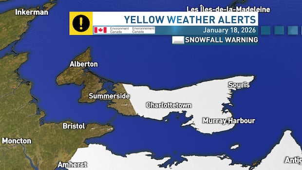
Environment Canada has issued a yellow snowfall warning for Queens and Kings counties, P.E.I. for Sunday evening, lasting until noon on Monday.
CBC meteorologist Jay Scotland said the system will track to the south and east and will see flurries become heavier in the evening, with steady snow expected to fall overnight into Monday morning.
“Looking at the latest guidance, there is potential for a widespread 10 to 20 cm of accumulating snow for central and eastern areas, before easing late Monday morning or early Monday afternoon,” Scotland said.
“I can’t rule out local amounts topping 20 cm for parts of Kings County, although amounts that high look less likely than they did earlier today.”
Scotland predicts less snow for western P.E.I. with five to 10 cm expected for Prince County.
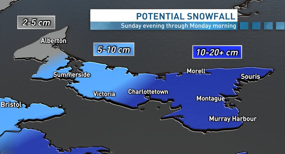
Snowfall amounts on P.E.I. could range from 5 to 25 cm, with the highest amounts forecast for Kings County. (Jay Scotland/CBC)
Scotland cautions that blustery northerly winds and temperatures hovering around the freezing mark will make for a messy Monday morning.
“This may be a heavier snow to clear, especially for southern and eastern areas,” he said.
“Even though this isn’t shaping up to be light and powdery snow, some blowing and drifting is possible early Monday … so be prepared for reduced visibility in addition to messy roads.”