Air temperatures in the -10s and -20s will lead to fluffy snow that accumulates quickly, making it difficult for plows to keep up with.
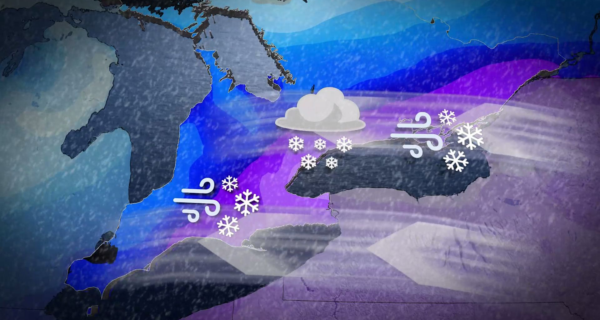
A cold easterly wind off Lake Ontario will create a band of lake-effect snow directed toward portions of the GTA. There’s still some uncertainty exactly where this band will line up, but anywhere from Oakville to Toronto to Pickering is at risk.
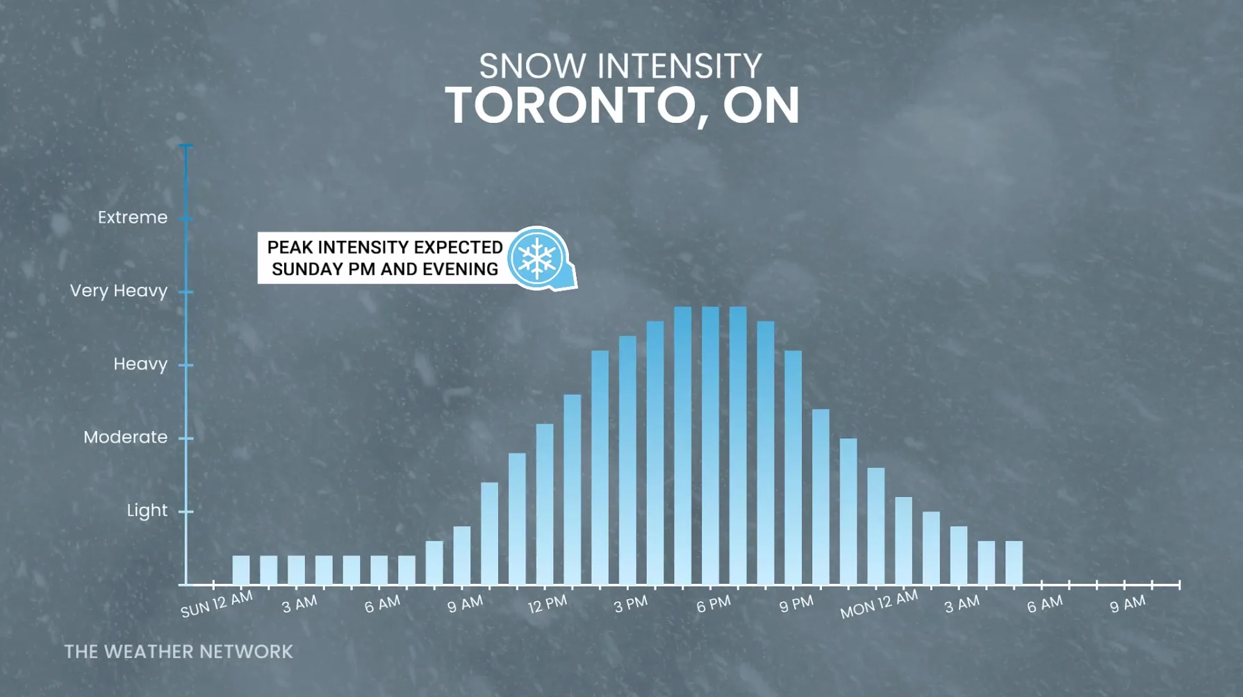
The highest impacts and accumulations will fall beneath this band of lake-enhanced snowfall, with totals on the order of 20-30+ cm with complete whiteouts possible.
RELATED: The Great Lakes’ winter superpower is fading, polar vortex punches through
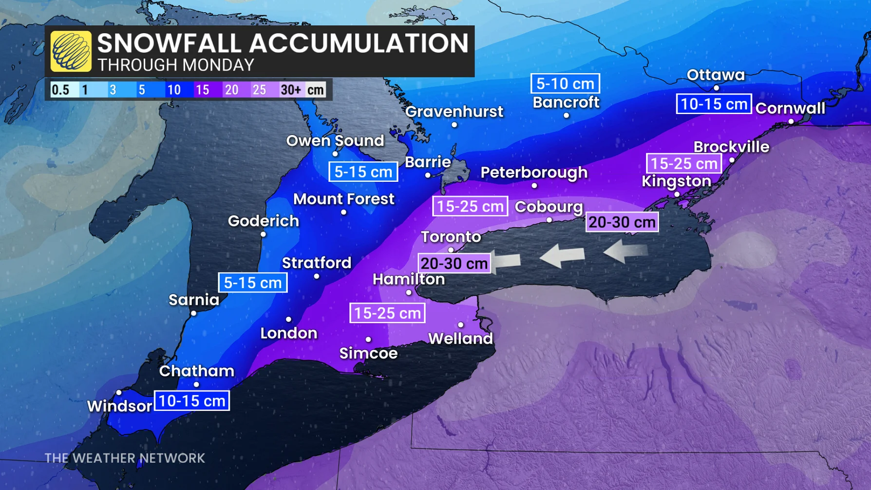
Communities north of the 407, including London, Barrie, and east toward Ottawa, can expect 10-20 cm of snow from this system through Monday morning.
Any snow that falls during this system will stick around with temperatures solidly below the freezing mark through the end of the month.
Next week will bring frigid conditions with high temperatures mainly in the minus teens and lows mostly in the -20s. Colder-than-normal temperatures are anticipated to persist into the first few days of February. A return to seasonal temperatures is expected around February 5, but a shift back to colder-than-normal conditions is possible by mid-February.
WATCH: Snow from Mexico to Toronto? Ontario braces for a big snowstorm
Stay with The Weather Network for all the latest on conditions across Ontario.