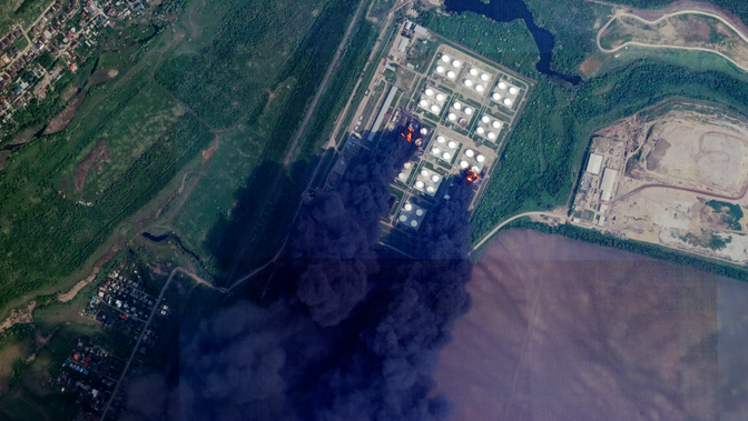
China and India will likely remain key buyers of Russian and Iranian crude. Even as sanctions tighten, several dynamics remain clear. Pipeline routes offer Russia resilience against maritime sanctions
while independent Chinese refiners (“teapots”) will continue to rely on shadow-fleet shipments. The utilisation of the Northern Sea Route (NSR) will grow seasonally[xi] and shadow fleet expansion will continue as long as sanctioned oil remains profitable. At the same time, targeted attacks on dark vessels might increase, heightening miscalculation risks. For operational agencies, this means preparing for low-probability, high-impact maritime crises, such as search and rescue operations, mass evacuations, major oil spills, and port shutdowns.
Managing dark-shipping risks at the baseline requires integrating at the minimum geospatial intelligence (GEOINT), synthetic aperture radars (SAR), maritime AIS analytics, financial and ownership data, and information-sharing through regional and national maritime security centres. Platforms like the IFC exemplify how navies, coast guards, regulators, shipping companies, and intelligence agencies can collaborate to detect, map, and mitigate dark shipping.
The 2025 Ukrainian strikes show that dark vessels are now at the crossroads of sanctions enforcement, hybrid conflict, and maritime safety. A sustained whole-of-government, whole-of-community maritime security approach – supported by commercially available satellite intelligence – is essential to managing these risks in an increasingly contested and multipolar world.
Actionable insights from integrated datasets are essential for coordinated responses across agencies. However, traditional approaches to acquiring data often fall short on the speed and accuracy required for timely and critical decisions. This is where emerging commercial space technologies can fill the gap. Planet, a leading provider of satellite data and analytics, operates hundreds of satellites in orbit, delivering high-resolution imagery with near-daily coverage and multiple revisits of areas of interest. This is especially valuable in maritime security strategies where an always-on monitoring capability is critical to enable agencies to detect risks early and respond to anomalies before they escalate.
By integrating satellite data and analytics combined with machine learning, defence agencies can now enhance their MDA across territorial and open seas using automated vessel recognition, attribution, and tracking. This author discussed this next-generation, AI-driven capability in a live webinar[xii], drawing on examples from the Asia-Pacific. With access to high-frequency and reliable insights, defence strategists can establish a baseline of normal operations and detect suspicious activities early on.