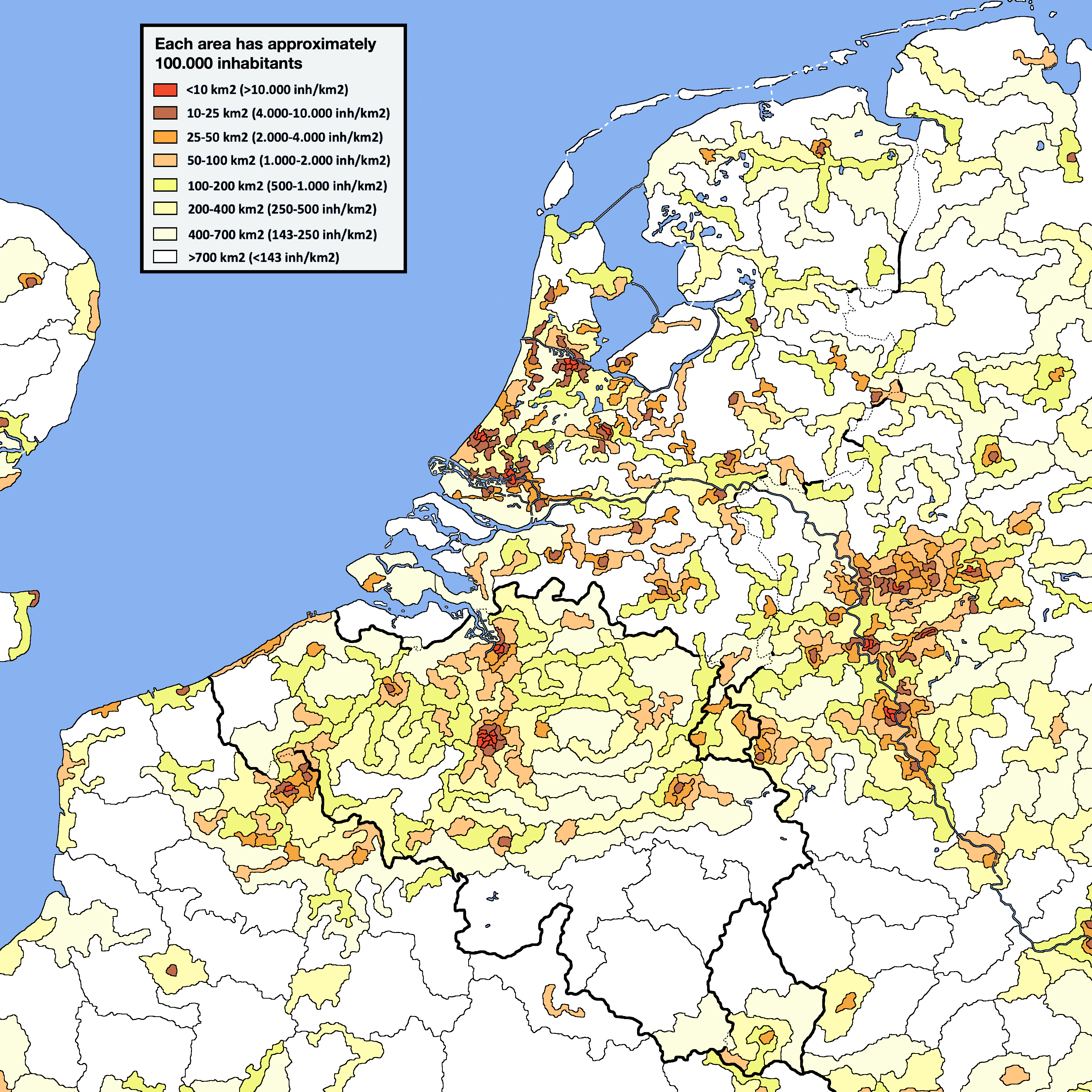
Self made population density map of the Netherlands (en het kleine broertje Belgium), every surface has 100.000 inhabitants, colour shows density

Self made population density map of the Netherlands (en het kleine broertje Belgium), every surface has 100.000 inhabitants, colour shows density
5 comments
Can you name the red and brown cities of the Netherlands? (the answers are here https://i.redd.it/q65v9zl47d481.png )
A different look on population density maps: every surface no matter what color has approximately 100.000 inhabitants and the color shows population density. You can count the areas the know the population of a city of metropolitan area.
Method:The program I used was Paint pro version, I used based maps and overlaid them with population density maps.
Data:- https://www.citypopulation.de/, Google maps allows to measure distance and count surface and Wikipedia
When you can recognise the square ugly blobs that form Nieuw- Vennep and Hoofddorp. The empty bit right next to them is Schiphol and the rest of the Haarlemmermeerpolder.
I’m not sure if it was supposed to be this detailed, but it seems to be there.
Interessant hoe dichtbewoond Zuid-Limburg kennelijk is.
… en een groot stuk Ruhrgebied.
Belgie is 31k km2 en Nederland 41k. Dat is slechts 25% groter, dus laten we België niet kleiner afschilderen dan het is. En ze hebben lekkere chocolade 🤪