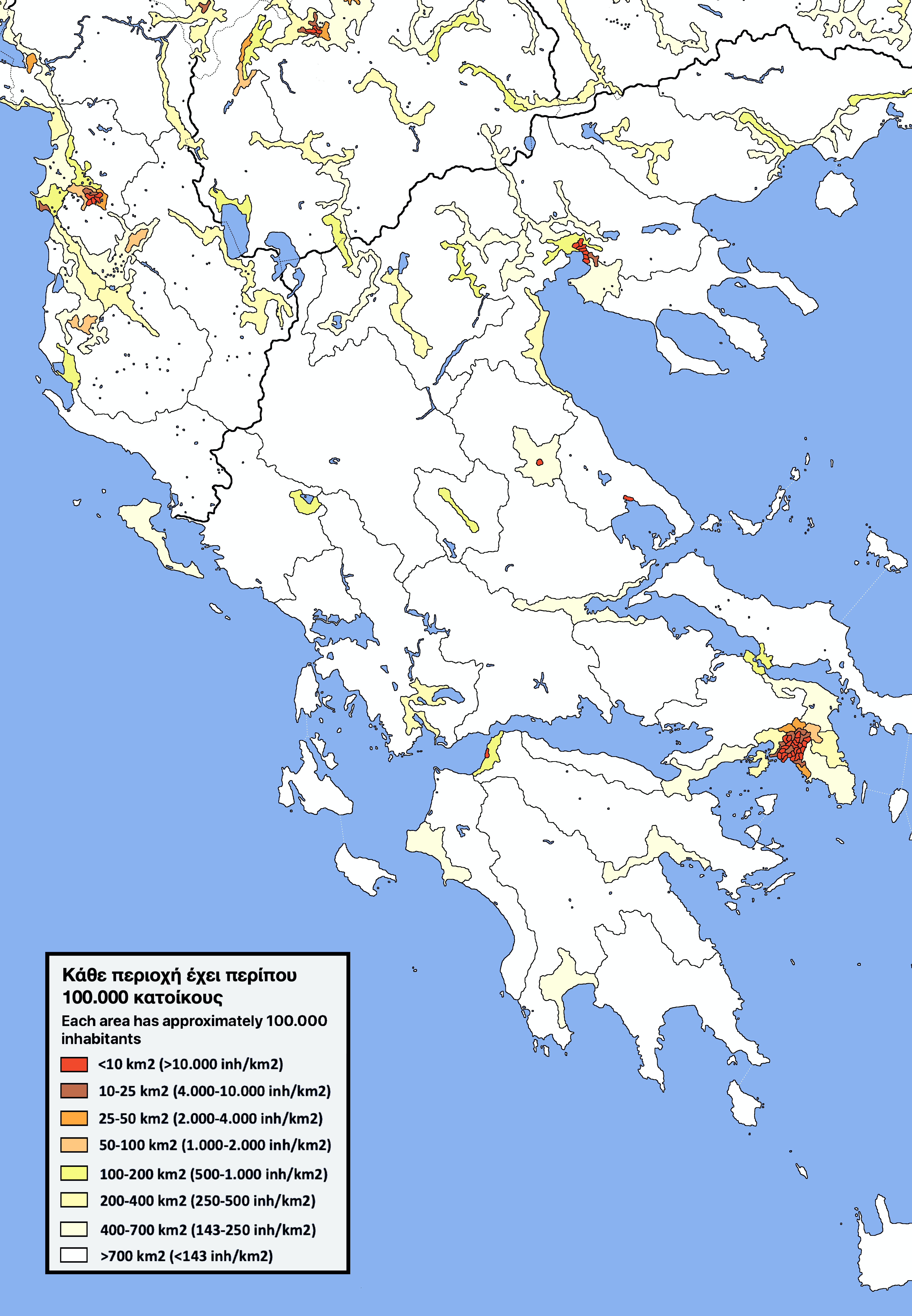
Self made population density map of mainland Greece, absolute amount of 100.000 inhabitants and colour shows population density

Self made population density map of mainland Greece, absolute amount of 100.000 inhabitants and colour shows population density
4 comments
Can you name the red and brown cities of mainland Greece? (the answers are here [https://i.redd.it/dzmn695y0d481.png](https://i.redd.it/dzmn695y0d481.png))
A different look on population density maps: every surface no matter what color has approximately 100.000 inhabitants and the color shows population density.You can count the areas the know the population of a city of metropolitan area.
Method:The program I used was Paint pro version, I used based maps and overlaid them with google maps screenshot views, population density maps or for the big cities with maps of their districts and quartiers.
Data:
– [https://www.citypopulation.de/](https://www.citypopulation.de/) has a lot of census data and current estimates, sometimes you have to make several clicks on the bottom of the page of each district to get some really detailed information
– Google maps allows to measure distance and count surface.
– Wikipedia
Μαζεύτηκαν όλοι στην Αθήνα. Πληρώστε τώρα ενοίκια πανάκριβα με άδεια σπίτια στα χωριά και την περιφέρεια.
Γιατί δεν δείχνει λίγο όλη την χώρα; Η Κρήτη δηλαδή και τα νησιά χάθηκαν;
άδεια κ έρημη η Δ.Μακεδονία
​
τώρα που κλείνουν κ Πτολεμαΐδα-Κοζάνη με την “απολιγνιτοποίηση” είναι να τη δώσουμε στις ΜΚΟ να φέρουν κανέναν κακομοίρη να κάτσει