
Status Orange wind warning for the whole country on FridayClare, Cork, Kerry and Limerick will be hit with worst of the weatherPublic told to expect ‘severe and destructive’ gusts of over 130kmh
Counties Clare, Cork, Kerry and Limerick can expect “severe, damaging and destructive gusts in excess of 130kmh”. The warning will be in place from 3am until 10am on Friday morning.
Impacts on the counties under the Status Red warning will include:
Danger to lifeExtremely dangerous travelling conditionCancellation of eventsWave overtoppingCoastal flooding in low-lying and exposed areasUnsafe working conditionsFallen treesSignificant and widespread power outagesStructural damageDisruption and cancellations to transport
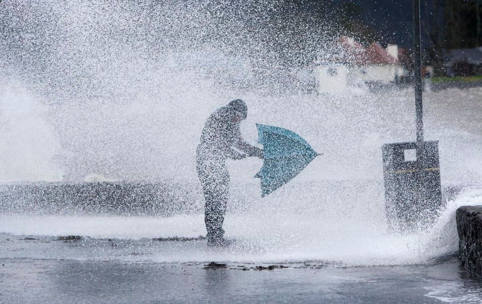
The public has been warned to take extra care on Friday when Storm Éowyn hits the country. Photo: stock image
Met Éireann has also issued a Status Orange wind warning for the whole country. That warning will be in place from 2am on Friday morning and remain in place until 5pm on Friday.
Gale-force southerly winds becoming westerly “will bring severe, damaging and destructive winds,” Met Éireann said, with gusts of up to 130kmh and even higher for a time.
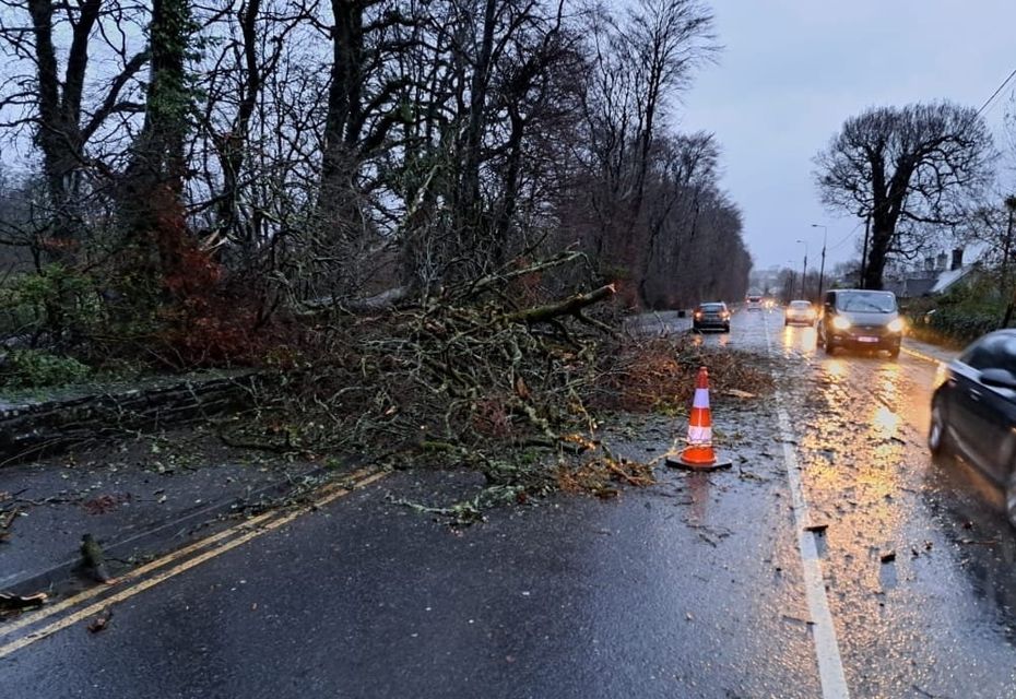
Impacts will include fallen trees, damage to power lines and power outages, structural damage, very difficult travelling conditions, disruption and cancellations to transport, and wave overtopping.
The National Emergency Coordination Group (NECG) met today ahead of the Status Red warning and advised those in counties under the warning to remain indoors and avoid unnecessary travel.
“Storm Éowyn is going to be a very dangerous and destructive weather event. The forecasted winds have the capacity to bring severe, damaging winds which will constitute a risk to life and property,” NECG chair Keith Leonard said.
“During the Red Level wind warnings, the public are advised to shelter in place. Where Orange warnings are in place, the public are also advised to limit travel to essential journeys only.
“An orange wind warning should not be underestimated – it can bring extremely strong gusts and can also pose a threat to life and property.
“I would urge people to stay away from coastal areas during this period and to heed the appeal from the Irish Coast Guard for people to ‘Stay Back, Stay High, Stay Dry’.
“It’s also important to remember that even after the storm has passed, there is a strong possibility of fallen trees and other debris so drivers are also urged to take care in the aftermath of the storm.”
There will also be a Status Yellow warning for rain on Friday for counties Cork, Kerry and Waterford from 9pm on Thursday night until 3am on Friday morning, with heavy rain to lead to localised flooding in those areas.
Today’s Status Yellow warning for fog for counties Carlow, Kildare, Kilkenny, Laois, Longford, Louth, Meath, Offaly, Westmeath, Cavan, Monaghan, Leitrim, Roscommon, Tipperary and Waterford lapsed at 10am.
Met Éireann has said it is continuously monitoring the evolving situation
Met Éireann has said mist and fog will be “stubborn” to clear in some parts of the north and northeast but will lift in most areas.
It will be dry across most of the country with some sunny spells and scattered showers. Highest temperatures will range from 4C to 9C.
It will be cold overnight with more fog and a chance of some frost, though southerly winds will clear any fog and frost. Lows will be between 1C and 4C.
On Thursday rain will move eastwards across the country in the morning, with some thunder possible.
A mix of sunny spells and showers will come from the west in the afternoon, with some showers turning heavy, including the chance of hail. Highest temperatures will be between 4C and 8C.
Irish weather warning colours explained
Storm Éowyn is expected to bring “powerful and disruptive winds” from Thursday night when it will become “very stormy”.
Outbreaks of rain from the Atlantic will spread across Munster and Connacht before midnight, then spread nationwide.
Met Éireann has said it is “continuously monitoring the evolving situation and weather warnings will be issued as confidence in the forecast track/intensity of the low-pressure system improves”.
Structural damage is expected on Friday for Storm Éowyn.
Rain will turn to sleet and snow in Connacht and Ulster, potentially causing hazardous travelling conditions.
It will be very windy with strong to gale force southeast winds and turn “extremely” windy in the early hours of Friday morning. Temperatures will range between 0C and 4C.
There will be disruption on Friday as “extremely strong and damaging winds” extend across the country.
Gale-force southwest winds will veer westerly in the afternoon and storm force winds are likely in some coastal areas.
Scattered showers will turn wintry during the day and the north of the country will see more persistent rain.
Highest temperatures will range from 6C to 9C, though it will feel much colder due to wind-chill.
Winds will begin to calm from Friday night but it will still be blustery. It will be cold with temperatues of -2C to 3C, bringing the possibility of some frost.