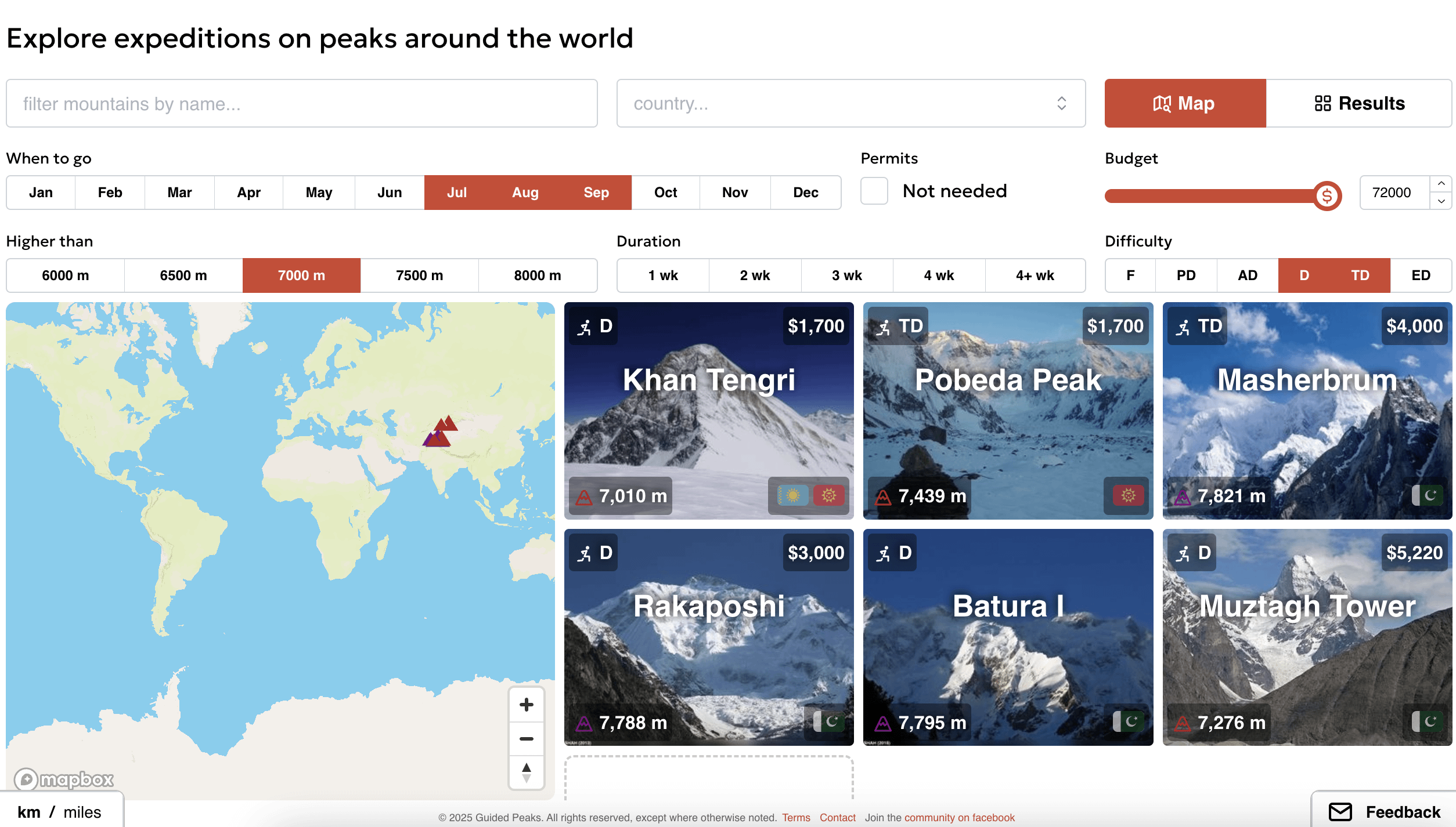
[OC] I combined data (difficulty, weather, permits, location, time to climb, prices, reviews) on 152 BIG mountains to make a UI for finding expeditions as a climber
Posted by name__already__taken
![[OC] I combined data (difficulty, weather, permits, location, time to climb, prices, reviews) on 152 BIG mountains to make a UI for finding expeditions as a climber](https://www.europesays.com/wp-content/uploads/2025/02/fiqaf1zw9ghe1-1920x1024.png)
[OC] I combined data (difficulty, weather, permits, location, time to climb, prices, reviews) on 152 BIG mountains to make a UI for finding expeditions as a climber
Posted by name__already__taken
1 comment
There is nothing ground breaking with this tool: all the data is freely available – but requries a lot of googling around. I wanted to save myself and others that hassle by amalgamating it into one thing.
* Most of the data is manual entry.
* For difficulties I used the french alpine system. There are different grading systems used worldwide, so normalising to one system made the data queryable. To simplify things I used the difficulty of the classic route up the mountain for peaks with multiple routes.
* For time of year I looked at the typical climbing season(s) on the mountain. Of course you can climb year round, but wanted to let people find the time where they’d have the highest chance of success.
* For all the reviews I used APIs to get them from three reviews sites. Then I had to filter them to get the relevant mountaineering reviews (since some guides also did guiding of other trip types).
You can find the UI I made here: [https://www.guidedpeaks.com/expeditions](https://www.guidedpeaks.com/expeditions)
Comments are closed.