![[OC] When AIS data shows you something you didn’t expect: a helicopter](https://www.europesays.com/wp-content/uploads/2025/04/5luhe1zbl7te1-1920x1024.jpeg)
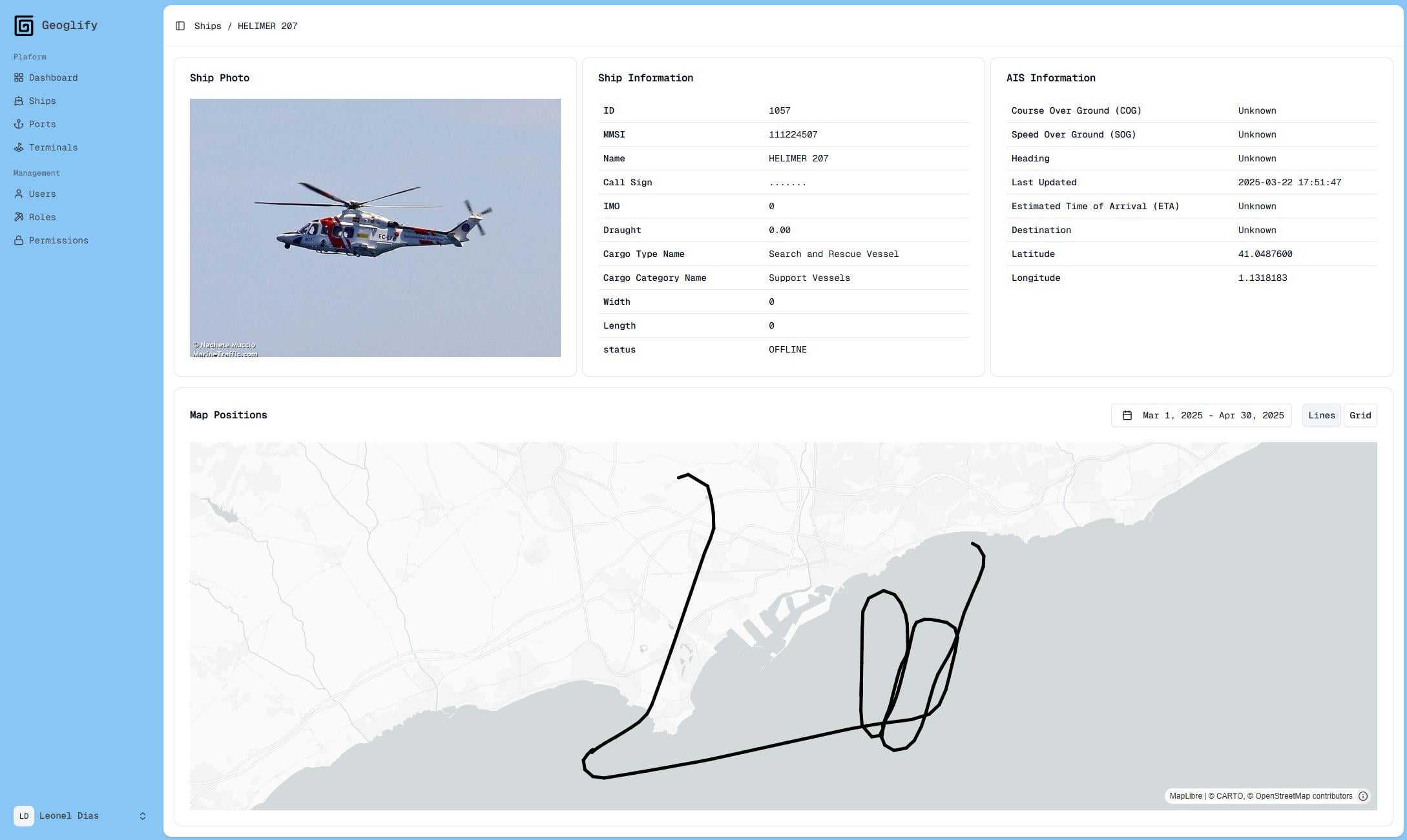
I was looking at AIS data in my project (Geoglify) and something unexpected appeared: a helicopter.
At first I thought it was a mistake. AIS (Automatic Identification System) is made for ships. It sends info like position, speed, and direction — but only for vessels. So why was a helicopter showing up?
After checking a bit more, I found out that some helicopters, especially the ones working offshore (like near oil platforms), might use AIS transponders for safety. It helps ships and platforms know where they are. Another possibility is a wrong configuration or some noise in the signal.
Either way, it was interesting. Real-time data always has surprises — and sometimes, flying ones.
Posted by geoglify
6 comments
[https://github.com/geoglify/geoglify](https://github.com/geoglify/geoglify)
Search and Rescue helicopters will often have to coordinate with ships, I assume AIS makes it easier for them to relay information either to a tender vessel (for refueling/landing/patient transfer) or a vessel in distress.
Looks like he was in the middle of drawing a dick when he got yelled at and told to return home.
The fact that they’re transmitting programmed tombstone data means they’re running an AIS unit (likely Type A) so I think that rules it out as signal noise.
Our ship-helicopter interface revolves around a dedicated flight tracking platform as well as a beacon that pings directly to the ship, however fitting a heli with an AIS would make it easier to coordinate search patterns with vessels of opportunity that don’t already have systems for communicating with aircraft
It seems to be a AgustaWestland helicopter, which is very versatile for offshore operations, such as search and rescue and oil-rig transport.
i thought the unexpected thing would be a helicopter pilot managing to not make a penis flight path.
Comments are closed.