[fireweather.eu]
Smoke from Canada’s ongoing wildfires has traveled more than 10,000 kilometers to reach Greece, satellite images analyzed by Athens-based fire meteorology group Flame have shown.
The wildfires, which broke out last week in Canada’s Manitoba province, have exhibited extreme behavior, forming towering plumes of smoke, or pyrocumulonimbus clouds, explained Theodore Giannaros, a researcher at the National Observatory in Athens, in a post.
These plumes of smoke have served as chimneys, propelling smoke to altitudes exceeding 9 kilometers, the researcher said. From there, powerful jet streams have carried the smoke across the Atlantic and into the Mediterranean region, he explained.
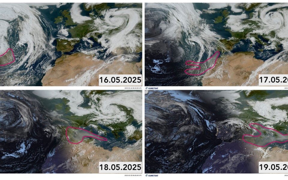
Satellite images shared by the Athens-based researcher in a recent post analyzing the event show smoke clouds over the Atlantic on May 16, reaching the northwest coast of Africa on May 17, arriving to the western Mediterranean on May 18 and reaching Greece and the East Mediterranean on May 19.
The phenomenon underscores how extreme wildfire behavior, fueled by climate change, can have far-reaching atmospheric effects, impacting air quality and visibility thousands of kilometers from the fire source.