Disruptions in Global Navigation Satellite Systems (GNSS) have significantly increased and are adversely affecting vessels navigating in the Gulf of Finland, Estonia’s Transport Administration said on Tuesday.
The time and location data provided by GNSS systems are widely used in navigation systems, and signal disruptions can cause unexpected failures in positioning and ship autopilot systems.
GNSS interference makes navigation more difficult for ships, increasing the risk of accidents, including serious environmental damage.
The disruptions have been traced back to Russia and Belarus, as they try and protect their critical and military infrastructure from drone attacks. Last week, Estonia was one of 13 EU member states to demand more action from the European Commission over the issue.
The number of disruptions in the Gulf of Finland has been steadily increasing during the first half of the year and intensified further in June, the Transport Administration said in a statement.
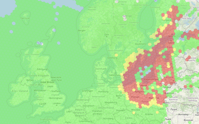 Data from website gpsjam.org shows where jamming is taking place (red and yellow areas) on June 15, 2025. Source: gpsjam.org
Due to the increased frequency of disruptions, Finland and Estonia have now issued a navigation warning for the Gulf of Finland, covering the territorial waters and exclusive economic zones of both countries.
“Since May 2024, Estonia has been continuously informing ships about the interference,” said Olavi Heinlo, head of the agency’s cartography department.
“The growing number of disruptions increased the need to share more information with ships, which is why we are working with our Finnish colleagues and have added a specific danger area to the electronic charts and updated the message in the Notices to Mariners,” he added.
Heinlo said that issuing warnings about various hazards is part of the “routine daily work” of authorities in both countries.
Finland and Estonia are also reporting the disruptions to the International Maritime Organization, which distributes the information to all 176 of its member states.
 Planes at Tartu Airport were unable to land due to GPS interference in 2024. An issue that has now been solved. Source: Maanus Kullamaa/Tartu 2024
The level of GPS interference over the region was “high” at over 10 percent on Sunday, the website gpsjam.org reported.
GPS and GNSS interference have caused problems with navigation of planes, ships, drones and other vehicles, such as tractors, in Estonia for almost two years. In the Baltic Sea region, interference around the heavily militarized Russian exclave Kaliningrad is often felt.
They pose no real danger, as air traffic control procedures and equipment have been upgraded to account for jamming by Russian authorities, said Erko Kulu, head of the Consumer Protection and Technical Regulatory Authority’s (TTJA) frequency management division, last month.
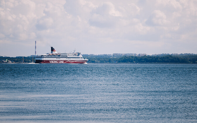
The Gulf of Finland is a busy shipping lane and also has dozens of passenger ferries crossing back and forth each day between Estonia, Finland and Sweden.
—
Follow ERR News on Facebook, Bluesky and X and never miss an update!