
by croatiaweek
July 24, 2025
in

A significant shift in weather is on its way to Croatia this weekend, with the Croatian Meteorological and Hydrological Service (DHMZ) issuing warnings for severe storms, heavy rain, hail, strong winds and a sharp drop in temperatures.
According to forecasters, the change marks a major turning point in this summer’s weather pattern.
Temperature drop of up to 15 degrees and severe storms expected
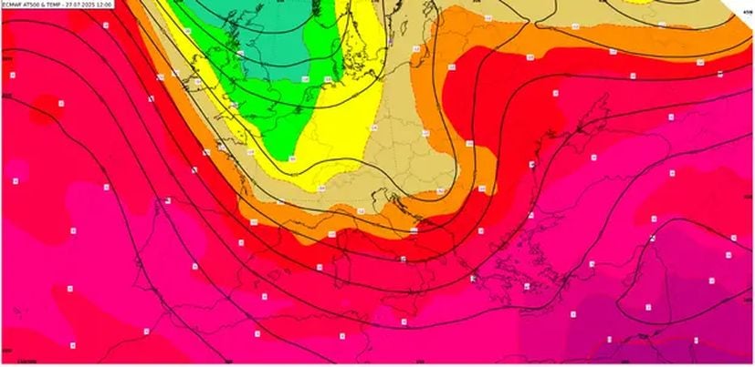
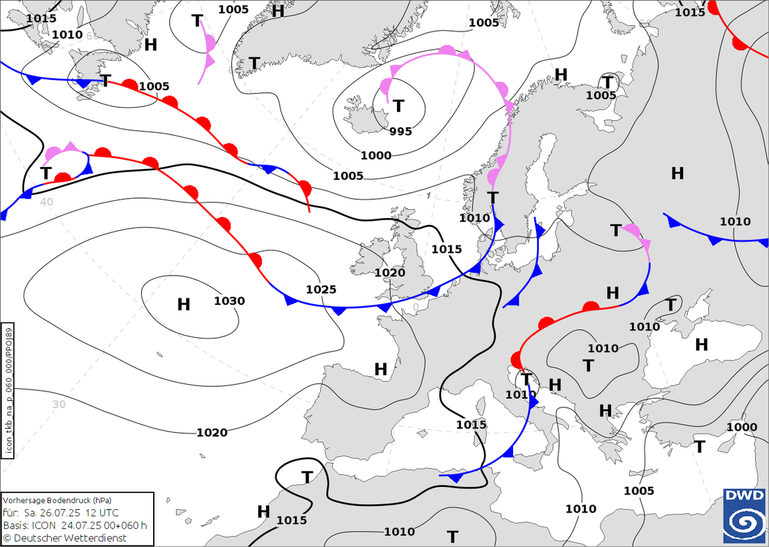
From Saturday, 26 July, a high-altitude cyclone is expected to move over Croatia, bringing with it unstable, moisture-rich air. A low-pressure system will also pass along the Adriatic coast, carrying frontal systems that will begin to move eastward later on Sunday.
Rainfall, thunderstorms and localised severe weather are forecast across the country. Some areas may see intense downpours in a short period of time, which could lead to flash flooding, particularly in urban and mountainous regions as well as the northern Adriatic.
Hail, storm-force winds and waterspouts at sea are also possible.
The most significant rainfall is likely late Saturday into the early hours of Sunday as the cyclone passes over. During this time, temperatures will also begin to fall noticeably – by as much as 15 degrees in some regions.
(Photo: DHMZ)
(Photo: DHMZ)
Brief calm before another round of instability
Although conditions may stabilise briefly on Sunday evening, the break will be short-lived. A new wave of bad weather is expected from the early hours of Monday, 28 July, as another low-pressure system develops over Italy and spreads towards Croatia overnight.
This second system will bring more heavy rain and storms, particularly along the coast, with possible thunderstorm activity again. The most intense rainfall is expected overnight from Monday into Tuesday, and this time heavier rain could also affect inland areas.
Smaller rivers and streams could react quickly to sudden downpours, increasing the risk of flash floods and localised flooding. In towns and cities, stormwater drainage systems may struggle to cope with high volumes of rain in short periods, raising the risk of urban flooding.
Authorities urge caution and close monitoring of forecasts
Although many may welcome the cooling temperatures, DHMZ and civil protection services advise citizens to take the warnings seriously. Localised storms and intense rainfall can develop quickly and pose risks in a short time.
Residents are urged to follow the latest forecasts and official updates on meteo.hr, and to adjust their plans and activities according to the weather conditions. Authorities also recommend staying alert to any instructions from local emergency services.
On Tuesday, wind speeds are expected to increase noticeably. Inland areas will experience moderate to strong northerly and north-easterly winds, while along the coast, strong bura and tramontana winds are forecast. Weather conditions should begin to settle by Tuesday evening.
At present, the water levels of Croatia’s major rivers remain low and are not expected to cause significant issues. However, heavy rain falling upstream in parts of Slovenia or Austria – especially in the Sava, Mura and Drava river basins – could change this.