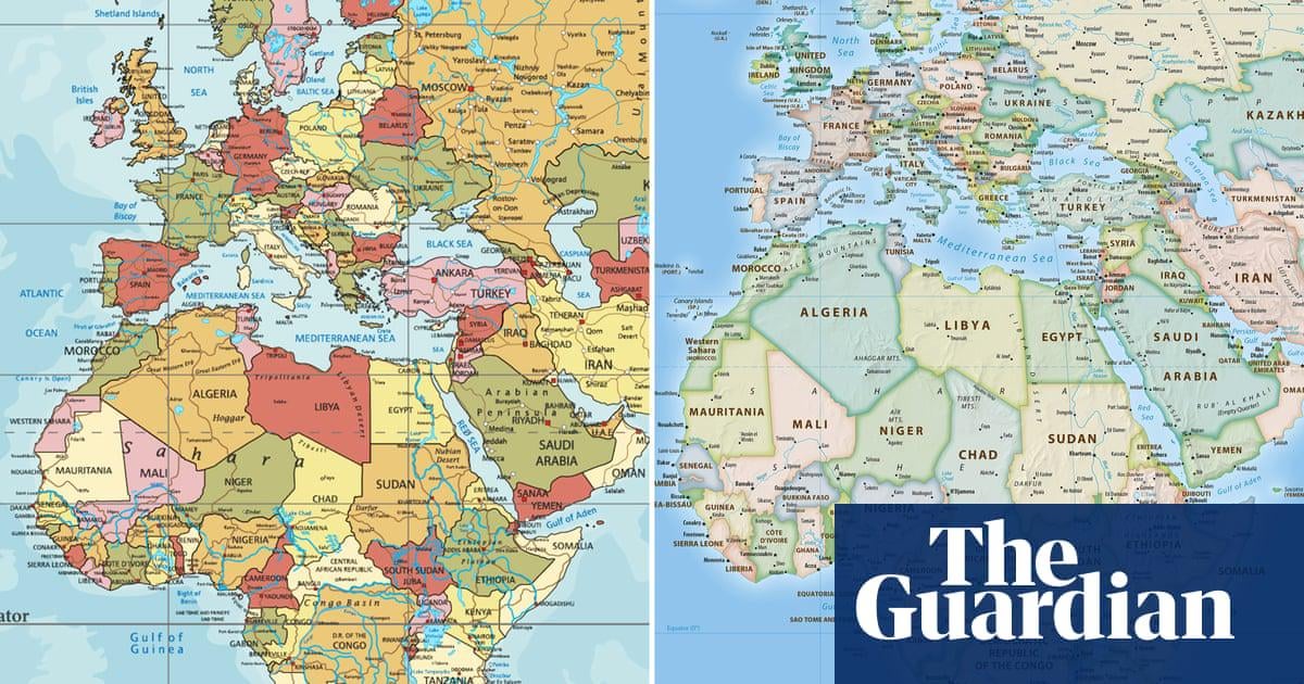
African Union joins calls to end use of Mercator map that shrinks continent’s size
https://www.theguardian.com/world/2025/aug/15/african-union-true-size-world-map-replace-mercator-version
Posted by F0urLeafCl0ver

African Union joins calls to end use of Mercator map that shrinks continent’s size
https://www.theguardian.com/world/2025/aug/15/african-union-true-size-world-map-replace-mercator-version
Posted by F0urLeafCl0ver
4 comments
Keeping shapes and angles is far more important that keeping the size. Having europe and US enlarge is IMHO a good thing for covering information due to economical and historical importance.
I have always found these African organizations to be a bit hysterical. Sure the Mercator projection has problems, but it gained its popularity for good reasons and it’s hanging around mostly out of inertia. That doesn’t make it mis or disinformation or mean people are purposely minimizing Africa.
I remember seeing an interview with an African woman who was crying about conversations to end the UN security council veto happening at the same time as discussions of adding an African permanent seat to the security council. She felt that the veto was being proposed to be removed from the security council because an African seat was being proposed. It was two totally separate conversations because the veto has caused the security council to become completely locked up. Just completely hysterical seeing racism where there isn’t any.
I’m getting the same feeling from this article the African union is seeing racism where there isn’t any, and while it’s good that we have what is potentially a better projection it’s a bit silly to be so hysterical about the old one.
Is this really a point of concern?
India isn’t considered marginal, despite looking smaller than Kazakhstan. How much can a map warp your ideas of relevance? Still, it might not be too bad to give it the benefit of the doubt. Drawing from my own experience, my perception of Greenland underwent a slight shift when we learned about map projections at school. Maybe if enough people care even a slight amount more, it could bring some change? I figure that’s wishful thinking though.
All map projections have flaws and most also have their uses. By all means African nations should use different projections if they are more useful.
The only map without significant flaws is a globe.
Comments are closed.