[OC] Tree Canopy Height in Atlanta, GA Posted by wndr_dst Tags:DataData Is BeautifulDataIsBeautiful 4 comments Presuming LiDAR data from where? Accuracy? When flown? Who obtained it? Thanks for posting this! I transplanted here in ‘98 I don’t like this because apparently Atlanta grew a new neighborhood since I bought [this map art](https://orkposters.com/product-category/u-s-cities/atlanta/?srsltid=AfmBOooY1MD4IEHS_jLi9rHQlUxPZs_bzGj4olypLp16WIaS9xDf1A-P). I think it’s where they annexed Emory. It’s the smaller, more northern of those two eastern protuberances. This is really a powerful layer for targeting street tree planting, storm water fixes and cooling investments where they’ll matter most. Comments are closed.
I don’t like this because apparently Atlanta grew a new neighborhood since I bought [this map art](https://orkposters.com/product-category/u-s-cities/atlanta/?srsltid=AfmBOooY1MD4IEHS_jLi9rHQlUxPZs_bzGj4olypLp16WIaS9xDf1A-P). I think it’s where they annexed Emory. It’s the smaller, more northern of those two eastern protuberances.
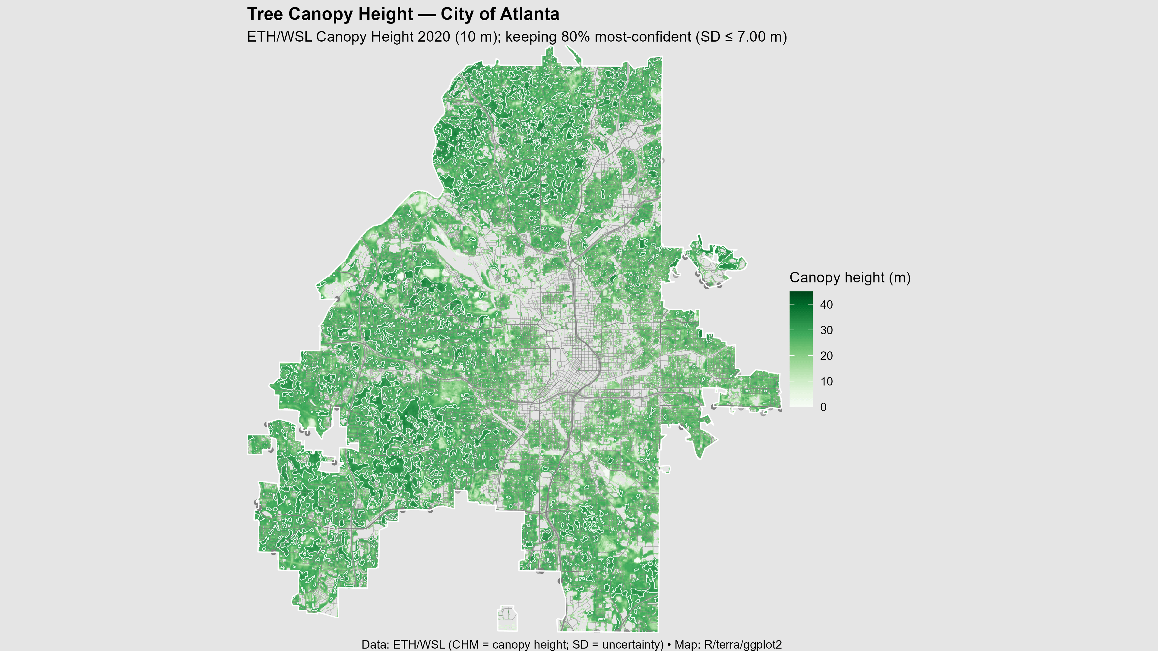
This is really a powerful layer for targeting street tree planting, storm water fixes and cooling investments where they’ll matter most.
![[OC] Tree Canopy Height in Atlanta, GA](https://www.europesays.com/wp-content/uploads/2025/08/9z0jmrf0r9kf1-1920x1024.png)
4 comments
Presuming LiDAR data from where? Accuracy? When flown? Who obtained it?
Thanks for posting this! I transplanted here in ‘98
I don’t like this because apparently Atlanta grew a new neighborhood since I bought [this map art](https://orkposters.com/product-category/u-s-cities/atlanta/?srsltid=AfmBOooY1MD4IEHS_jLi9rHQlUxPZs_bzGj4olypLp16WIaS9xDf1A-P). I think it’s where they annexed Emory. It’s the smaller, more northern of those two eastern protuberances.
This is really a powerful layer for targeting street tree planting, storm water fixes and cooling investments where they’ll matter most.
Comments are closed.