Might take a while but it's doable and I'm surprised no one has done it, even just for 15 minutes of YouTube fame.
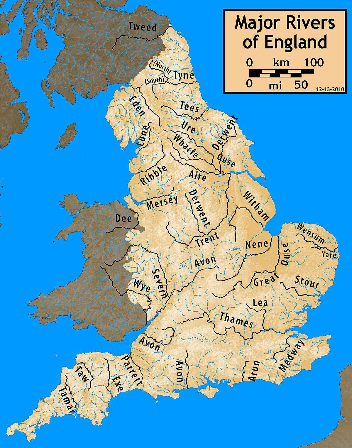
(Couldn't find a good map of UK rivers, just England, but you get the gist)
by Limp-Direction-5668
Might take a while but it's doable and I'm surprised no one has done it, even just for 15 minutes of YouTube fame.
(Couldn't find a good map of UK rivers, just England, but you get the gist)
by Limp-Direction-5668
31 comments
Well I’ve had to shelve my video for next month, I may use this idea.
Thank you kind redditor!
I imagine there will be a lot of walking up big hills / mountains / high ground….
Are people allowed to cross streams, becks, babbling brooks etc?
Why are there 2 Avon rivers
What would count as a river? Just officially labeled rivers or would streams also need to be avoided?
I love this idea. Would need to define whether brooks, creeks etc are okay to cross and what defines a river for this but I think that’s a great idea for a unique challenge
I guess the problem would be finding ‘interesting’ places that are not on rivers. There’s not much going on on the ridges at the top of catchments.
Saor Alba
For the purist form of this you’d need to follow lines dividing the various drainage basins
Scotland’s watershed runs north to south, and is famously some of the roughest wilderness in Europe. Peter Wright was claiming in 2013 that only a handful of people had ever done it. It would make an excellent final leg of your attempt!
A lot of hill paths take you over becks and gills so it would have to be a case of going off road.
The Paddle boarding community would possibly attempt this.
Those would be some knarly walks, the water sheds are usually rough country in England, in Scotland they’re especially wild.
Pretty sure I’ve seen this maze on the back of a menu before
Seems like this would be impossible given the most northern point is on the other side of the Tweed.
https://preview.redd.it/25d3wyp8dykf1.jpeg?width=1200&format=pjpg&auto=webp&s=59030a21bd57fc4bd1e11aeb572ecc6aeca7f304
I did the thing
Put a topology map on top of that and you might see a problem. River sources typically start in the mountains
Humber erasure
A major river, or any river?
We’re very fluvial. It might be difficult.
Rivers are also underground though. And some dry up in the summer.
It looks like it will take about 3 years to get out of Cornwall!
I would think impossible. This only shows major rivers, there are a shedload of rivers, streams etc not shown on this map.
As there are a lot more rivers than on the that map
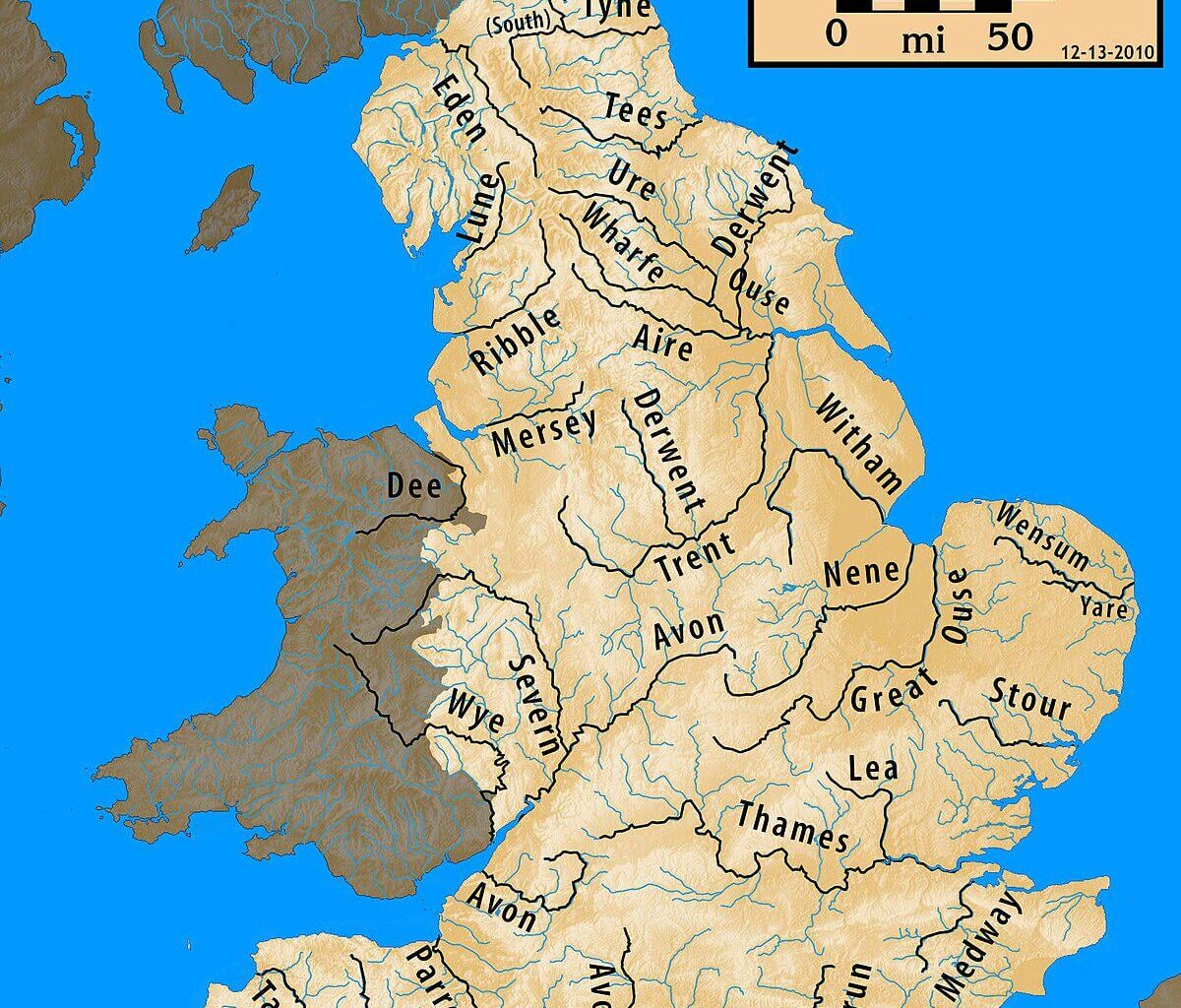
Here’s a river map of wales:
https://preview.redd.it/f6kydq6jfykf1.jpeg?width=1024&format=pjpg&auto=webp&s=10d1ea9872c4cc35cfe6831e2de31b6f1e144886
There are also a lot more smaller rivers or water ways that weren’t able to be mapped
Most of the clear way (such as from west from north Camarthen to east of Aberaron is top of mountains and may not have permissible walk ways. Also you’ll be in the absolute middle of nowhere so be difficult to get support.
It’s just very difficult to do
Edit: I’ve actually spent a good chunk of time on this and believe it’s impossible to go north to south without getting your feet wet
TIL there’s more than one river Derwent..
You say Uk, but that isnt all of it.
Nice try, witch.
Traditionally vampires can’t cross running water so they’d be the ones to ask. I wonder if that also restricts them while flying in bat mode if altitude isn’t a factor.
@ GeoWizard
You could do it in a snub nose Morris minor
Oh, so the UK is only England, I see.
That’s not the UK that’s England ! 3 countries light m8 !!!
Comments are closed.