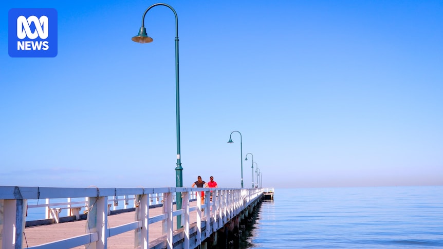
The infamous variability of spring weather across southern Australia will be on full display during the coming week.
First, south-eastern states will bask in maximums as much as 10 degrees Celsius above average this weekend, while Western Australia shivers under another spell of wintry showers and storms.
The WA soaking will then shift east, triggering the first thunderstorm outbreak of the season for parts of South Australia, Victoria and New South Wales on Sunday and Monday.
A major rain event is then predicted across eastern Australia from Tuesday — a system which has the potential to bring more than a month’s worth of rain to parts of the Murray Basin.
Loading…Australia’s heat engine ignites
Spring is the ultimate transition season as tropical and polar air battle for supremacy across mid-latitudes.
Through the weekend, tropical air which will gain territory over south-east states thanks to a northerly airstream from Australia’s “heat engine” — the name given to northern inland WA, which is the source of the hottest weather reaching most corners of the nation.
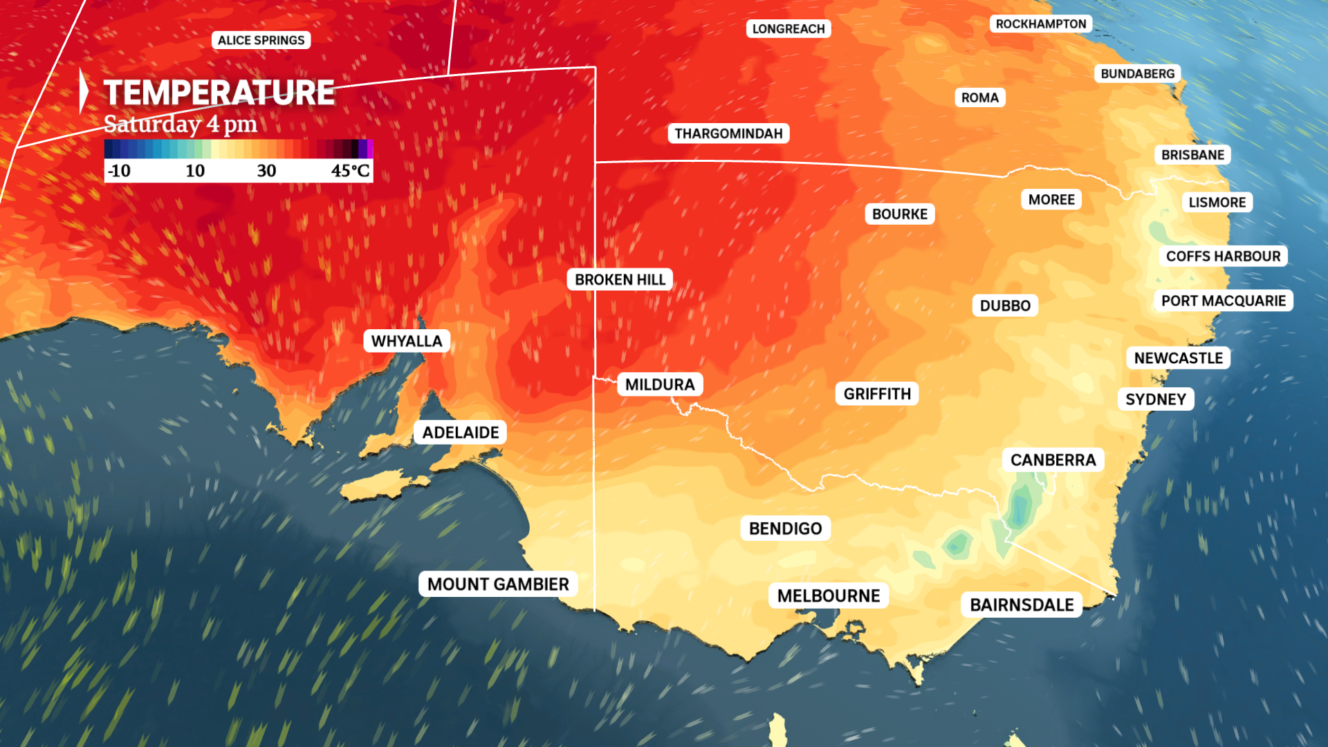
Temperatures will exceed 30C on Saturday across inland SA, and nudge 30C over far west NSW and around Mildura. (ABC News)
Many inland parts of SA will exceed 30C for the first time since April.
Our capitals can also expect the warmest weather since autumn between Saturday and Monday.
Adelaide: 25C Saturday, highest maximum since May 13.Melbourne: 22C Sunday, highest maximum since May 13.Canberra: 22C Sunday, highest maximum since May 7.Sydney: 27C Monday, highest maximum since April 21.
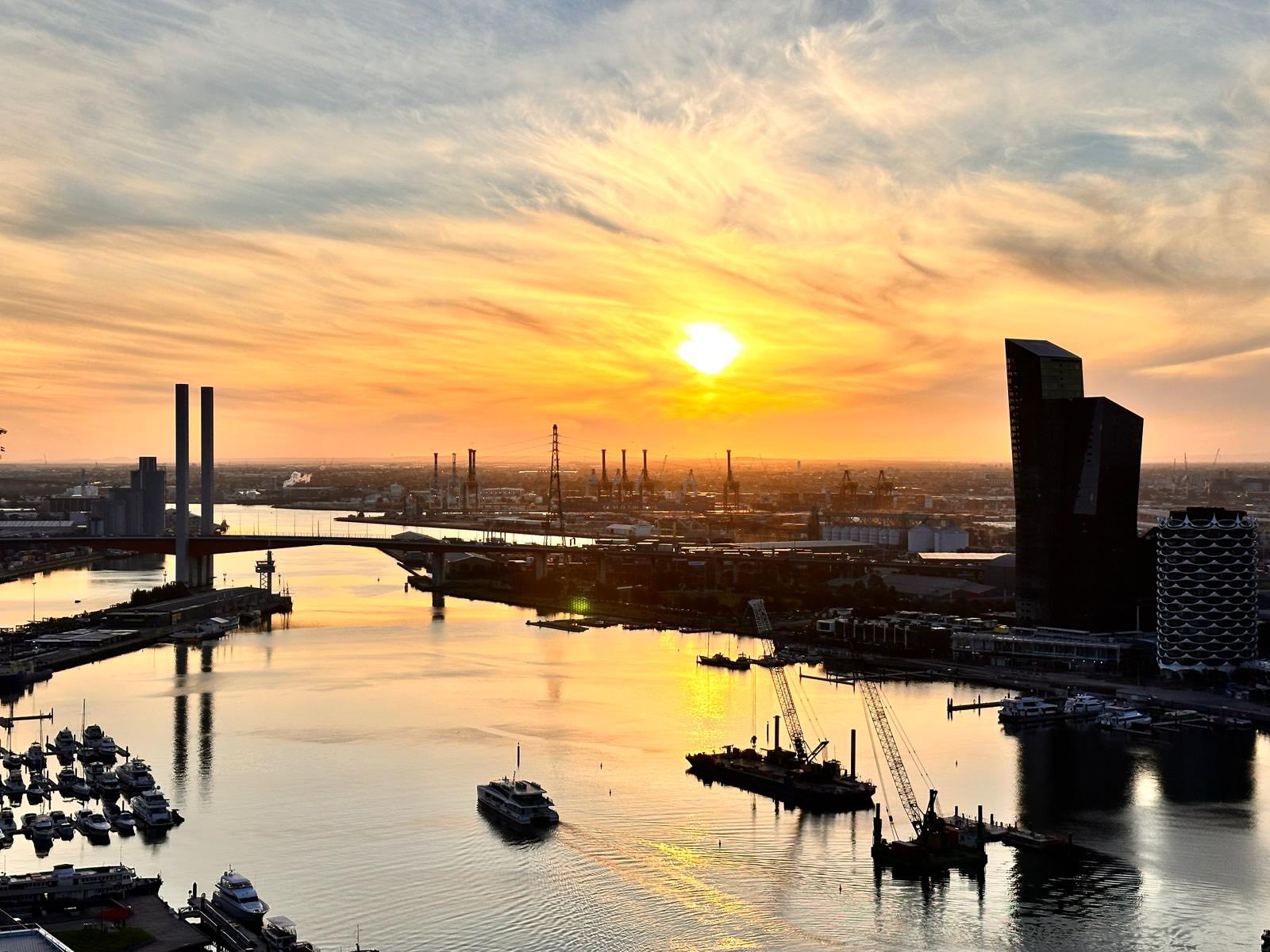
The sun sets on a cold Melbourne Friday that saw a high of only 15C, but warmer weather is ahead this weekend. (Supplied: Amruta Wazalwar)
While many will welcome a weekend of spring heat, the northerlies will become fresh to strong, leading to possible raised dust in SA and the Mallee on Saturday, along with the risk of damaging gusts along the Victorian ranges on Sunday.
True to spring form, the burst of heat will be followed by several pulses of polar air, combining to slash temperatures by as much 15C by midweek.
The first wave of colder air from the south already reached WA on Friday. Perth was sitting on just 13C at 2pm.
Stormy skies to spread from WA to eastern states
Just days into spring, the wet outlook for the season is already showing signs of coming to fruition.
After the wettest winter in 29 years across south-west WA, rain returned on Friday near a cold front and low, with as much as 30 millimetres soaking Perth by sunset.
Showers and a few storms will continue across western and southern WA today, before the system moves east and weakens on Sunday.
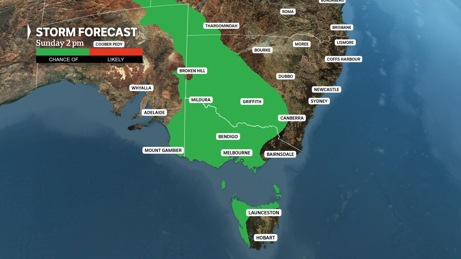
Thunderstorms are possible from the central outback to Tasmania on Sunday, with severe storms possible in Victoria and near the NSW-SA border. (ABC News)
Despite the front decaying, when combined with warm air over south-east Australia it will trigger a band of showers and thunderstorms on Sunday and Monday from the central interior down to Tasmania.
The storms across eastern SA, western NSW and through much of Victoria will be enhanced by an overlying jet stream blowing at speeds up to 250 kilometres per hour.
These fierce winds will not only amplify the initial growth of storms but also increase the strength of downdrafts — a combination that could lead to damaging to destructive wind gusts at the surface.
While wind is the main threat, some of the more violent storms could also bring hail and heavy rain.

A fierce jet stream over Australia this weekend could enhance thunderstorms and lead to gusty winds. (ABC News)
While Melbourne could see showers from early Sunday, the greatest risk from storms will be later over northern suburbs due to their proximity to the Great Dividing Range.
Widespread heavy rain, drought relief from Tuesday
For many regions, the upcoming storms are just an appetiser for the main event.
A second front will surge onto the WA south coast on Sunday, before tracking east and clashing with incoming tropical moisture to generate a band of rain across south-east states on Tuesday and Wednesday.
Rain totals could reach up to 50mm on the NSW and eastern Victorian ranges. While across the southern Murray Basin, an average of 10 to 30mm is likely, providing further drought relief following similar intensity falls through winter.
While the band should clear off the east coast on Wednesday, what is unclear at this stage is whether an associated low-pressure system will form — a scenario which would also support 50mm totals over pockets of western NSW.
An inland low could also lead to heavier falls in parts of Victoria or southern Queensland, depending on the exact track taken towards the Tasman Sea.

Much of southern Australia can expect at least 10mm of rain during the next week, with up to 50mm possible on the south-east ranges. (ABC News)
Negative IOD now strongest in three years
A negative Indian Ocean Dipole (IOD) is helping to fuel the upcoming rain and storms.
The wet phase of the Indian Ocean first developed in late July, intensified rapidly through August, and is now challenging 2010, 2016 and 2022 as the strongest such event so far this century.
The latest weekly calculation of the IOD index was -1.28, sitting comfortable below the negative IOD threshold of -0.4.
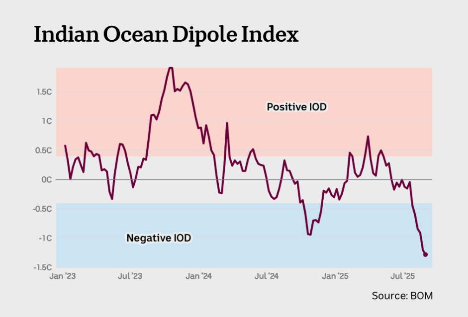
The latest IOD measurement shows a well-developed event likely to influence Australia’s weather through spring. (ABC News)
However, the strength of a regional or global climate driver, including a Pacific La Niña or El Niño, is not directly proportional to its impact on Australia’s weather.
So, while seasonal modelling predicts a wet spring, a near-record negative IOD does not guarantee near-record rainfall.