Published on
October 3, 2025

Walking the Fire Line: Australian Summer Travel Faces New Risks, Bushfire, and More You Need to Know has become a reality for travellers this year. Australians and international visitors are now walking the fire line as climate extremes reshape plans. The Australian summer travel season is no longer predictable. Instead, it faces new risks that demand attention. In many places, rising heat and sudden dry spells increase the threat of bushfire. Tourists may encounter road closures, smoke haze, or delayed itineraries. Yet, these challenges also highlight the resilience of communities and the evolving travel experience.
Families, backpackers, and adventure seekers alike now need to plan summer travel smarter. Weather updates, flexible bookings, and local safety alerts matter more than ever. Walking the fire line means not only adjusting journeys but also respecting the fragile landscapes of Australia. Travellers who prepare well will still find wonder in this unique land, despite the risks.
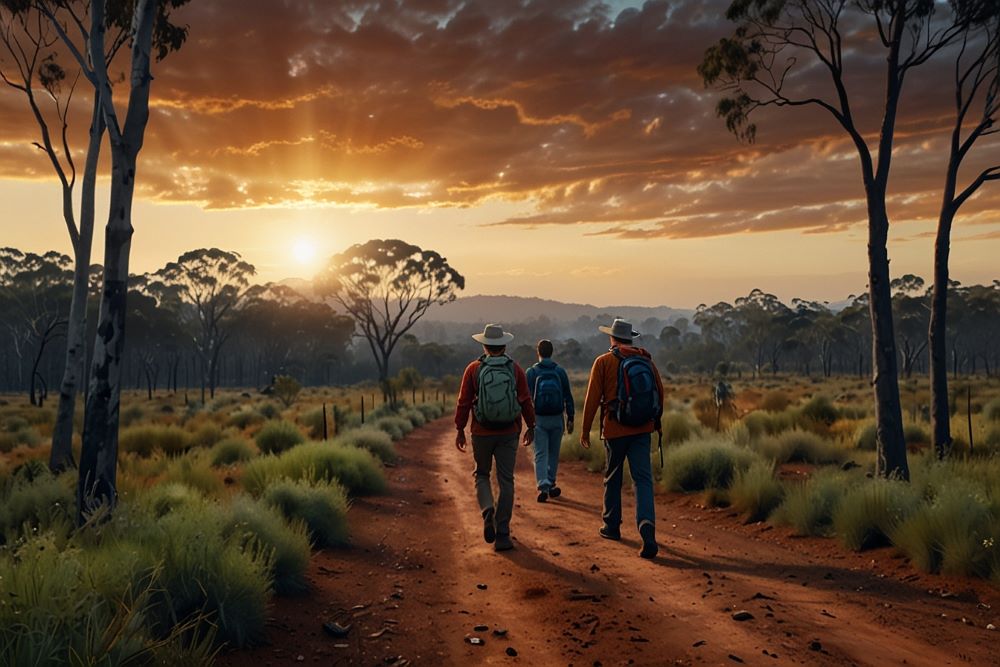
I’ve always been drawn to Australia’s wild places — from the eucalyptus-fringed bushland to the red dust of outback tracks, from coastal trails in Victoria to the rugged ridges of Tasmania. But in recent months, even the act of travel has begun to feel more precarious: shifting wind patterns, heat surges, and sudden dry spells are rewriting the map of risk for would-be visitors. What was once predictable is no longer safe to assume.
In 2025, experts say a rare atmospheric event—Sudden Stratospheric Warming (SSW)—is adding a new wrinkle to Australia’s bushfire forecast. The implications stretch from regional safety planning to the choices travellers must now make: where to go, when, and how to stay alert.
The Atmosphere’s Upset: What Is Sudden Stratospheric Warming?
In late September, scientists observed a dramatic temperature rise of more than 30 °C in the stratosphere above Antarctica — from about –50 °C to –20 °C. This kind of phenomenon, known as Sudden Stratospheric Warming (SSW), is extremely rare in the southern hemisphere — only two strong events had been reliably documented before (in 2002 and 2019).
But it matters because it weakens the stratospheric polar vortex — a high-altitude belt of fast westerly winds — which then ripples down into the lower atmosphere and can shift the usual climate drivers. In Australia, that means the usual spring forecasts are now being revisited — wetter expectations are being tempered by warnings of warmer, drier, more fire-prone conditions.
Meteorologists emphasise, though, that we are in a contest of influences. On one side is the SSW pushing for heat and dryness; on the other are oceanic signals — including a negative Indian Ocean Dipole and possible La Niña — that lean toward wetter conditions, especially in eastern Australia. Which driver “wins” is uncertain.
Still, the shift is strong enough that experts are now warning that fire risk forecasts must adapt. Gone are the days when spring might be considered “safe” by default.
From Forecast to Fire: Why the Stakes Are Rising
A few decades ago, predicting bushfire risk was more straightforward: drought, fuel loads, and weather patterns were the main metrics. But today, extreme variability is intruding.
Greg Mullins, founder of Emergency Leaders for Climate Action and former commissioner of Fire and Rescue NSW, says that what we’re seeing is a paradigm shift. He points out that the earlier spring outlook — calling for wetter-than-average conditions and negligible fire risk (except in drought-affected SA and Victoria) — is being overhauled in real time. The SSW has forced forecasters and emergency planners to ask: how long will this “upset” last? Mullins says this may be a “whole new ball game.”
He recalls that in past SSW years (2002 and 2019), Australia experienced some of its worst fire periods. In 2003, for example, Canberra was hit by a ferocious firestorm that destroyed 500 buildings. The message is clear: rare atmospheric events can amplify existing vulnerabilities.
Recent summer travel months already show signs of danger. Queensland, for instance, has imposed total fire bans, and authorities say current weather conditions are “perfect for bushfires to ignite and spread quickly.” In parts of southeast Australia, unseasonal heat is compounding seasonal dryness, pushing fire danger ratings upward.
At the same time, Australia is not alone. Studies out of the University of Tasmania point to a global rise in “catastrophic wildfires,” especially in regions with Mediterranean or temperate forests — including southern Europe, western North America, and southern Australia. The overlap of climate change, greater temperature extremes, and shifting weather patterns means many of the world’s most scenic, biodiverse destinations are under rising threat.
Tourist Hotspots Now on the Line
Australia’s allure — from the Great Ocean Road through eucalyptus heartlands to alpine national parks — often lies in remoteness, wildness, and connection to nature. But those qualities also make many destinations vulnerable.
Victoria, New South Wales, Tasmania: The Eastern Corridor
The southeast (Victoria, parts of New South Wales, Tasmania) is closely watched. With SSW pushing dry westerlies northward, these regions may see more heat and fewer rain-bearing fronts in spring. Even as some ocean signals would support wetter forecasts, the new modelling weakens certainty.
Particularly at risk are the Gippsland region, southwestern Victoria, and Murraylands in South Australia — areas already flagged by fire chiefs despite spring forecasts for above-average rainfall.
Visitors to the Blue Mountains, Gippsland coast, Grampians, or Tasmania’s wilderness zones may now need to watch daily fire danger ratings, stay flexible, and keep abreast of warnings.
The North, the Outback, and Western Australia
While much attention focuses on the southeast, the north and central zones of Australia carry their own hazards. This season’s heatwave in Queensland led to a total fire ban and arrests of alleged arsonists, demonstrating how rapid flare-ups are possible even in ostensibly less fire-prone zones.
In Western Australia, parts of the Kimberley, Dampier Peninsula, and Pilbara have already been identified as having increased fire danger, particularly as dry conditions persist.
Travellers heading to remote deserts, Kimberley tours, outback highways, or semi-arid national parks must watch for sudden wind shifts, smoke, and closures — even if those areas are not traditionally high on fire corps’ radar.
What Travellers Should Do NowStay Flexible, Stay Informed
Traditional fixed itineraries may no longer suffice. Know the local fire danger ratings and forecasts for your region, often available via state fire service or Bureau of Meteorology (BOM) channels.
If warnings escalate (e.g., “Catastrophic” or “Emergency” fire danger days), rethink plans: hiking routes, camping spots, and remote drives may need canceling or rerouting.
Travel Timing Matters
Spring is now a more volatile season. Consider shifting travel to periods when forecasts are more stable (late spring into early summer) in fire-lowering zones. But remember: with climate trends pushing extremes earlier and later, no time is entirely safe.
Choose Lower-Risk Locations or Buffer Zones
Coastal regions buffered by sea breezes, higher altitude zones less prone to heat accumulation, and areas with water supply infrastructure (e.g., lakes, dams) offer marginally better margins. National parks with established evacuation routes and clear communication are preferable to fringe wildernesses where help is days away.
Be Prepared and Self-ReliableCarry a smoke/air quality mask, goggles, and a portable air purifier — smoke hazards can travel far from the fire front.Build a “go bag” with essential supplies, first aid, maps, and chargers.Keep water stocks and firefighting tools (shovel, rake) in vehicles when journeying through rural landscapes.Have a communication plan. Satellite or HF radios may be wise in remote terrain.Pay attention to local authorities; note the nearest fire stations or ranger posts for evacuation guidance.Adjust Expectations, Not Just Plans
Even in zones not directly threatened by fire, smoke may drift and degrade air quality dramatically. That can affect hiking, breathing, visibility, and even flight operations.
Accommodation providers and tour operators are likely to monitor risks more closely—expect last-minute adjustments or cancellations.
What the Experts Are WatchingDuration of the SSW influence. If the warming persists into summer, its impact will be stronger.Interactions with ocean drivers. Ocean temperature anomalies and modes like the Indian Ocean Dipole or La Niña may alter which weather signal dominates.Fuel conditions. The past few years have brought cycles of heavy rain and vegetation growth; now drying out, many areas may carry abundant fuel loads ready to ignite.New “fire regime boundaries.” Some regions traditionally safe may shift into higher risk zones — mental maps of fire risk are being redrawn.
Importantly, infrastructure and emergency systems must adapt faster. Planning for static assumptions is no longer adequate. As Mullins cautions, rewriting the outlooks is now part of every season.
Looking Ahead: Travel, Climate, and Resilience
The Australia I once visited — vast, unpredictable, yet manageable via careful preparation — is changing. As a traveller, you no longer only respond to weather forecasts; you must also anticipate atmospheric surprises like SSW events that ripple through continents.
Given these shifts, travel in Australia in coming years may lean more toward adaptive planning: shorter legs, built-in flex, insurance, and acceptance of more uncertainty. But the trade-off is still worth it — lightning-lit ridgelines, night-skies over eucalypt ranges, and the slow dawn in bushland are experiences many will still treasure.
In the coming months, this new era of fire-aware travel will be a test: for regions, emergency services, tour operators, and visitors alike. The question is not only whether nature will surprise us — but whether we can respond swiftly enough to travel without putting ourselves and local communities in harm’s way.
