

Some weather models suggest the UK could see snow this month (Image: Getty Images)
Parts of Europe were plunged into winter this week, with up to 20 inches of snow blanketing regions across the Western Balkans.
The surprise snowfall across Europe has led to speculation that the UK could soon see snow, with some reports suggesting flurries of up to 20cm could hit northern areas later this month.
However, the Met Office has confirmed there is “no indication” of snow in the forecast throughout October. The weather agency says conditions look likely dry and settled next week.
A Met Office spokesperson told the Manchester Evening News: “There is currently no indication of snow in the forecast.
“The long-range forecast becomes clearer closer to the time, and currently suggests there could be settled conditions next week thanks to high pressure, and possibly more unsettled weather later in the month.
“Keep an eye on our forecast to stay up to date as October goes on.”
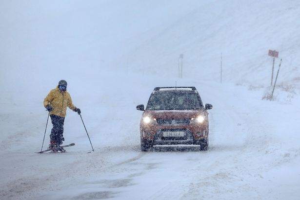
It is rare for widespread snow to hit the UK in October(Image: Getty Images)
Surprise snowfall hits Europe
Thousands of people were left without electricity across the Western Balkans after early snowfall brought widespread disruption on Friday (October 3).
Heavy snow blanketed hilly regions of Serbia and Bosnia, while persistent rainfall in lower areas sparked fears of potential floods and mudslides.
More than half a metre (20 inches) of snow has already accumulated at higher altitudes. Meteorologist Slobodan Sovilj from the state Hydrometeorological Service has suggested it could reach record levels for October.
“We have a number of areas without electricity because of broken trees and branches that fell on power lines,” Aleksandar Mitrovic, head of the Ivanjica municipality in central Serbia, told The Independent.
It comes after temperatures reached up to 30C in the Western Balkans in September. During summer heatwaves, temperatures soared over 40C.
The UK’s October forecast
The Met Office long range forecast currently suggests that high pressure is likely to be in charge next week, with more unsettled conditions later in the month.
From Friday (October 10) to the following Sunday (October 19), the forecast states: “On Friday, the far north of the UK will see some rain and drizzle, and it will be rather windy here. Other western parts of the UK may also see some light rain and drizzle at times. The rest of the country will be dry with some bright or sunny spells and fairly light winds.
“Thereafter, high pressure is expected to dominate for most if not all of the rest of the period, bringing plenty of dry, settled weather. Cloud amounts will be variable, and some overnight fog is likely, this slowly clearing through the morning. Thicker cloud and some rain may affect the far north at times though.
“Temperatures will be near average overall, but with some chilly nights possible, perhaps with isolated frost.”
Looking further ahead, the Met Office forecast states: “The final third of October will likely see a transition to more unsettled conditions across the UK, with high pressure relinquishing its grip, though the timing and manner of this is uncertain.
“Whether this takes the form of successive depressions moving in from the Atlantic or a rather slower-evolving weather pattern remains to be seen, but there is a greater chance of most if not all places seeing spells of rain or showers and possibly strong winds later in the month, these conditions continuing into the start of November.
“Temperatures will probably be close to average overall.”